MyTopo
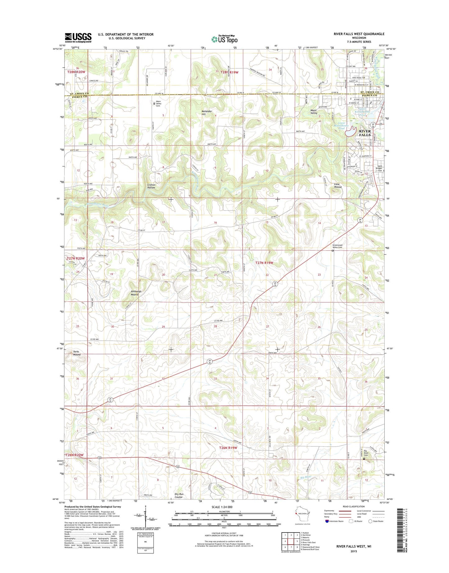
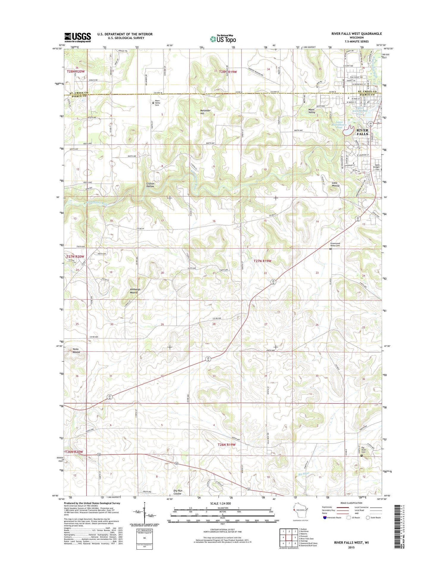
River Falls West Wisconsin US Topo Map
Couldn't load pickup availability
2018 topographic map quadrangle River Falls West in the state of Wisconsin. Scale: 1:24000. Based on the newly updated USGS 7.5' US Topo map series, this map is in the following counties: Pierce, St. Croix. The map contains contour data, water features, and other items you are used to seeing on USGS maps, but also has updated roads and other features. This is the next generation of topographic maps. Printed on high-quality waterproof paper with UV fade-resistant inks.
Quads adjacent to this one:
West: Prescott
Northwest: Hudson
North: Northline
Northeast: Roberts
East: River Falls East
Southeast: Diamond Bluff East
South: Diamond Bluff West
Southwest: Hastings
Contains the following named places: Angel Hill School, Apostolic Church, Ashbaugh Mound, Big River Presbyterian Cemetery, Clifton Highlands Golf Course, Clifton Hollow Golf Club, Clifton Hollow School, Clifton Townhall, Glass Valley School, Glen Park, Glen Park Municipal Swimming Pool, Greenwood Valley Cemetery, Hagestad Student Center, Hillcrest Rest Home, Ingram Center, Johnson Hall, Junction Falls Dam, Kinnickinnic State Park, Lafette School, Lone Mound, Lower Kinnickinnic Pond, Mann Valley, Mann Valley Cemetery, Mann Valley Church, May Hall, Melander Hill, Oak Knoll School, Pierce Valley School, Powell Falls 2WP180 Dam, Prucha Hall, River Falls Public Montessori Elementary School, Riverside Square Shopping Mall, Rocky Branch, Rocky Branch Elementary School, Saint Bridget Cemetery, Sand Hill School, South Fork Kinnickinnic River, Stratton Hall, Sunnyside School, Tegeler Airport, Tower Park, Town of Clifton, Upper Kinnickinnic Pond, Wells Park, West Dale Park, Westside Elementary School, Yorks Mound