MyTopo
Solon Springs Wisconsin US Topo Map
Couldn't load pickup availability
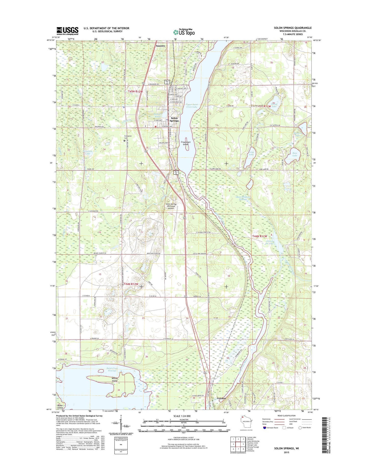
2018 topographic map quadrangle Solon Springs in the state of Wisconsin. Scale: 1:24000. Based on the newly updated USGS 7.5' US Topo map series, this map is in the following counties: Douglas. The map contains contour data, water features, and other items you are used to seeing on USGS maps, but also has updated roads and other features. This is the next generation of topographic maps. Printed on high-quality waterproof paper with UV fade-resistant inks.
Quads adjacent to this one:
West: Buckety Creek
Northwest: Lyman Lake
North: Bennett
Northeast: Lake Minnesuing
East: Metzger Lake
Southeast: Chittamo
South: Gordon
Southwest: Minong Flowage
Contains the following named places: Bass Lake, Bird Sanctuary Lake, Crownhart Island, Douglas County State Wildlife Area, Eau Claire River, Evergreen Cemetery, Ferguson Lake, Island Lake, Leo Creek, Long Lake, Lower Ox Creek, Lower Ox Lake, Lucius Woods State Park, Muskrat Lake, Olson Meadows Flowage, Park Creek, Park Creek Pond, Park Creek Pond G1997 2 Dam, Saint Croix Flowage, Saint Pius X Church, Sauntry, Smith G1997.5 Dam, Solon Springs, Solon Springs Municipal Airport, Solon Springs Police Department, Solon Springs Post Office, Solon Springs School, Solon Springs Town Police Department, Solon Springs Volunteer Fire Department, Town of Gordon, Town of Solon Springs, Upper Saint Croix Lake, Village of Solon Springs, Wilcox Island, ZIP Code: 54838