MyTopo
Stetsonville Wisconsin US Topo Map
Couldn't load pickup availability
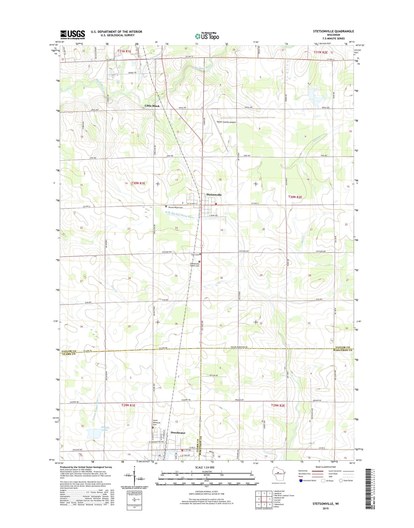
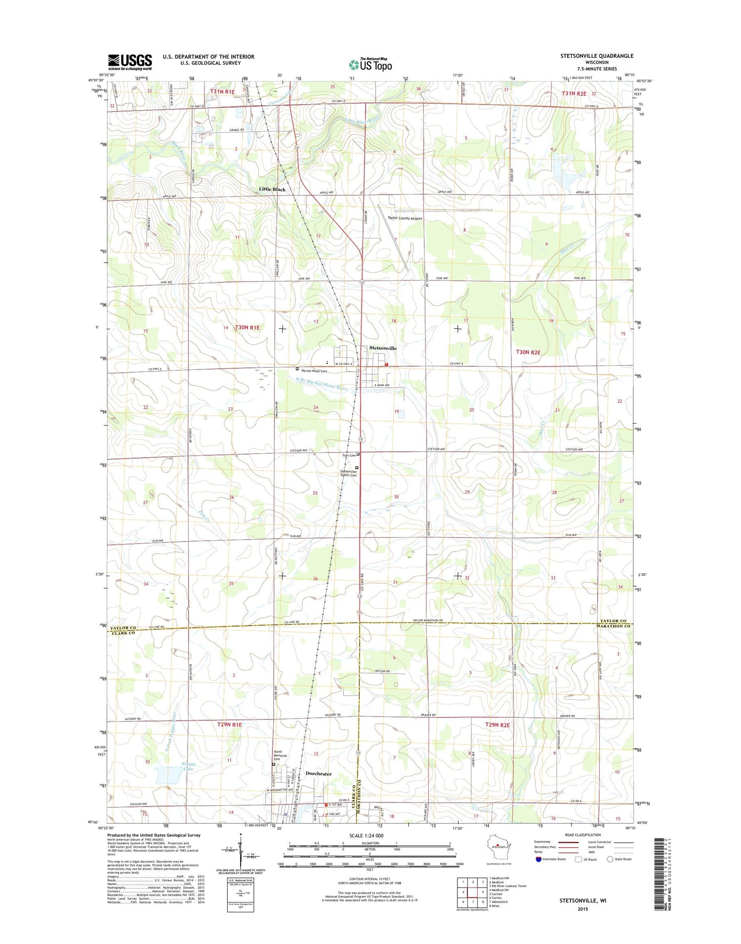
2018 topographic map quadrangle Stetsonville in the state of Wisconsin. Scale: 1:24000. Based on the newly updated USGS 7.5' US Topo map series, this map is in the following counties: Taylor, Marathon, Clark. The map contains contour data, water features, and other items you are used to seeing on USGS maps, but also has updated roads and other features. This is the next generation of topographic maps. Printed on high-quality waterproof paper with UV fade-resistant inks.
Quads adjacent to this one:
West: Medford SW
Northwest: Medford NW
North: Medford
Northeast: Rib River Lookout Tower
East: Corinth
Southeast: Milan
South: Abbotsford
Southwest: Curtiss
Contains the following named places: Clearview School, Cleveland School, Correction Creek, Deer Creek, Dorchester, Dorchester Elementary School, Dorchester Fire and Emergency Services, Dorchester G262 Dam, Dorchester Police Department, Dorchester Post Office, Draper School, Kalepp Dam, Kalepp Lake, Liberty School, Little Black, Little Black River, Medford School, North Dorchester Memorial Cemetery, Peace United Church of Christ, Pleasant Valley School, Sacred Heart Cemetery, Saint Louis Church, Saint Louis Grade School, Saint Peter Lutheran Church, Spruce Grove School, Stetsonville, Stetsonville Elementary School, Stetsonville Post Office, Stetsonville Public Cemetery, Stetsonville Volunteer Fire Department, Taylor County Airport, Town of Deer Creek, Victory School, Village of Dorchester, Village of Stetsonville, Zion Lutheran Cemetery, ZIP Codes: 54425, 54480