MyTopo
Stevenstown Wisconsin US Topo Map
Couldn't load pickup availability
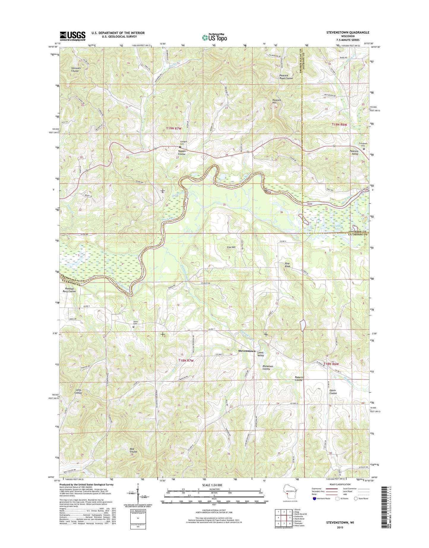
2018 topographic map quadrangle Stevenstown in the state of Wisconsin. Scale: 1:24000. Based on the newly updated USGS 7.5' US Topo map series, this map is in the following counties: La Crosse, Trempealeau, Jackson. The map contains contour data, water features, and other items you are used to seeing on USGS maps, but also has updated roads and other features. This is the next generation of topographic maps. Printed on high-quality waterproof paper with UV fade-resistant inks.
Quads adjacent to this one:
West: Galesville
Northwest: Ettrick
North: Hegg
Northeast: North Bend NE
East: North Bend
Southeast: West Salem
South: Onalaska
Southwest: Holmen
Contains the following named places: 0.3 Reservoir, 54636, Cox Hill, Evergreen Cemetery, Fleming Creek, Gavin Coulee, Glasgow Cemetery, Glasgow School, Hardies Church, Hardies Creek, Hardies Creek School, Hardies Creek State Forest, Horseshoe Lake, Lewis Valley, Lewis Valley School, Michelson Coulee, Oines H1807 Dam, Peacock Hill, Peacock Hill Quarry, Peacock Valley, Pine Knob, Pine Knob School, Ponstad Berg Coulee, Roberts Coulee, Sacia Cemetery, Sour Creek, Sour Creek School, Stevenstown, Stevenstown School, Toppen Coulee, Union Mills School, Wilson Creek School