MyTopo
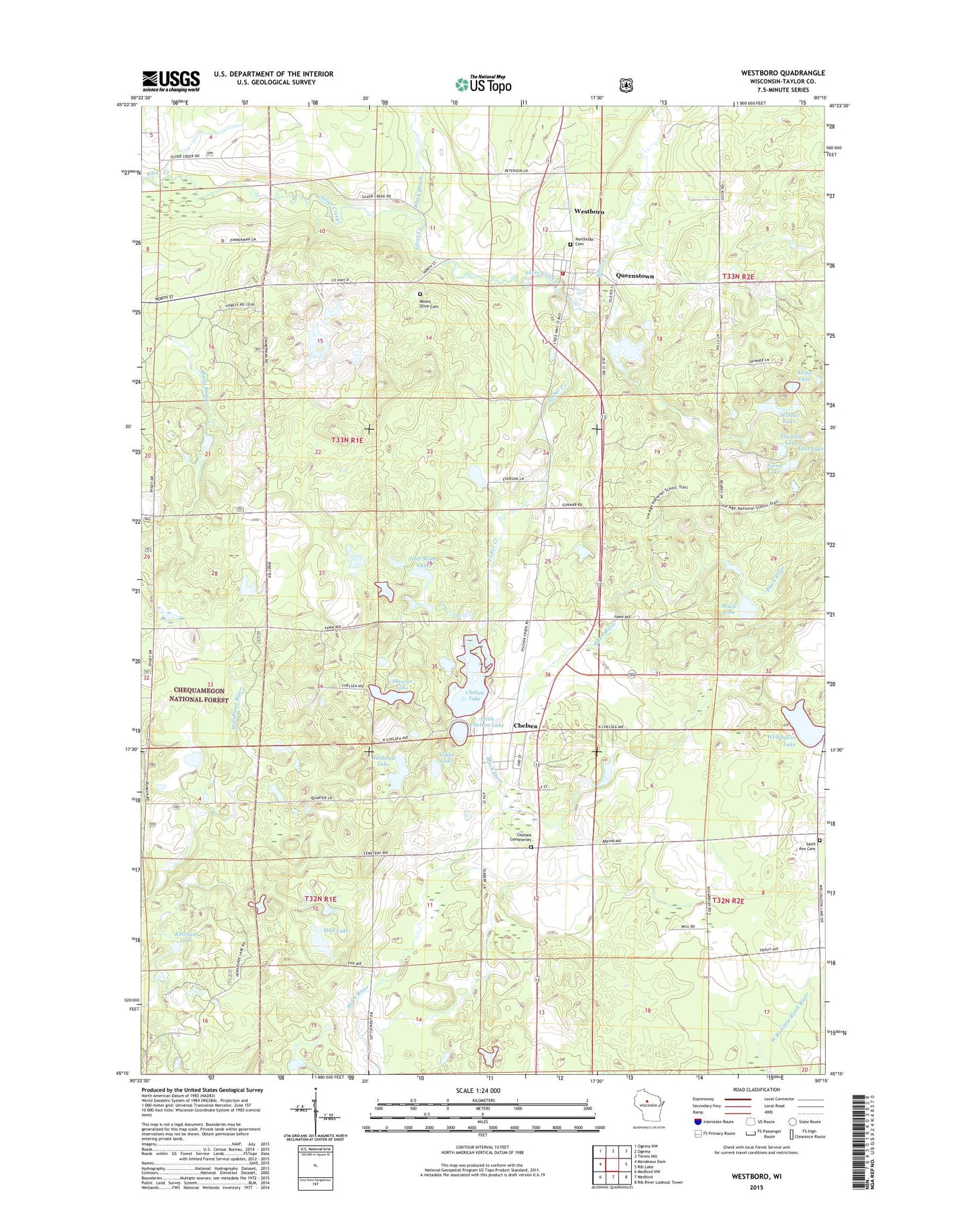
Westboro Wisconsin US Topo Map
Couldn't load pickup availability
2018 topographic map quadrangle Westboro in the state of Wisconsin. Scale: 1:24000. Based on the newly updated USGS 7.5' US Topo map series, this map is in the following counties: Taylor. The map contains contour data, water features, and other items you are used to seeing on USGS maps, but also has updated roads and other features. This is the next generation of topographic maps. Printed on high-quality waterproof paper with UV fade-resistant inks.
Quads adjacent to this one:
West: Mondeaux Dam
Northwest: Ogema NW
North: Ogema
Northeast: Timms Hill
East: Rib Lake
Southeast: Rib River Lookout Tower
South: Medford
Southwest: Medford NW
Contains the following named places: 1 Reservoir, Black Brook, Black Lake, Bullhead Lake, Chelsea, Chelsea Cemetery, Chelsea Census Designated Place, Chelsea Lake, Chelsea Lake 2WP1491 Dam, Duchien Lake, Eugene Mathey E 5228 Dam, Fisher Creek, Gibbs Lake, Half Moon Lake, Highland School, Ketcham Lake, Kettle Lake, Little Chelsea Lake, Mount Olive Cemetery, Mud Lake, Niene Lake, Northside Cemetery, Queenstown, Saint Ann Cemetery, Shearer Lake, Silver Creek Elementary School, Skinner Lake, Wellington Lake, Westboro, Westboro Census Designated Place, Westboro Post Office, Westboro Volunteer Fire Department, Winding Brook School