MyTopo
Zoar Wisconsin US Topo Map
Couldn't load pickup availability
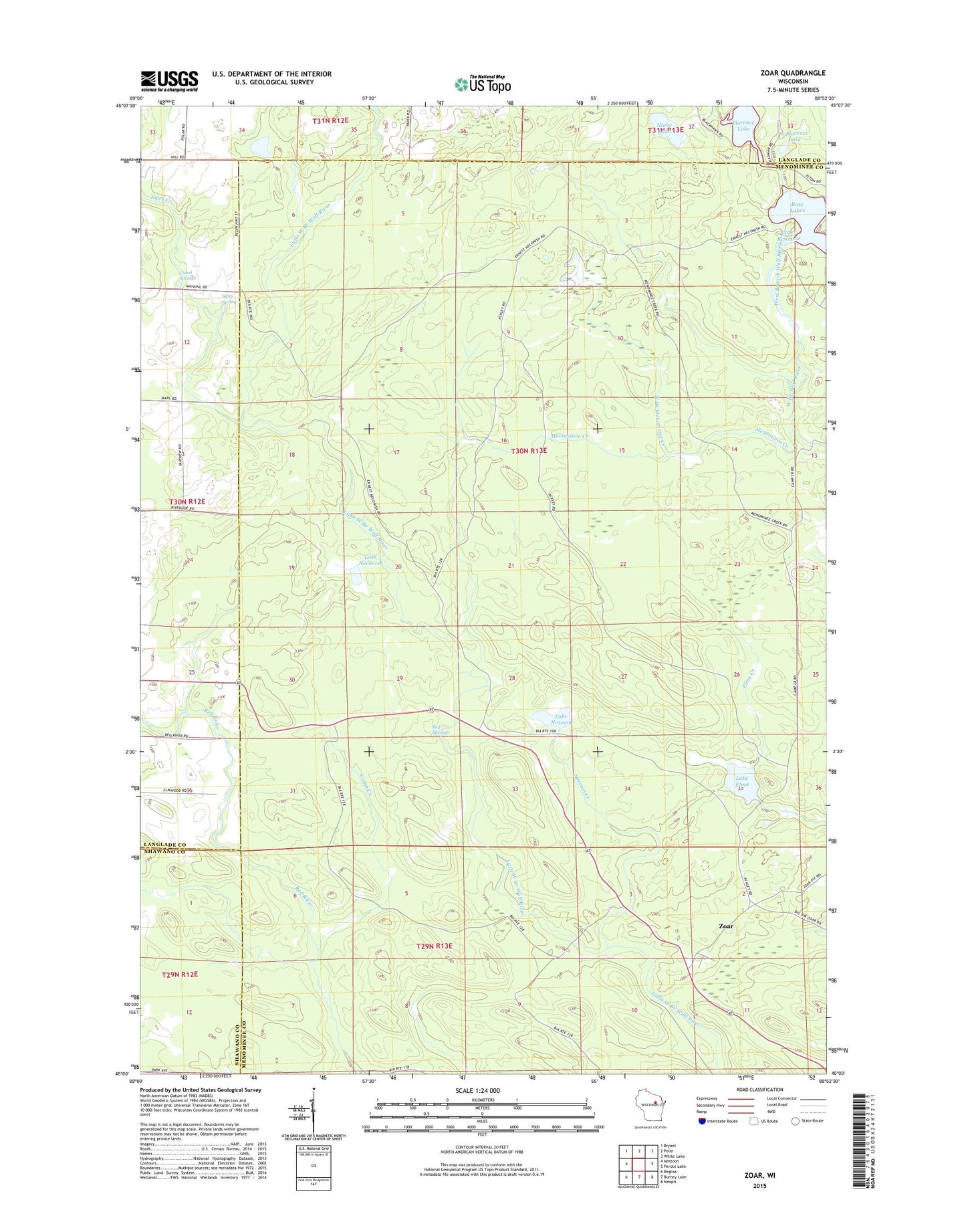
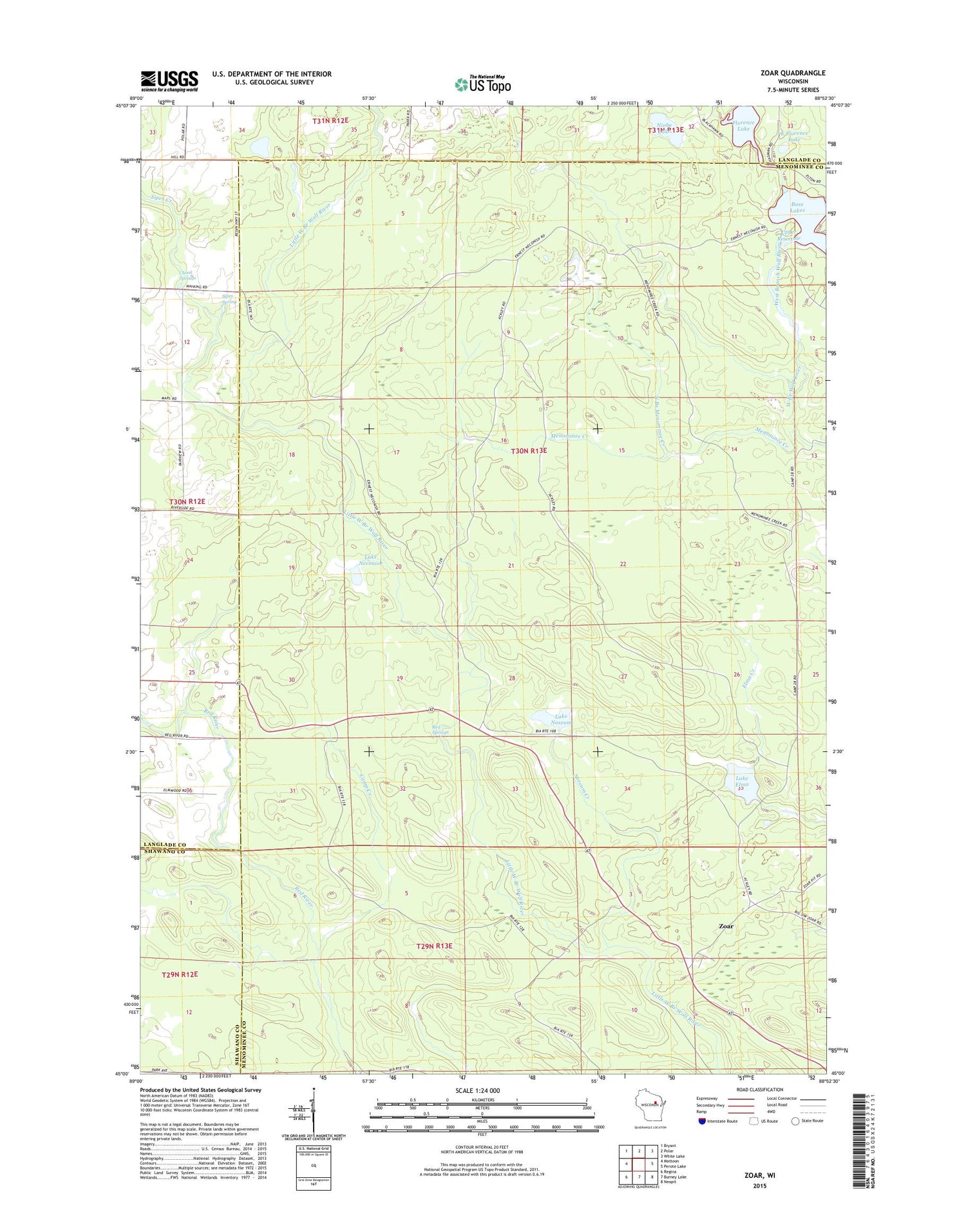
2018 topographic map quadrangle Zoar in the state of Wisconsin. Scale: 1:24000. Based on the newly updated USGS 7.5' US Topo map series, this map is in the following counties: Menominee, Langlade, Shawano. The map contains contour data, water features, and other items you are used to seeing on USGS maps, but also has updated roads and other features. This is the next generation of topographic maps. Printed on high-quality waterproof paper with UV fade-resistant inks.
Quads adjacent to this one:
West: Mattoon
Northwest: Bryant
North: Polar
Northeast: White Lake
East: Perote Lake
Southeast: Neopit
South: Burney Lake
Southwest: Regina
Contains the following named places: Bass Lakes, Camp Black Hawk, Camp Creek, Chisel Springs, Deer Creek, East Florence Lake, Florence Lake, Lake Dam, Lake Elma, Lake Neconish, Lake Noseum, Menominee Creek, Niobe Lake, North Branch Menominee Creek, Noseum Creek, Rabe Creek, Red River Camp, Red Springs, Sipes Creek, Sipes Spring, Upper Reservoir, Zoar, Zoar Census Designated Place