MyTopo
Blue Miner Lake Wyoming US Topo Map
Couldn't load pickup availability
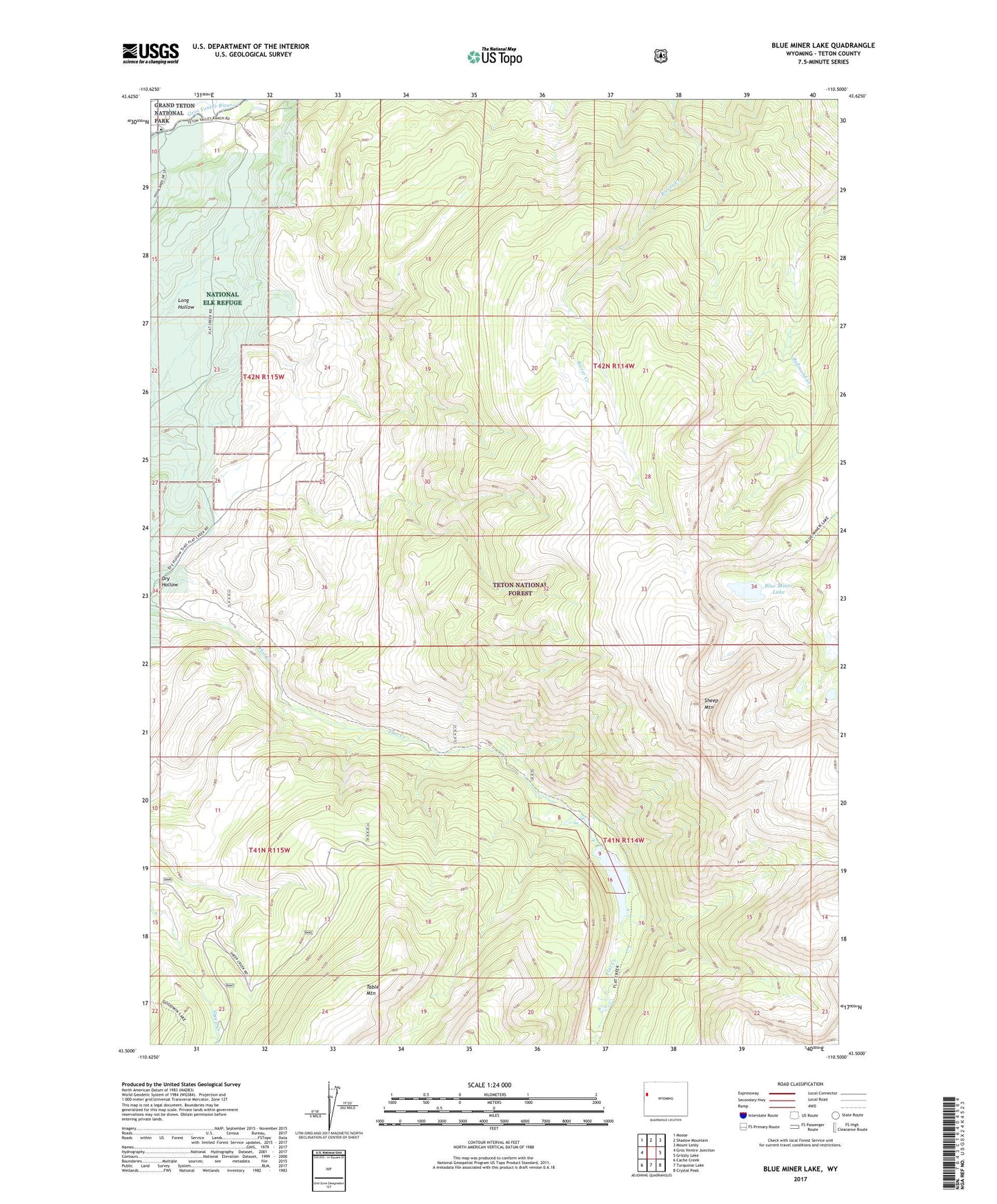
2021 topographic map quadrangle Blue Miner Lake in the state of Wyoming. Scale: 1:24000. Based on the newly updated USGS 7.5' US Topo map series, this map is in the following counties: Teton. The map contains contour data, water features, and other items you are used to seeing on USGS maps, but also has updated roads and other features. This is the next generation of topographic maps. Printed on high-quality waterproof paper with UV fade-resistant inks.
Quads adjacent to this one:
West: Gros Ventre Junction
Northwest: Moose
North: Shadow Mountain
Northeast: Mount Leidy
East: Grizzly Lake
Southeast: Crystal Peak
South: Turquoise Lake
Southwest: Cache Creek
Contains the following named places: Blue Miner Lake, Dry Hollow, Flat Creek Ranch, Gros Ventre Slide Geological Area, Kelly, Kelly School, Sheep Mountain, Teton Game Management Area, Teton Valley Ranch