
MyTopo
Dudley Creek Wyoming US Topo Map
Couldn't load pickup availability
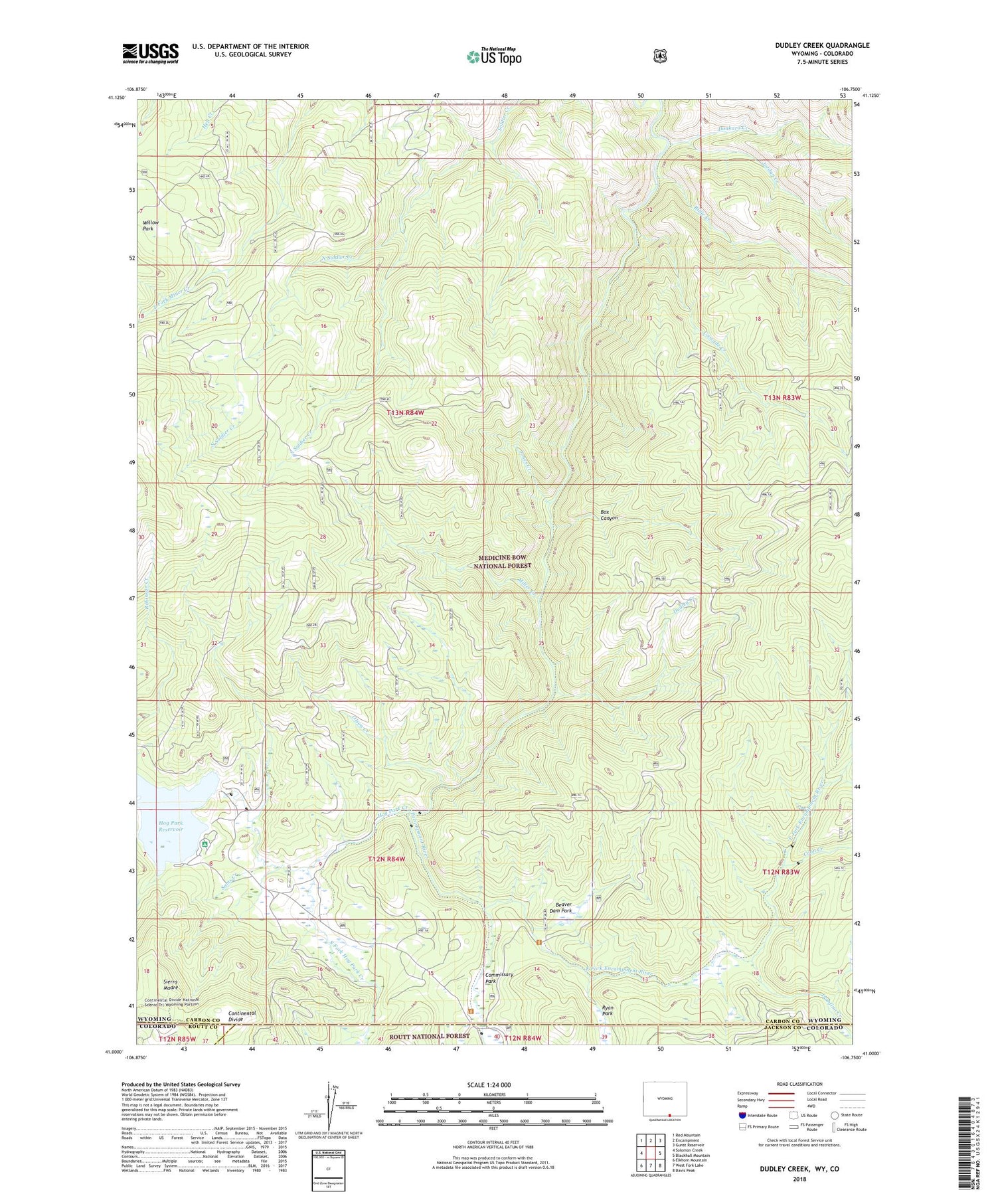
2021 topographic map quadrangle Dudley Creek in the state of Wyoming. Scale: 1:24000. Based on the newly updated USGS 7.5' US Topo map series, this map is in the following counties: Carbon, Jackson, Routt. The map contains contour data, water features, and other items you are used to seeing on USGS maps, but also has updated roads and other features. This is the next generation of topographic maps. Printed on high-quality waterproof paper with UV fade-resistant inks.
Quads adjacent to this one:
West: Solomon Creek
Northwest: Red Mountain
North: Encampment
Northeast: Gunst Reservoir
East: Blackhall Mountain
Southeast: Davis Peak
South: West Fork Lake
Southwest: Elkhorn Mountain
Contains the following named places: Beaver Dam Park, Billie Creek, Box Canyon, Brady Creek, Broadway Mine, Camper Creek, Cascade Creek, Cascade Mine, Commissary Park, Coon Creek, Damfino Creek, Dudley Creek, Dunkard Creek, East Fork Encampment River, Encampment River, Encampment River Wildernes, Encampment River Wilderness, Finch Cow Camp, Fireline Trail, Hog Park Creek, Hog Park Dam, Jones Creek, Jordan Creek, Miller Creek, North Soldier Creek, Olson Creek, Purgatory Gulch, Sams Creek, South Fork Hog Park Creek, South Soldier Creek, Willow Park


