MyTopo
Eagle Creek Wyoming US Topo Map
Couldn't load pickup availability
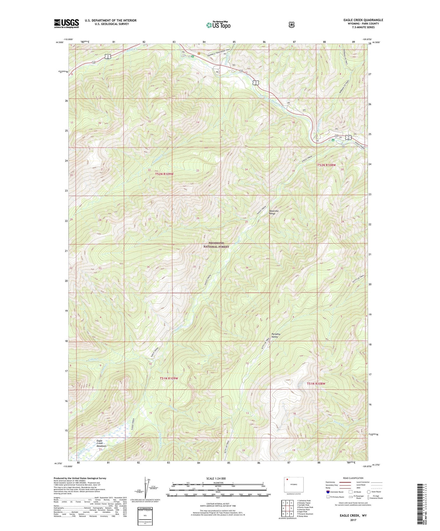
2021 topographic map quadrangle Eagle Creek in the state of Wyoming. Scale: 1:24000. Based on the newly updated USGS 7.5' US Topo map series, this map is in the following counties: Park. The map contains contour data, water features, and other items you are used to seeing on USGS maps, but also has updated roads and other features. This is the next generation of topographic maps. Printed on high-quality waterproof paper with UV fade-resistant inks.
Quads adjacent to this one:
West: Plenty Coups Peak
Northwest: Cathedral Peak
North: Pahaska Tepee
Northeast: Sunlight Peak
East: Chimney Rock
Southeast: Sheep Mesa
South: Pinnacle Mountain
Southwest: Eagle Peak
Contains the following named places: Cabin Creek, Canfield Creek, Cloudburst Creek, Crouch Creek, Crouch Prospect Mine, Eagle Creek, Eagle Creek Campground, Eagle Creek Meadows, Eagle Creek Summer Homes, Grinnell Creek, Grinnell Creek Summer Homes, Kitty Creek, Mormon Creek, Mormon Creek Summer Hours, Neva Creek, Pahaska Campground, Paradise Valley, Sleeping Giant Campground, Sleeping Giant Winter Sports Area, Threemile Campground