MyTopo
Fremont Lake South Wyoming US Topo Map
Couldn't load pickup availability
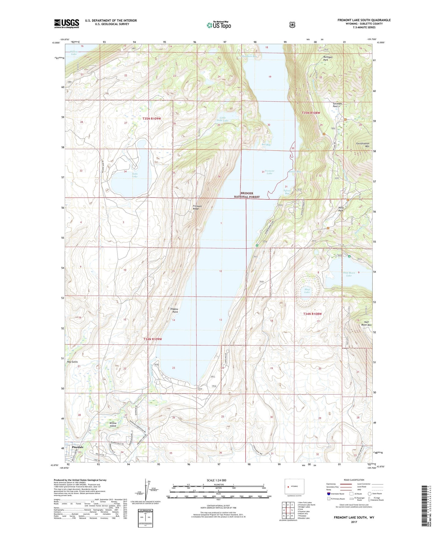
2021 topographic map quadrangle Fremont Lake South in the state of Wyoming. Scale: 1:24000. Based on the newly updated USGS 7.5' US Topo map series, this map is in the following counties: Sublette. The map contains contour data, water features, and other items you are used to seeing on USGS maps, but also has updated roads and other features. This is the next generation of topographic maps. Printed on high-quality waterproof paper with UV fade-resistant inks.
Quads adjacent to this one:
West: Cora
Northwest: New Fork Lakes
North: Fremont Lake North
Northeast: Bridger Lakes
East: Fayette Lake
Southeast: Boulder Lake
South: Pinedale
Southwest: Mount Airy
Contains the following named places: Beaver Bay, Box Bay, Chambers Bay, Fremont Ditch, Fremont Lake, Fremont Lake Campground, Fremont Ridge, Fremont Ridge Mine, Half Moon Campground, Higgins Point, Highland Ditch, Kelly Park, Lakeside Lodge, Little Soda Lake, Lower Fremont Boat Ramp, Mud Lake, Mulligan Park, Park Loop Ski Trail, Sandy Beach Picnic Area, Soda Lake, Spring Creek, Summit Lake Trail, Surveyor Creek, Surveyor Park, Sweeney Creek, Sylvan Bay, Sylvan Bay Summer Home Area, White Pine Lodge Ski Area, Willow Island