MyTopo
Green Mountain Wyoming US Topo Map
Couldn't load pickup availability
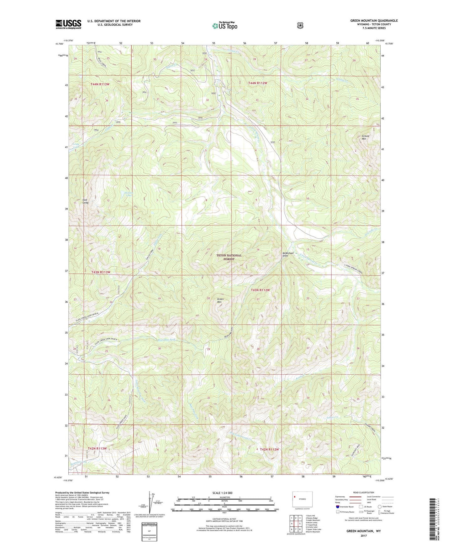
2021 topographic map quadrangle Green Mountain in the state of Wyoming. Scale: 1:24000. Based on the newly updated USGS 7.5' US Topo map series, this map is in the following counties: Teton. The map contains contour data, water features, and other items you are used to seeing on USGS maps, but also has updated roads and other features. This is the next generation of topographic maps. Printed on high-quality waterproof paper with UV fade-resistant inks.
Quads adjacent to this one:
West: Mount Leidy
Northwest: Davis Hill
North: Rosies Ridge
Northeast: Angle Mountain
East: Tripod Peak
Southeast: Burnt Mountain
South: Upper Slide Lake
Southwest: Grizzly Lake
Contains the following named places: Dry Lake Creek, East Leidy, Green Mountain, Grouse Creek, Grouse Mountain, Hidden Lake, Kettle Creek, Leidy Creek, Little Bear Paw Fork, McMichael Draw, Nation Creek, Teton National Forest