MyTopo
Hecla Wyoming US Topo Map
Couldn't load pickup availability
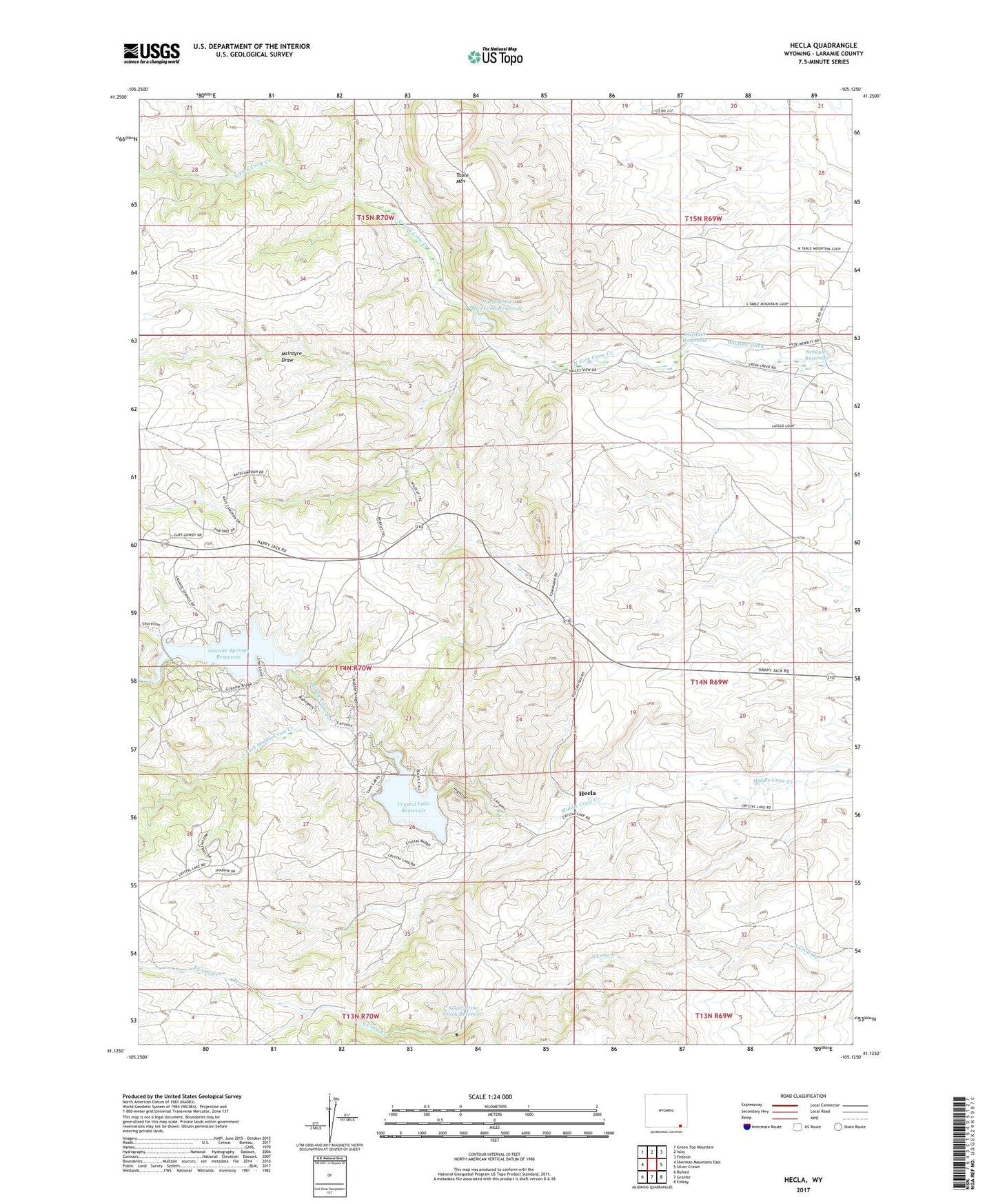
2021 topographic map quadrangle Hecla in the state of Wyoming. Scale: 1:24000. Based on the newly updated USGS 7.5' US Topo map series, this map is in the following counties: Laramie. The map contains contour data, water features, and other items you are used to seeing on USGS maps, but also has updated roads and other features. This is the next generation of topographic maps. Printed on high-quality waterproof paper with UV fade-resistant inks.
Quads adjacent to this one:
West: Sherman Mountains East
Northwest: Green Top Mountain
North: Islay
Northeast: Federal
East: Silver Crown
Southeast: Emkay
South: Granite
Southwest: Buford
Contains the following named places: Arizona Mine, Barlett Copper King Mine, Brush Creek, Comstock Mines, Copper King Mine, Crystal Lake Dam, Crystal Lake Reservoir, Fairview Mine, Globe Prospect, Granite Springs Dam, Granite Springs Reservoir, Great Standard Group Mine, Hecla, Hecla Mine and Prospects, Kopper Krown Group Mine, London Mine, Louise Mine, McIntyre Draw, McIntyre Ranch, Merritt Ranch, North Crow Diversion Reservoir, North Crow Diversion Reservoir Dam, North Crow School, Rambler Mine, Renslaer Reservoir, Schuyler Reservoir, South Crow Creek Reservoir, South Fork Middle Crow Creek, Table Mountain, Whitney Ditch