MyTopo
Hilight Wyoming US Topo Map
Couldn't load pickup availability
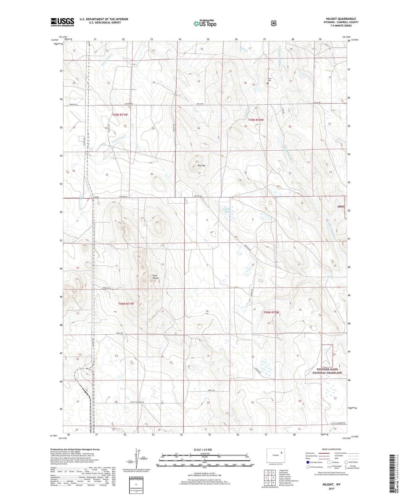
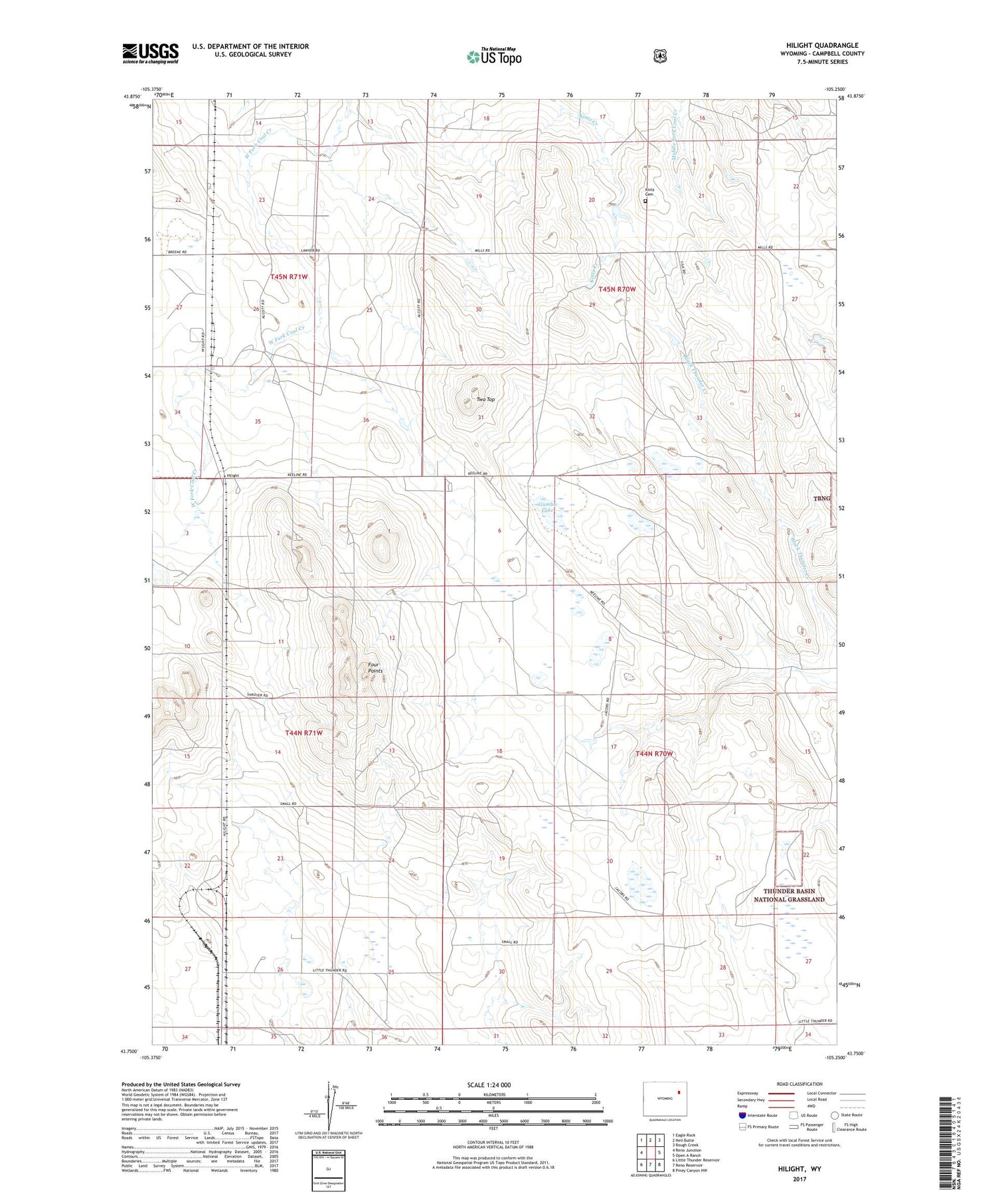
2021 topographic map quadrangle Hilight in the state of Wyoming. Scale: 1:24000. Based on the newly updated USGS 7.5' US Topo map series, this map is in the following counties: Campbell. The map contains contour data, water features, and other items you are used to seeing on USGS maps, but also has updated roads and other features. This is the next generation of topographic maps. Printed on high-quality waterproof paper with UV fade-resistant inks.
Quads adjacent to this one:
West: Reno Junction
Northwest: Eagle Rock
North: Neil Butte
Northeast: Rough Creek
East: Open A Ranch
Southeast: Piney Canyon NW
South: Reno Reservoir
Southwest: Little Thunder Reservoir
Contains the following named places: Four Points, Gumbo Lake, Hansen Lakes, Hilight, Hilight Gas Plant, Hilight Oil and Gas Field, Isenberger Reservoir, Jacobs Ranch, Kintz Cemetery, Ostlund Pit, Reynolds Airport, Springen Ranch, Two Top