MyTopo
Little Saddle Mountain Wyoming US Topo Map
Couldn't load pickup availability
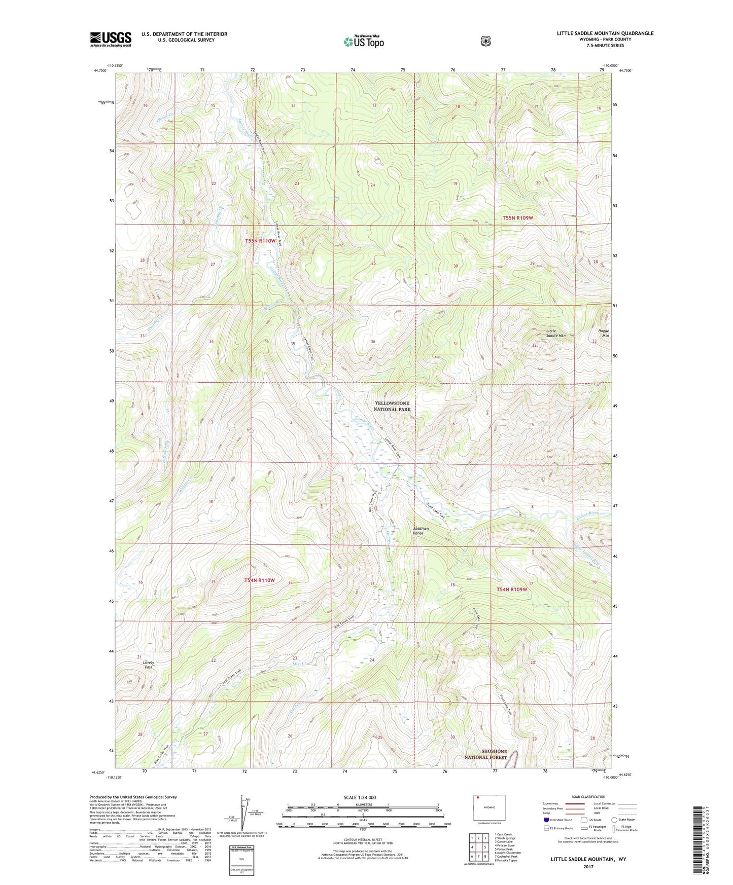
2021 topographic map quadrangle Little Saddle Mountain in the state of Wyoming. Scale: 1:24000. Based on the newly updated USGS 7.5' US Topo map series, this map is in the following counties: Park. The map contains contour data, water features, and other items you are used to seeing on USGS maps, but also has updated roads and other features. This is the next generation of topographic maps. Printed on high-quality waterproof paper with UV fade-resistant inks.
Quads adjacent to this one:
West: Pelican Cone
Northwest: Opal Creek
North: Wahb Springs
Northeast: Canoe Lake
East: Pollux Peak
Southeast: Pahaska Tepee
South: Cathedral Peak
Southwest: Mount Chittenden
Contains the following named places: Buffalo Fork, Clover Creek, Cold Creek, Cold Creek Patrol Cabin, Frost Lake Trail, Hague Mountain, Lamar River Trail, Little Lamar River, Little Saddle Mountain, Lovely Pass, Mirror Fork, Mist Creek, Mist Creek Trail, Timothy Creek, Willow Creek