
MyTopo
Mount Washington MyTopo Explorer Series Map
Couldn't load pickup availability
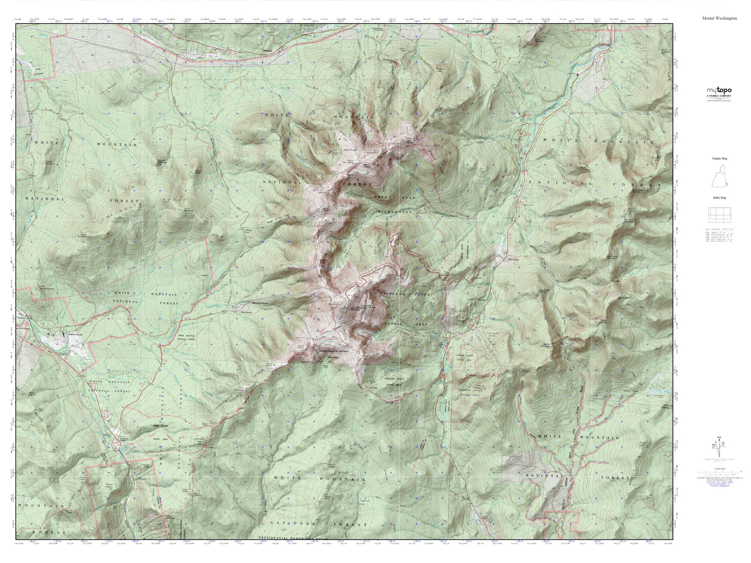
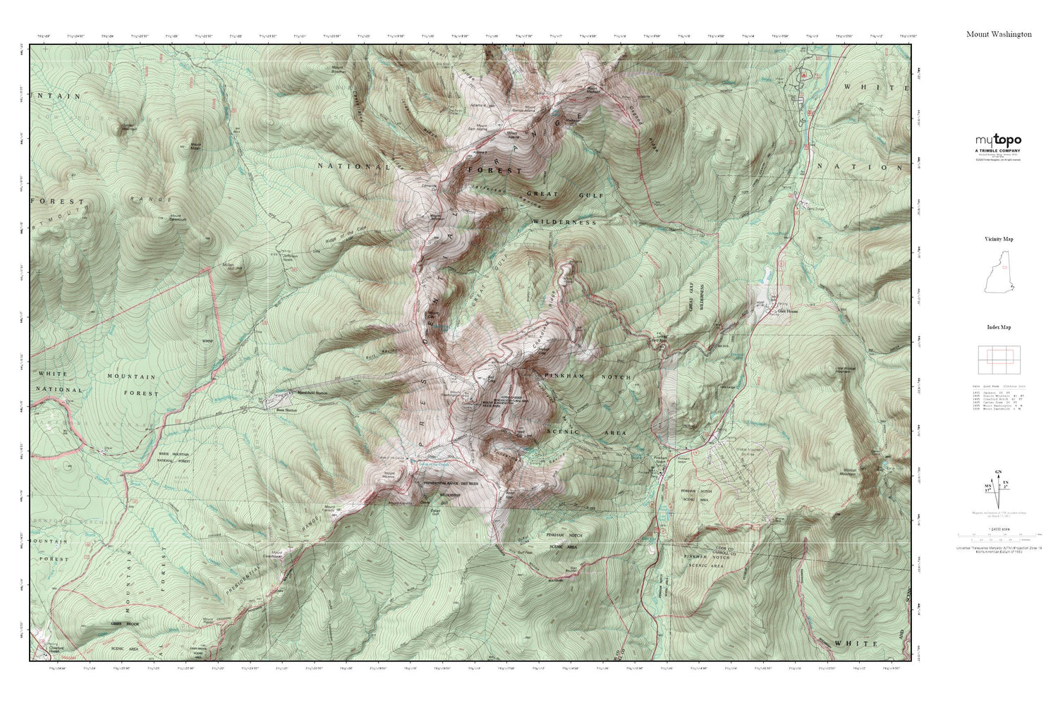
Topographic map of Mount Washington in the state of New Hampshire. From the MyTopo Explorer Series.
This topo map features shaded relief and comes with UTM / MGRS and Latitude/Longitude grids.
For more than two decades, MyTopo has provided maps to the most adventurous among us.. those who love to explore our nation’s remote wilderness areas, climb our highest peaks, and trek across our vast public lands. This map is part of a curated collection of the most popular places for which MyTopo customers have designed maps. It is a “bucket list” of the most amazing places to hike, hunt, and explore.
This map contains the following named places: 03575,03593,Abenaki Brook,Adams Five,Adams Slide Trail,Agiocochook Crag,Alpine Garden Trail,Alpine Gardens,Assaguam Brook,Ball Crag,Bigelow Lawn,Boott Spur,Boott Spur Trail,Burt Ravine,Buttress Trail,Castellated Ridge,Castle Path,Chandler Brook,Chandler Ridge,Chandlers Purchase,Clay Brook,Crawford Path,Crawfords Purchase,Crew Cut Trail,Currier Mountain,Cutler River,Dartmouth Range,Davis Path,Desolation Pond,Edmands Col,Edmands Path,Emerald Pool,Franklin Brook,Glen Boulder,Glen Boulder Trail,Glen Ellis Falls,Glen Ellis Falls Picnic Area,Glen Ellis Falls Scenic Area,Great Gulf,Great Gulf Shelter,Great Gulf Trail,Great Gulf Wilderness,Gulf of Slides,Gulf Peak,Gulfside Trail,Halfway Brook,Hermit Lake,Huntington Ravine,Israel Ridge,Jefferson Brook,Jefferson Notch,Jefferson Ravine,Jewell Trail,Lakes of the Clouds,Lion Head,Lost Pond,Low and Burbanks Grant,Lows Bald Spot,Madison Gulf,Marshfield Station,Millen Hill,Monroe Brook,Montalban Ridge,Mount Adams,Mount Clay,Mount Dartmouth,Mount Eisenhower,Mount Eisenhower Trail,Mount Franklin,Mount Jefferson,Mount Mitten,Mount Monroe,Mount Pleasant Brook,Mount Sam Adams,Mount Washington,Nelson Crag,Nelson Crag Trail,New River,Nowell Ridge,Oakes Gulf,Oakes Gulf Trail,Old Jackson Road,Osgood Trail,Parapet Brook,Pinkham Notch,Pinkham Notch Camp,Pinkham Notch Scenic Area,Pinkham Notch Visitor Center,Pinkhams Grant,Presidential Range,Raymond Path,Ridge of the Caps,Six Husbands Trail,Sokokis Brook,Spaulding Lake,Sphinx Trail,Summit House,Thompson and Meserves Purchase,Thompson Brook,Tip-Top House,Tuckerman Ravine,Vals Ledge,Wamsutta Trail,Washburn Point,Westside Trail,White Mountains,WHOM-FM (Mount Washington),Wildcat Mountain Ski Area,Wildcat Ridge,WZPK-FM (Berlin)


