MyTopo
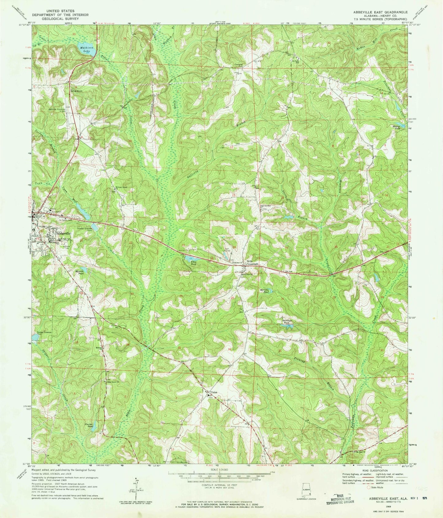
Classic USGS Abbeville East Alabama 7.5'x7.5' Topo Map
Couldn't load pickup availability
Historical USGS topographic quad map of Abbeville East in the state of Alabama. Map scale may vary for some years, but is generally around 1:24,000. Print size is approximately 24" x 27"
This quadrangle is in the following counties: Henry.
The map contains contour lines, roads, rivers, towns, and lakes. Printed on high-quality waterproof paper with UV fade-resistant inks, and shipped rolled.
Contains the following named places: Abbeville Fire and Rescue, Abbeville Junior High School, Abbeville Methodist Church, Abbeville Municipal Airport, Abbeville Police Department, Abbeville Post Office, Bethel Church, Cat Branch, Cedar Grove Church, Chattahoochee Country Club and Golf Course, Christ Temple Number Two Church, Davis Branch, Ebenezer Cemetery, Ebenezer Methodist Episcopal Church, Edsel Adams Dam, Fincher Pond, First Baptist Church, Fleming Branch, G B Mathison Dam, Galloway Branch, Henry County, Henry County Sheriff's Office, Hickory Grove Cemetery, Hickory Grove Church, Little Abbie Creek, M L Tillis Pond Dam, Mathison Lake, Merritts Pond, Messick Pond, Midway Church, Moneys Pond, Mount Zion Church, Mountain Creek, Nordan Branch, Old Zion Baptist Church, Old Zion Cemetery, Pilgrims Rest Freewill Baptist Church, Saint Paul Church, Saint Pauls School, Saint Peters Cemetery, Shorterville Division, Skippers Creek, Spring Hill Church, Starlings Pond, The Most Holy Church, Tillis Pond, Town Creek, Union, Union Freewill Baptist Church, Vann Mill Creek, Watford Branch, Wills Crossroads, ZIP Code: 36310