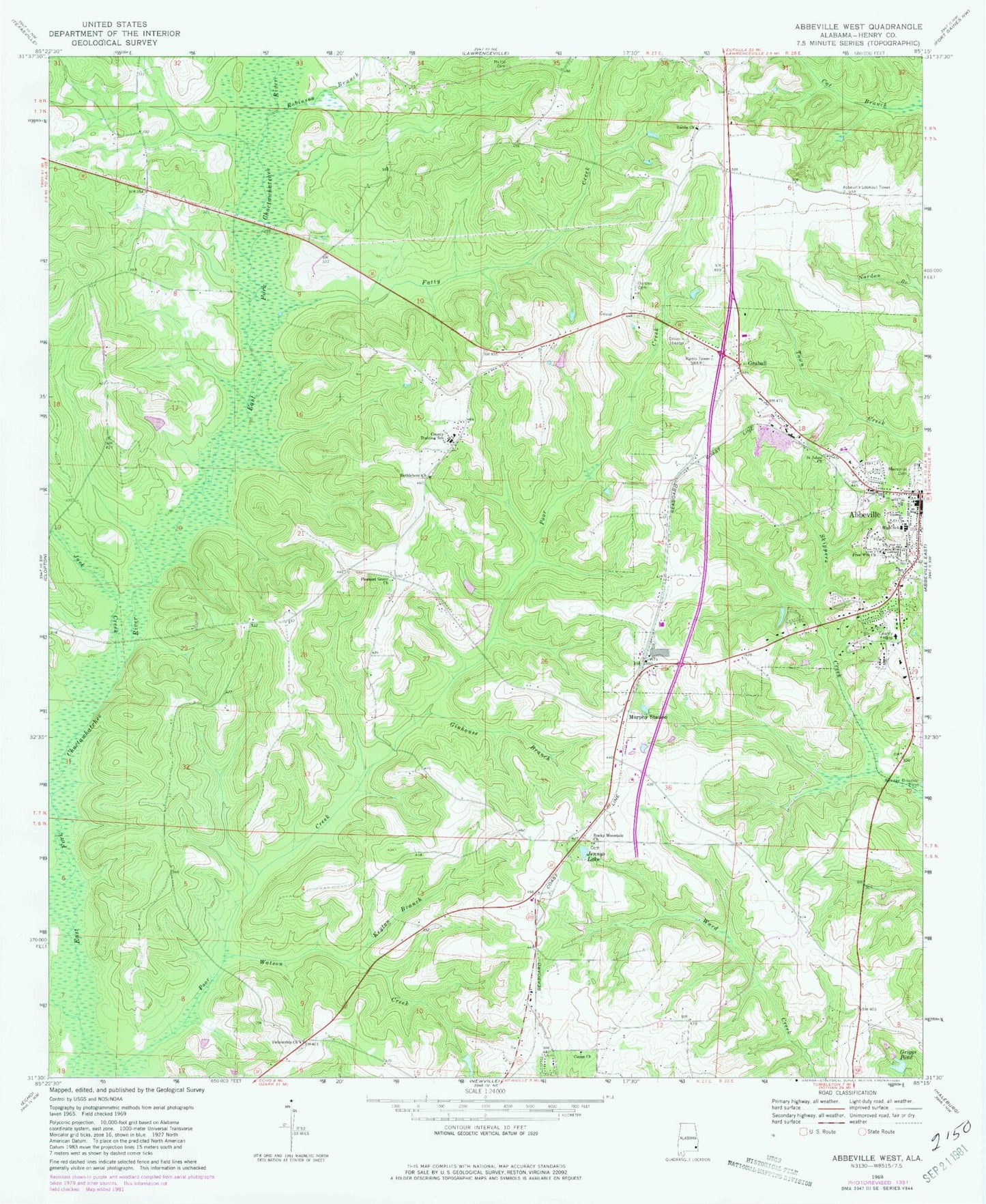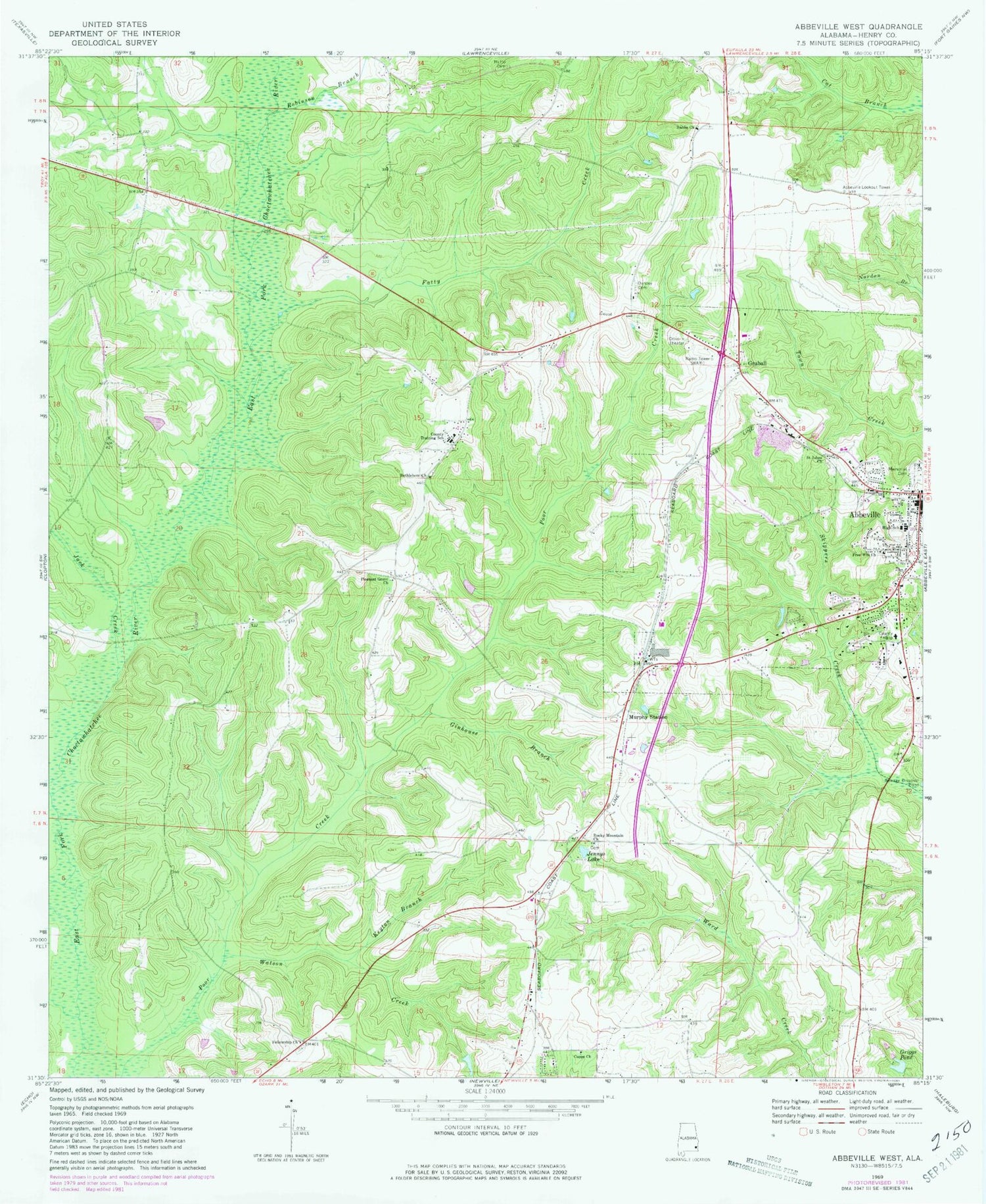
MyTopo
Classic USGS Abbeville West Alabama 7.5'x7.5' Topo Map
Couldn't load pickup availability
Historical USGS topographic quad map of Abbeville West in the state of Alabama. Map scale may vary for some years, but is generally around 1:24,000. Print size is approximately 24" x 27"
This quadrangle is in the following counties: Henry.
The map contains contour lines, roads, rivers, towns, and lakes. Printed on high-quality waterproof paper with UV fade-resistant inks, and shipped rolled.
Contains the following named places: Abbeville, Abbeville Division, Abbeville High School, Abbeville Lookout Tower, Abbeville Memorial Church of God in Christ, Bethlehem Church, Capps Church, City of Abbeville, Danzey Cemetery, Fatty Creek, Fellowship Baptist Church Cemetery, Fellowship Church, Free Will Church, Ginhouse Branch, Graball, Griggs Pond, Henry County Health and Rehabilitation Facility, Henry County Hospital, Henry County Hospital Airport, Henry County Industrial School, Jack Creek, Jennys Lake, Keyton Branch, Murphy Station, Panther Creek, Pleasant Grove Cemetery, Pleasant Grove Missionary Baptist Church, Robinson Branch, Rocky Mountain Church, Saint Johns Church, Sardis Baptist Church, SpectraCare Health Systems Henry County Clinic, WARI-AM (Abbeville), Watson Creek, WXLE-FM (Abbeville)