
MyTopo
Classic USGS Abbeville West South Carolina 7.5'x7.5' Topo Map
Couldn't load pickup availability
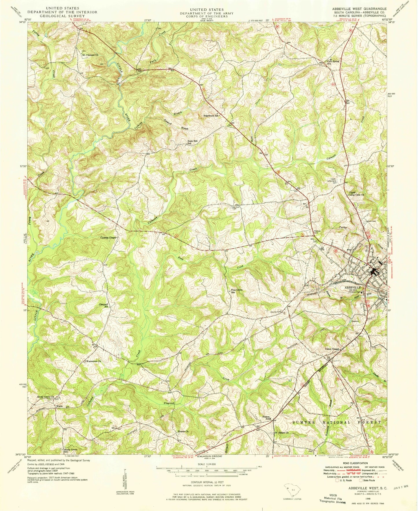
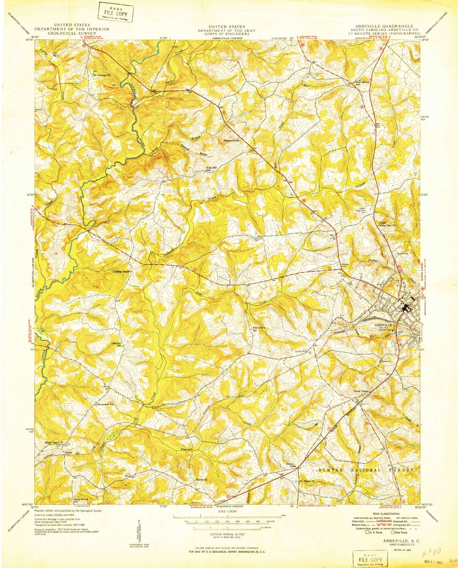
Historical USGS topographic quad map of Abbeville West in the state of South Carolina. Map scale may vary for some years, but is generally around 1:24,000. Print size is approximately 24" x 27"
This quadrangle is in the following counties: Abbeville.
The map contains contour lines, roads, rivers, towns, and lakes. Printed on high-quality waterproof paper with UV fade-resistant inks, and shipped rolled.
Contains the following named places: Abbeville, Abbeville Area Medical Center, Abbeville Associate Reformed Presbyterian Church, Abbeville County, Abbeville County Courthouse, Abbeville County Emergency Medical Services 1, Abbeville County F D Sharon Station 1, Abbeville County Farm, Abbeville County Fire Department Edgewood Station 6, Abbeville County Fire Department Headquarters, Abbeville County Health Center, Abbeville Division, Abbeville Fire Department, Abbeville High School, Abbeville Historic District, Abbeville Museum, Abbeville Opera House, Abbeville Presbyterian Church, Abbeville Public Library, Abbeville Water Plant, Adams Branch, Chappell School, City of Abbeville, Cochran Branch, Cold Spring, Cold Spring School, Court Square, Cross Road Ministries, Cypress Chapel, Dover, Edgewood School, First Baptist Church, Flagreed Creek, Grace Chapel African Methodist Episcopal Church, Greenville Street Elementary School, Harrisburg Street Grade School, Hobson Cemetery, Main Street United Methodist Church, Melrose Cemetery, Mount Clement Church, Old Zion Cemetery, Park Creek, Penny Creek, Pine Grove School, Poplar Grove Davidic School, Redd Creek, Reid Creek, Reids Creek, Rock Hill School, Rockhill Church, Sacred Heart Catholic Church, Saint James African Methodist Episcopal Church, Saint Peters Church, Shady Grove Church, Shady Grove School, Sharon, Sharon Cemetery, Sharon Church, Sharon School, South Side Baptist Church, Stalls Pond Dam D-3041, Tanyard Branch, The Learning Center, Trinity Cemetery, Trinity Episcopal Church, Union Baptist Church, Union Chapel, Upper Long Cane Cemetery, Upper Long Cane Presbyterian Church, WABV-AM (Abbeville), Warrenton, Warrenton Cemetery, Warrenton Presbyterian Church, Washington Street Presbyterian Church, Watts, Westside Baptist Church, Zion Holiness Church, ZIP Code: 29620