MyTopo
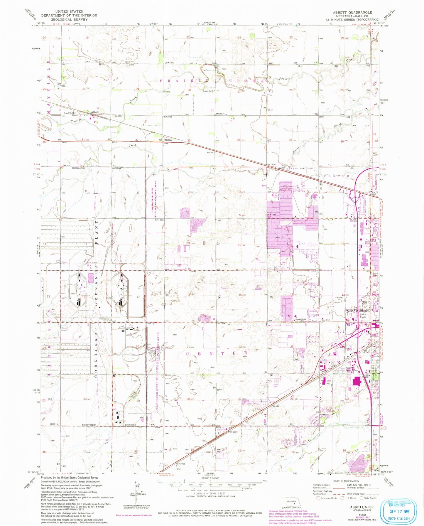
Classic USGS Abbott Nebraska 7.5'x7.5' Topo Map
Couldn't load pickup availability
Historical USGS topographic quad map of Abbott in the state of Nebraska. Map scale may vary for some years, but is generally around 1:24,000. Print size is approximately 24" x 27"
This quadrangle is in the following counties: Hall.
The map contains contour lines, roads, rivers, towns, and lakes. Printed on high-quality waterproof paper with UV fade-resistant inks, and shipped rolled.
Contains the following named places: Abbott, Abbott Post Office, Abundant Life Christian Center, Berean Bible Church, Calvary Baptist Church, Church of Christ, Conestoga Mall, Cornhusker Army Ammunition Plant, Cornhusker State Wildlife Management Area-Parcel Three, Cornhusker State Wildlife Management Area-Parcel Two, Engleman Elementary School, First United Methodist Church, George Park, Grand Island Fire Department Station 3, Grand Island Fire Department Station 4, Grand Island Mall, Grand Island Post Office, Indianhead Golf Club, Isle de Grand Shopping Center, Jehovahs Witnesses Kingdom Hall, Midwest Medical Transport Company, Nebraska State Highway Patrol Troop C, Nebraska Veterans Home Cemetery, Northwest High School, Ovina, Ovina Post Office, Peace Lutheran Church, Resurrection Catholic Church, School Number 15, School Number 18, School Number 38, School Number 54, Third City Christian Church, Tiffany Square, Township of Center, Webb Plaza Post Office, West Park Plaza Mobile Home Park, Westlawn Memorial Cemetery, Westridge Middle School, Womens Health Services, Word of Faith Grand Island Family Church, ZIP Code: 68803