MyTopo
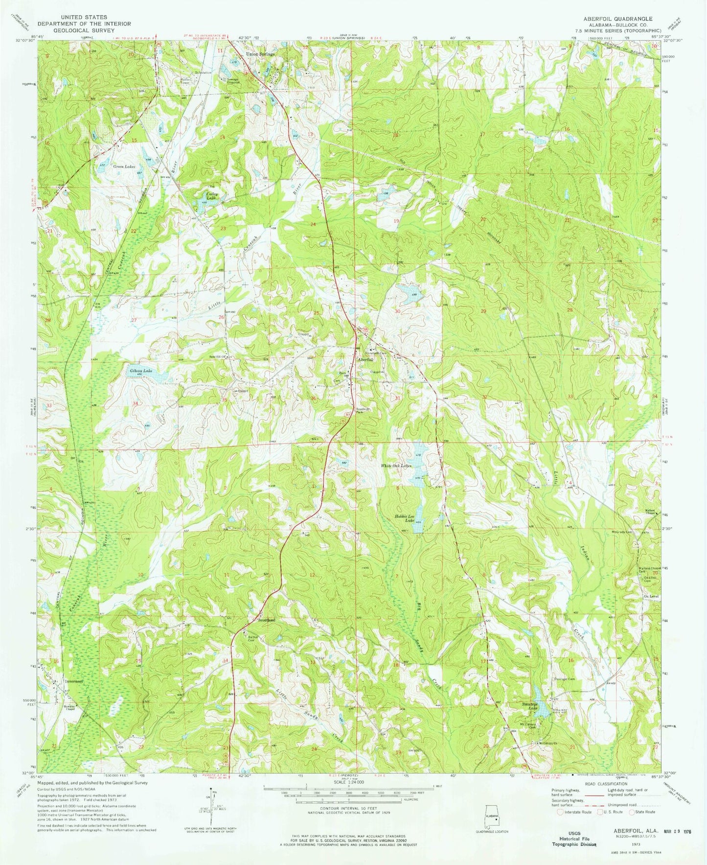
Classic USGS Aberfoil Alabama 7.5'x7.5' Topo Map
Couldn't load pickup availability
Historical USGS topographic quad map of Aberfoil in the state of Alabama. Map scale may vary for some years, but is generally around 1:24,000. Print size is approximately 24" x 27"
This quadrangle is in the following counties: Bullock.
The map contains contour lines, roads, rivers, towns, and lakes. Printed on high-quality waterproof paper with UV fade-resistant inks, and shipped rolled.
Contains the following named places: Aberfoil, Aberfoil Junior High School, Bethel Cemetery, Bethel Presbyterian Church, Bethel School, Bullock County, C F Green Lake, C F Green Lake Dam, Carlisle Mill, Colley Lake, Colley Pond Dam, Cypress Pond, Dasinger Cemetery, Elizabeth Baptist Church, Elizabeth Cemetery, Gibson Dam, Gibson Lake, Green Lakes, Hawkins Chapel, High Ridge Church, Hobbie Lee Dam, Hobbie Lee Lake, Indian Creek, Indian Creek Elementary School, Indian Creek Post Office, Inverness, Inverness Baptist Church, Little Conecuh River, Lydia Baptist Cemetery, Mallard Chapel, Mallard Chapel Cemetery, McGrady Cemetery, Mount Calvary Cemetery, Mount Calvary Church, Neal Chapel African Methodist Episcopal Zion Church, O H Williams Lake, O H Williams Lake Dam, Ox Level, Ox Level Cemetery, Sand Hill Church, Scottland, Smiths Store, Smuteye Lake, Smuteye Pond Dam, Stavo, Tito, Varner Dam, Varner Lake, Walter Cemetery, Walter Chapel, White Oak Lake Number One, White Oak Lake Number Two, White Oak Lakes, White Oak Number One Dam, White Oak Number Two Dam