
MyTopo
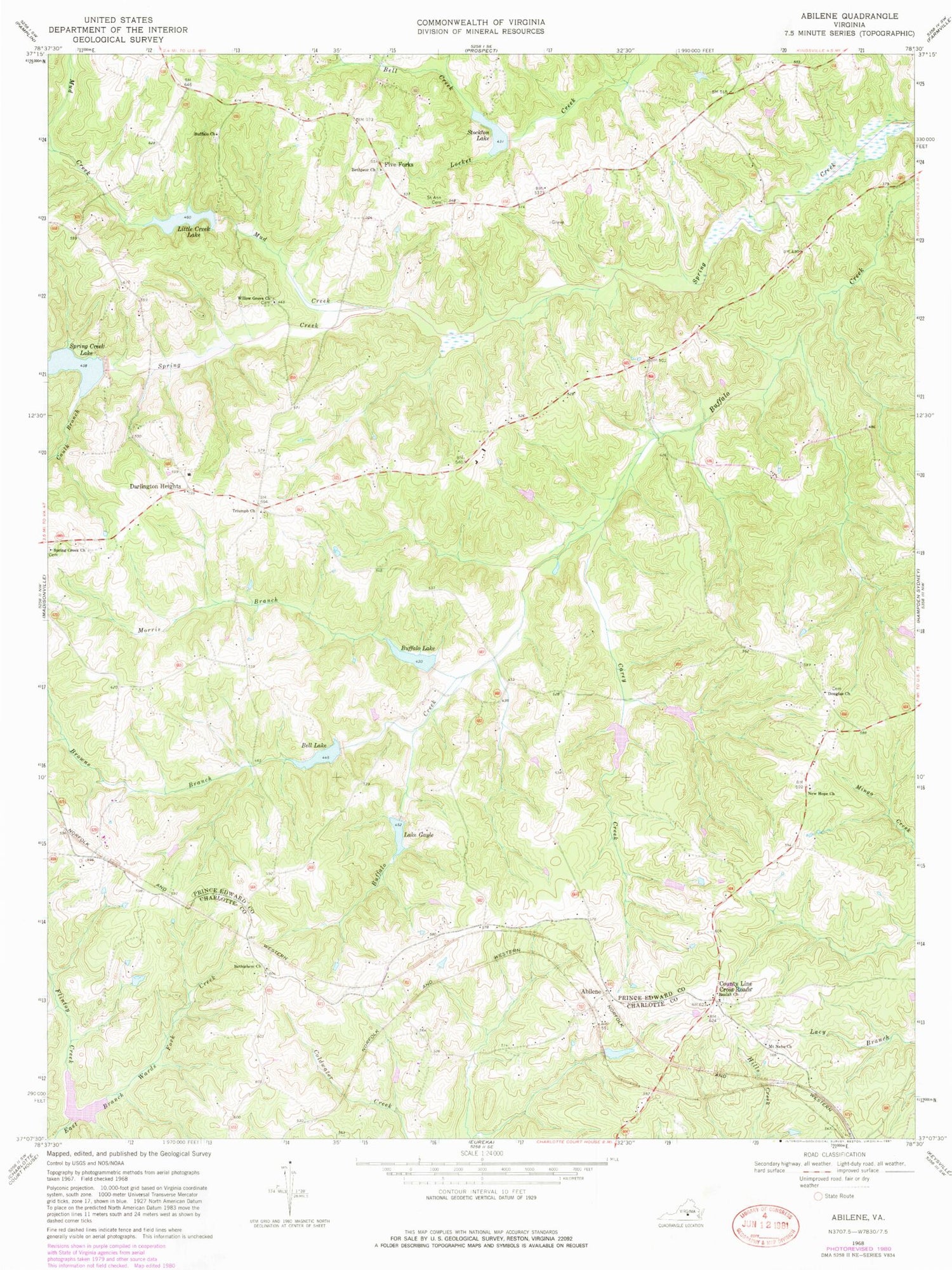
Classic USGS Abilene Virginia 7.5'x7.5' Topo Map
Couldn't load pickup availability
Historical USGS topographic quad map of Abilene in the state of Virginia. Map scale may vary for some years, but is generally around 1:24,000. Print size is approximately 24" x 27"
This quadrangle is in the following counties: Charlotte, Prince Edward.
The map contains contour lines, roads, rivers, towns, and lakes. Printed on high-quality waterproof paper with UV fade-resistant inks, and shipped rolled.
Contains the following named places: Abilene, Abilene Airport, Bell Creek, Bell Lake, Bethlehem Church, Bethpeor Cemetery, Bethpeor Church, Beulah Church, Browns Branch, Buffalo Cemetery, Buffalo Church, Buffalo Creek Number Eight Dam, Buffalo Creek Number Five Dam, Buffalo Creek Number Four Dam, Buffalo Creek Number Nine Dam, Buffalo Creek Number Seven Dam, Buffalo Creek Number Six Dam, Buffalo Creek Number Three Dam, Buffalo Creek Number Two Dam, Buffalo Lake, Carey Creek, Caulk Branch, County Line Cross Roads, Darlington Heights, Darlington Heights School, Darlington Heights Volunteer Fire Department, District 501, Douglas Cemetery, Douglas Church, Five Forks, Five Forks School, Flintoy Creek, Lake Gayle, Little Creek Lake, Morris Branch, Mount Nebo Church, Mud Creek, New Hope Baptist Church, Saint Ann Cemetery, Spring Creek Church, Spring Creek Lake, Stockton Lake, Tredway, Triumph Church, Willow Grove Church


