MyTopo
Classic USGS Ables Springs Texas 7.5'x7.5' Topo Map
Couldn't load pickup availability
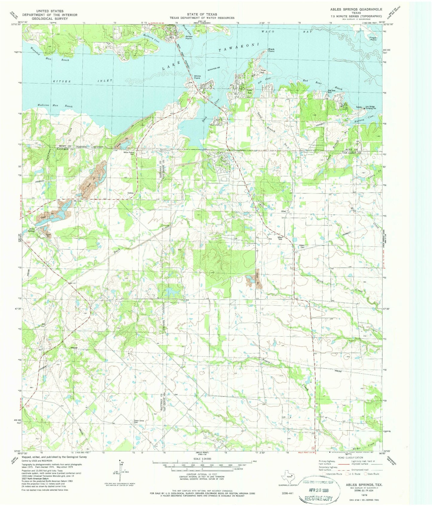
Historical USGS topographic quad map of Ables Springs in the state of Texas. Map scale may vary for some years, but is generally around 1:24,000. Print size is approximately 24" x 27"
This quadrangle is in the following counties: Hunt, Kaufman, Van Zandt.
The map contains contour lines, roads, rivers, towns, and lakes. Printed on high-quality waterproof paper with UV fade-resistant inks, and shipped rolled.
Contains the following named places: Ables Springs, Ables Springs Cemetery, Alsa, Arrow Point, Ash Cove, Black Point, Cedar Grove, Cedar Grove Cemetery, Duck Cove, Duck Cove Bridge, Duck Creek, Finger Point, Goettsche Lake, Goettsche Lake Dam, Howell Cemetery, Iron Bridge Pumping Station, Kitsee Inlet, Lakeview Church, McBee Field, McCoy, Medicine Man Reach, Mulberry Cove, Mustang Cove, Red Bear Park, Red Bear Reach, Red Deer Park, Rolling Oaks Volunteer Fire Department, Sand Branch Number One, Sand Branch Number Two, Sycamore Creek, Waco Bay, White Point, White Point Causeway, Whites Prairie Cemetery, Wounded Man Reach