
MyTopo
Classic USGS Accident Maryland 7.5'x7.5' Topo Map
Couldn't load pickup availability
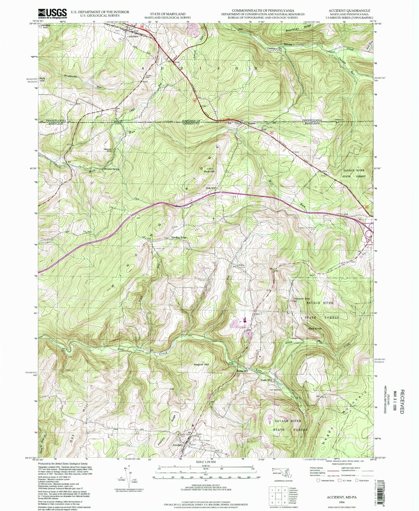
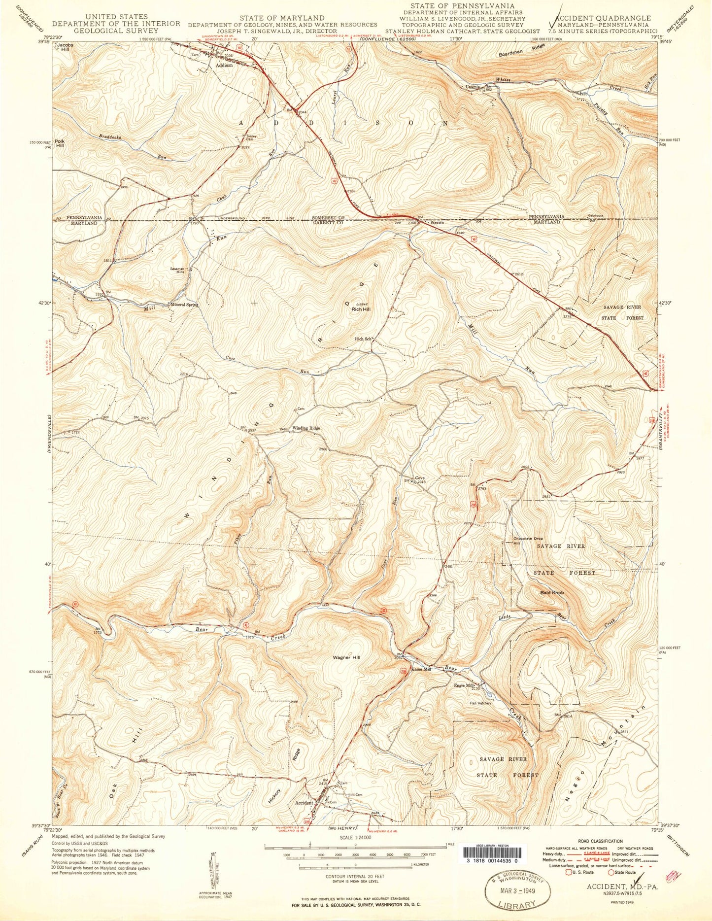
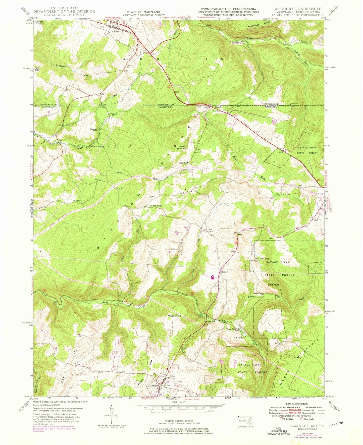
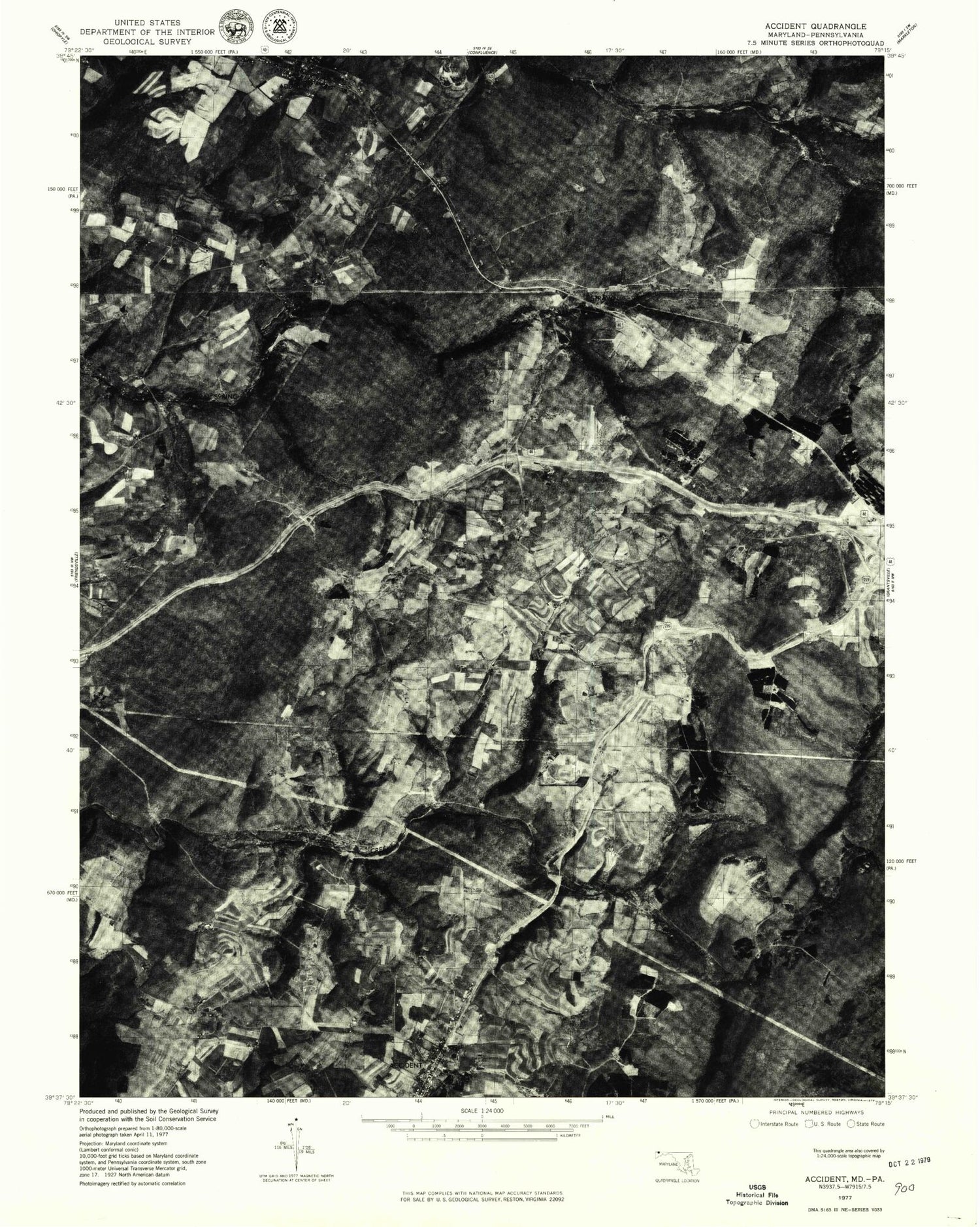
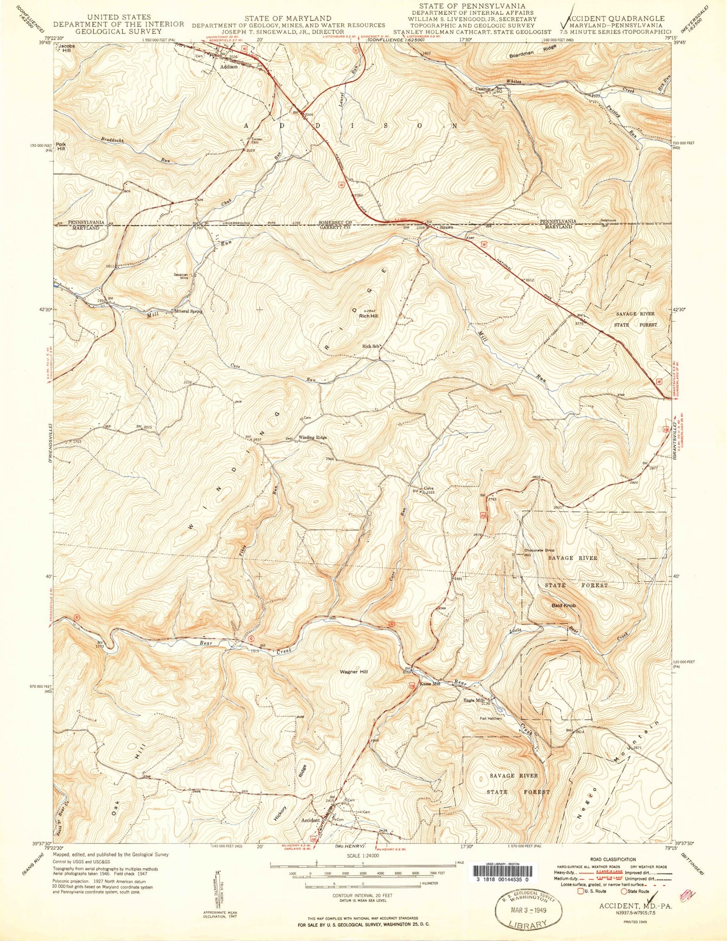
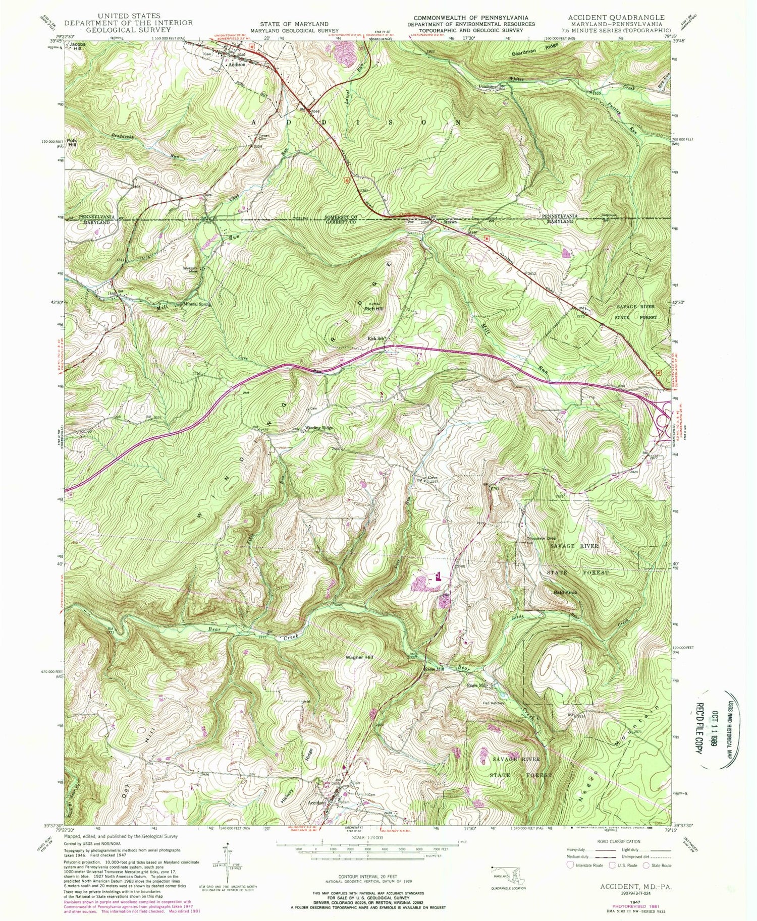
Historical USGS topographic quad map of Accident in the states of Maryland, Pennsylvania. Map scale may vary for some years, but is generally around 1:24,000. Print size is approximately 24" x 27"
This quadrangle is in the following counties: Garrett, Somerset.
The map contains contour lines, roads, rivers, towns, and lakes. Printed on high-quality waterproof paper with UV fade-resistant inks, and shipped rolled.
Contains the following named places: Accident, Accident Elementary School, Accident Evangelical Lutheran Church, Accident Post Office, Accident Volunteer Fire Department Station 50, Addison, Addison Post Office, Addison Volunteer Fire Department - Station 613, Bald Knob, Bear Creek Fish Rearing Station, Borough of Addison, Chocolate Drop Hill, Chub Run, Cove, Cove Run, District 5 Accident, Engle Mill, Fikes Run, Hoy Run, Kaese Mill, Little Bear Creek, Mineral Spring, Niles Mill, Northern Garrett High School, Northern Middle School, Oak Hill, Pine Springs, Puzzley Run, Rich Hill, Rich School, Saint Johns English Lutheran Church, Saint John's English Lutheran Church Cemetery, Saint Johns Lutheran Church, Sausman Mine, State Line United Methodist Church, Strawn, Town of Accident, Town of Accident Police, Turney Cemetery, Unamis, Wagner Hill, Winding Ridge, Zion Evangelical Lutheran Church, ZIP Code: 15411