MyTopo
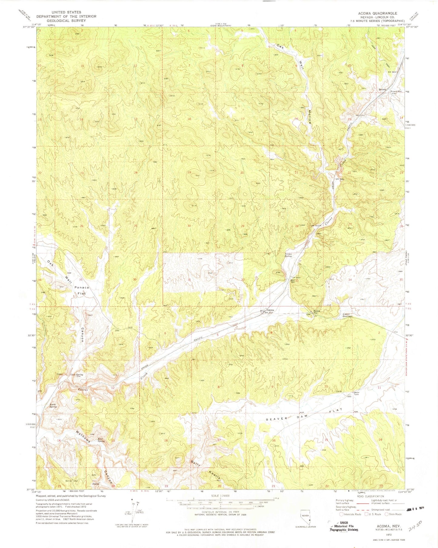
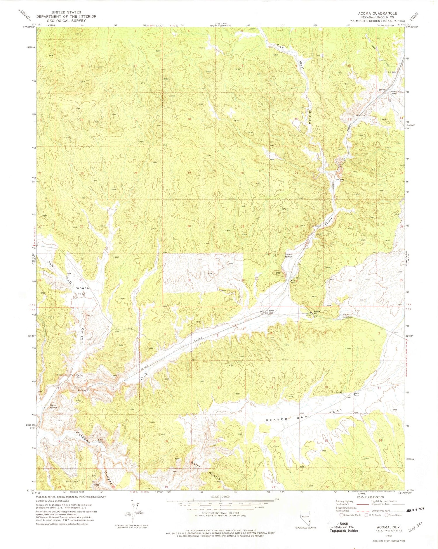
Classic USGS Acoma Nevada 7.5'x7.5' Topo Map
Regular price
$16.95
Regular price
Sale price
$16.95
Unit price
per
Couldn't load pickup availability
Historical USGS topographic quad map of Acoma in the state of Nevada. Map scale may vary for some years, but is generally around 1:24,000. Print size is approximately 24" x 27"
This quadrangle is in the following counties: Lincoln.
The map contains contour lines, roads, rivers, towns, and lakes. Printed on high-quality waterproof paper with UV fade-resistant inks, and shipped rolled.
Contains the following named places: Acoma, Acoma Mine, Acoma Post Office, Acoma Reservoir, Acoma Spring, Bally Knolls, Beaver Dam Flat, Boykin Mine, Brown, Browns Well, Cave Spring, East Spring, Five Mile Spring, Joseco, Joseco Post Office, Mathews Canyon, North Spring, Oak Well Canyon, Oak Well Hollow, Panaca Flat