MyTopo
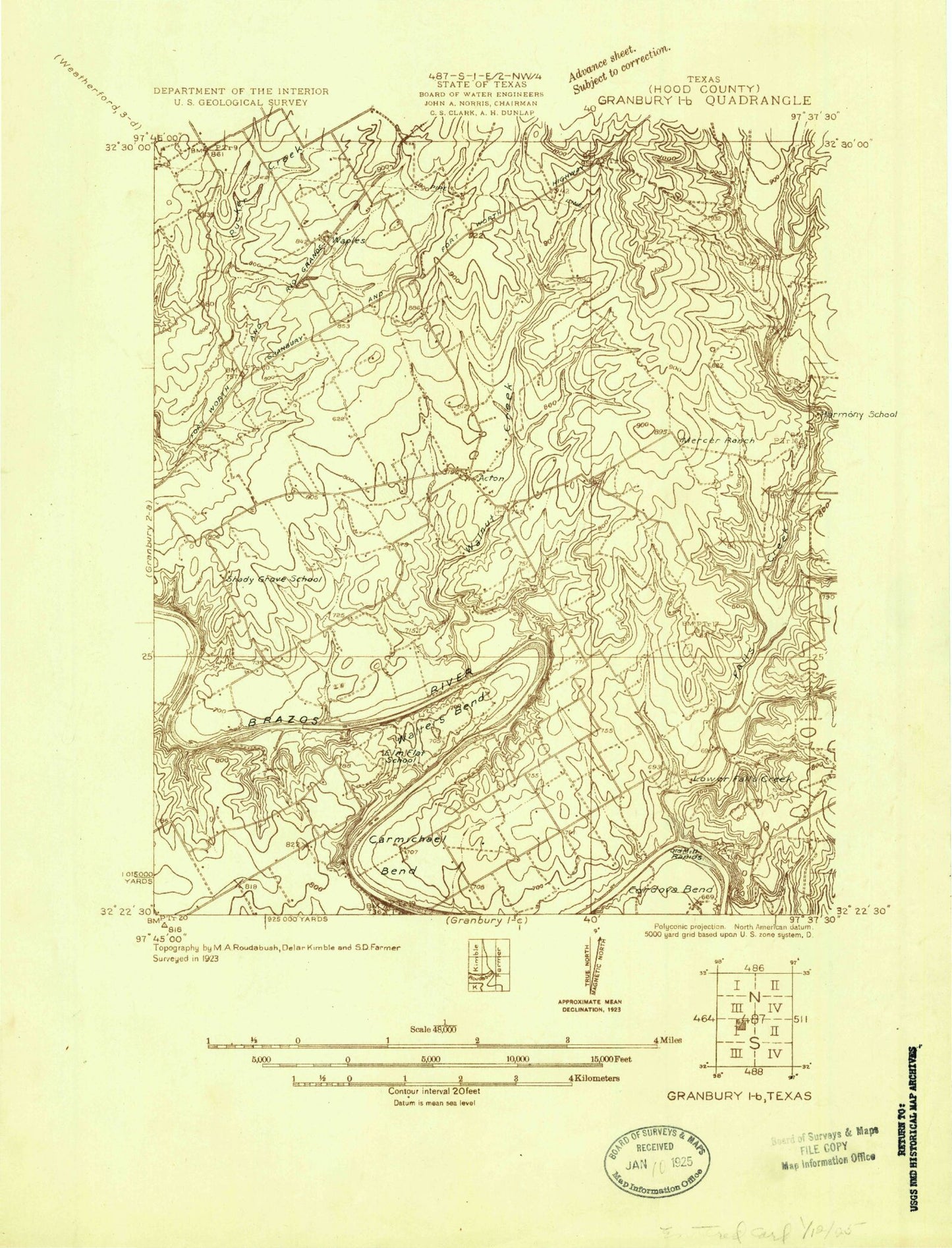
Classic USGS Acton Texas 7.5'x7.5' Topo Map
Couldn't load pickup availability
Historical USGS topographic quad map of Acton in the state of Texas. Map scale may vary for some years, but is generally around 1:24,000. Print size is approximately 24" x 27"
This quadrangle is in the following counties: Hood.
The map contains contour lines, roads, rivers, towns, and lakes. Printed on high-quality waterproof paper with UV fade-resistant inks, and shipped rolled.
Contains the following named places: Acton, Acton Baptist Church, Acton Cemetery, Acton Elementary School, Acton Post Office, Acton State Park, Camp Leonard, Canyon Creek Census Designated Place, Carmichael Bend, City of DeCordova, Contrary Creek, DeCordova, Decordova Bend Estates / Acton Volunteer Fire Department, El Tesoro, Ellaine Grande Ranch Lake, Ellaine Grande Ranch Lake Dam, Elm Flat Cemetery, Faith Assembly of God Church, Fall Creek, Good Shepherd Episcopal Church, Granbury East Division, Hood County Justice of Peace Precinct 3, Ike Branch, Lick Branch, Lusk Branch, Mambrino School, McCarthy Branch, Nassau Bay Airport, Nolan Branch, Oak Woods Intermediate School, Randle Dam, Randle Lake, Rocky Branch, Saint Frances Cabrini Catholic Church, Station Branch, United Methodist Church Acton, Walnut Creek, Walsh Lake, Walsh Lake Dam, Walters Bend, Waples, Wright Branch, ZIP Code: 76049