MyTopo
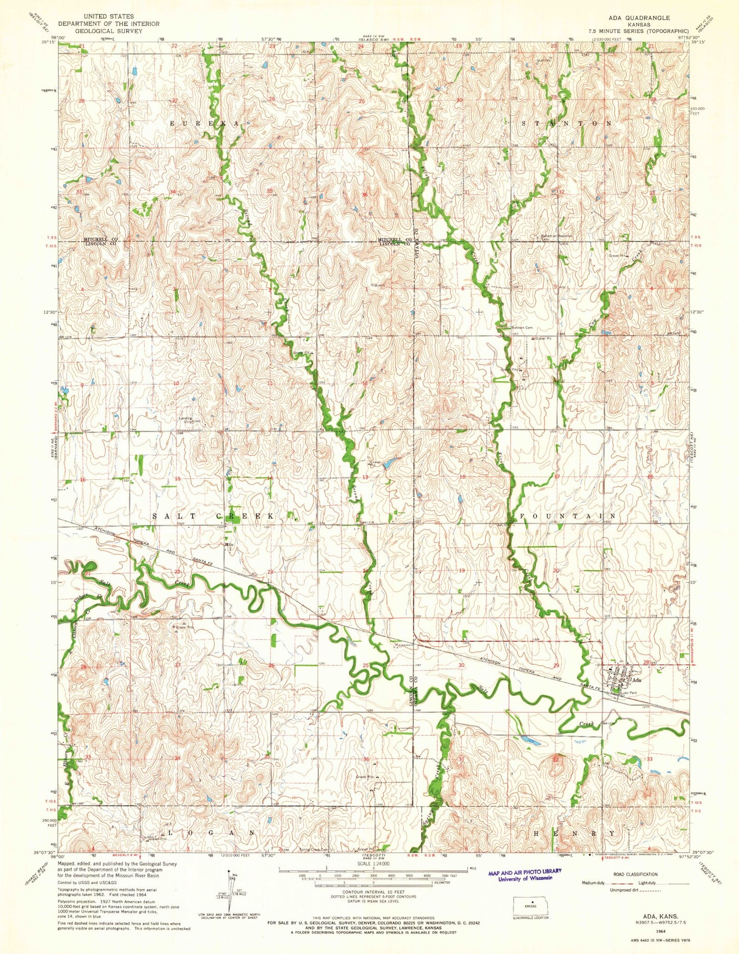
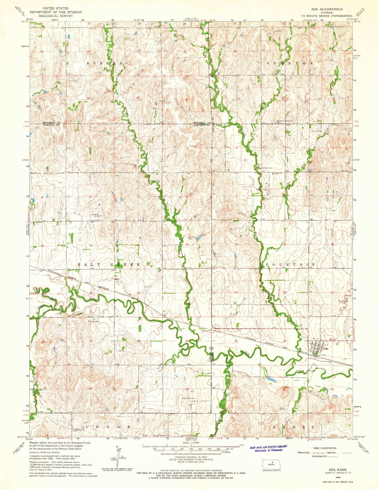
Classic USGS Ada Kansas 7.5'x7.5' Topo Map
Couldn't load pickup availability
Historical USGS topographic quad map of Ada in the state of Kansas. Map scale may vary for some years, but is generally around 1:24,000. Print size is approximately 24" x 27"
This quadrangle is in the following counties: Lincoln, Mitchell, Ottawa.
The map contains contour lines, roads, rivers, towns, and lakes. Printed on high-quality waterproof paper with UV fade-resistant inks, and shipped rolled.
Contains the following named places: Ada, Ada Census Designated Place, Ada Grain Company Grain Elevator Number 1, Ada Ottawa Lincoln Fire Station 1, Ada United Methodist Church, Antioch Baptist Church, Baldwin Cemetery, Bohemain National Cemetery, Bohemian National Cemetery, Cow Creek, East Elkhorn Creek, First Creek, Luke Park, Milo, Second Creek, Spring Creek, Spring Creek Cemetery, Township of Salt Creek, West Elkhorn Creek