MyTopo
Classic USGS Adams Nebraska 7.5'x7.5' Topo Map
Couldn't load pickup availability
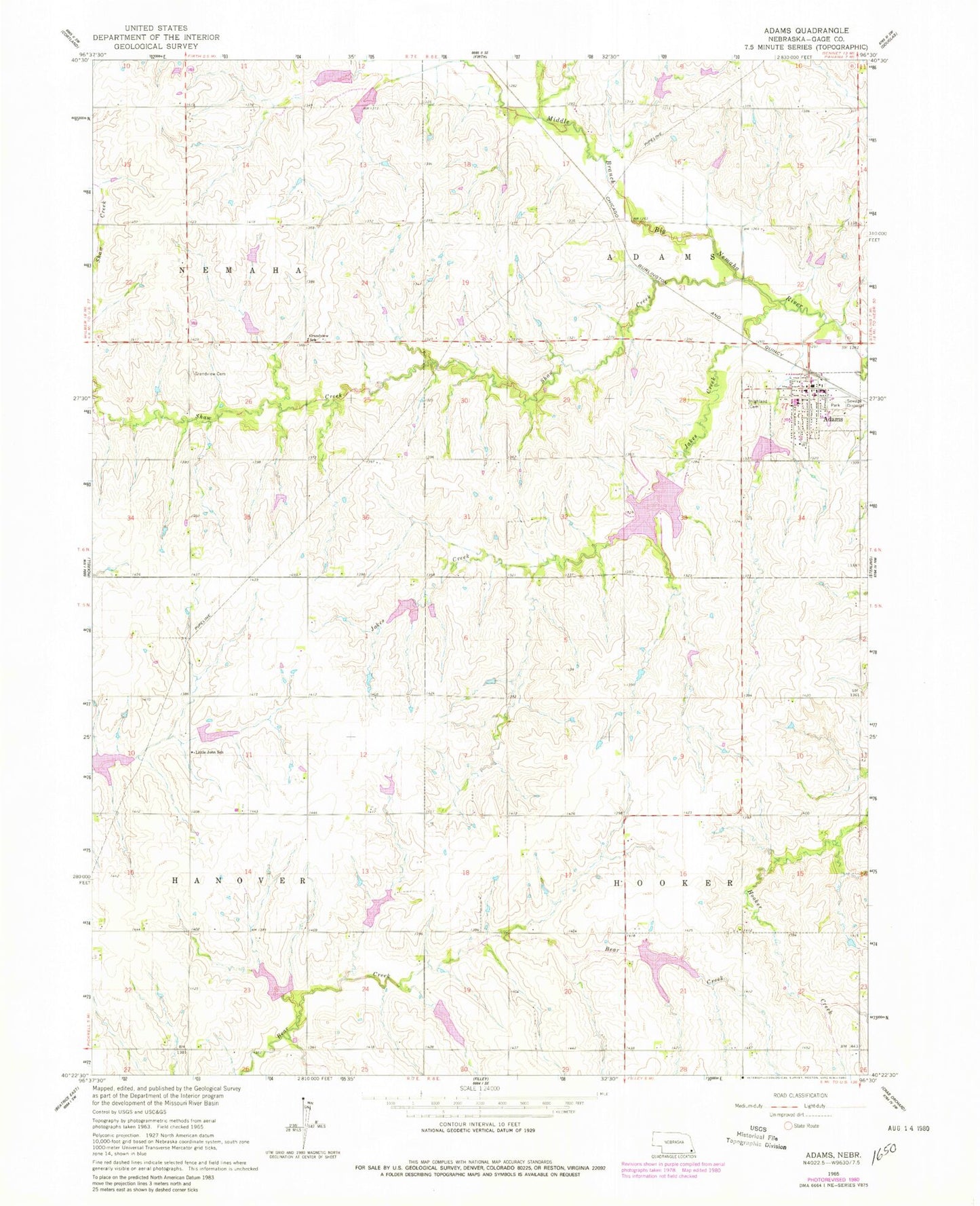
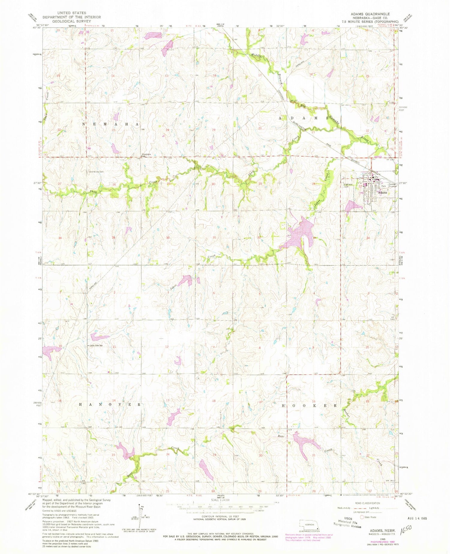
Historical USGS topographic quad map of Adams in the state of Nebraska. Map scale may vary for some years, but is generally around 1:24,000. Print size is approximately 24" x 27"
This quadrangle is in the following counties: Gage.
The map contains contour lines, roads, rivers, towns, and lakes. Printed on high-quality waterproof paper with UV fade-resistant inks, and shipped rolled.
Contains the following named places: Adams, Adams Post Office, Adams Public Library, Adams Public Schools, Adams Rescue Squad, Adams Rural Fire Department, American Lutheran Church, Bear Creek Dam 7-B, Bear Creek Dam 7-E, Bear Creek Dam 7-F, Bear Creek Dam 7-G, Bear Creek Dam 7-J, Bear Creek Reservoir 7-B, Bear Creek Reservoir 7-E, Bear Creek Reservoir 7-F, Bear Creek Reservoir 7-G, Bear Creek Reservoir 7-J, Farmers Elevator Company Elevator, Gold Crest Retirement Center, Grandview Cemetery, Grandview School, Highland Cemetery, Jakes Creek, Little John School, M B Big Nemaha Dam 9-C, M B Big Nemaha Dam 9-D, M B Big Nemaha Reservoir 9-C, M B Big Nemaha Reservoir 9-D, Pierce Creek Dam 5-B, Pierce Creek Reservoir 5-A, Pierce Creek Reservoir 5-B, Remmers School, Shaw Creek, Township of Adams, Township of Hooker, United Methodist Church, Upper Big Nemaha Dam 25-C, Upper Big Nemaha Dam 7-A, Upper Big Nemaha Dam G-13, Upper Big Nemaha Dam G-18A, Upper Big Nemaha Dam G-25, Upper Big Nemaha Dam G-35, Upper Big Nemaha Dam G-37, Upper Big Nemaha Reservoir 25-C, Upper Big Nemaha Reservoir 7-A, Upper Big Nemaha Reservoir G-13, Upper Big Nemaha Reservoir G-18A, Upper Big Nemaha Reservoir G-25, Upper Big Nemaha Reservoir G-35, Upper Big Nemaha Reservoir G-37, Vanengen Chiropractic Clinic, Village of Adams, ZIP Code: 68301