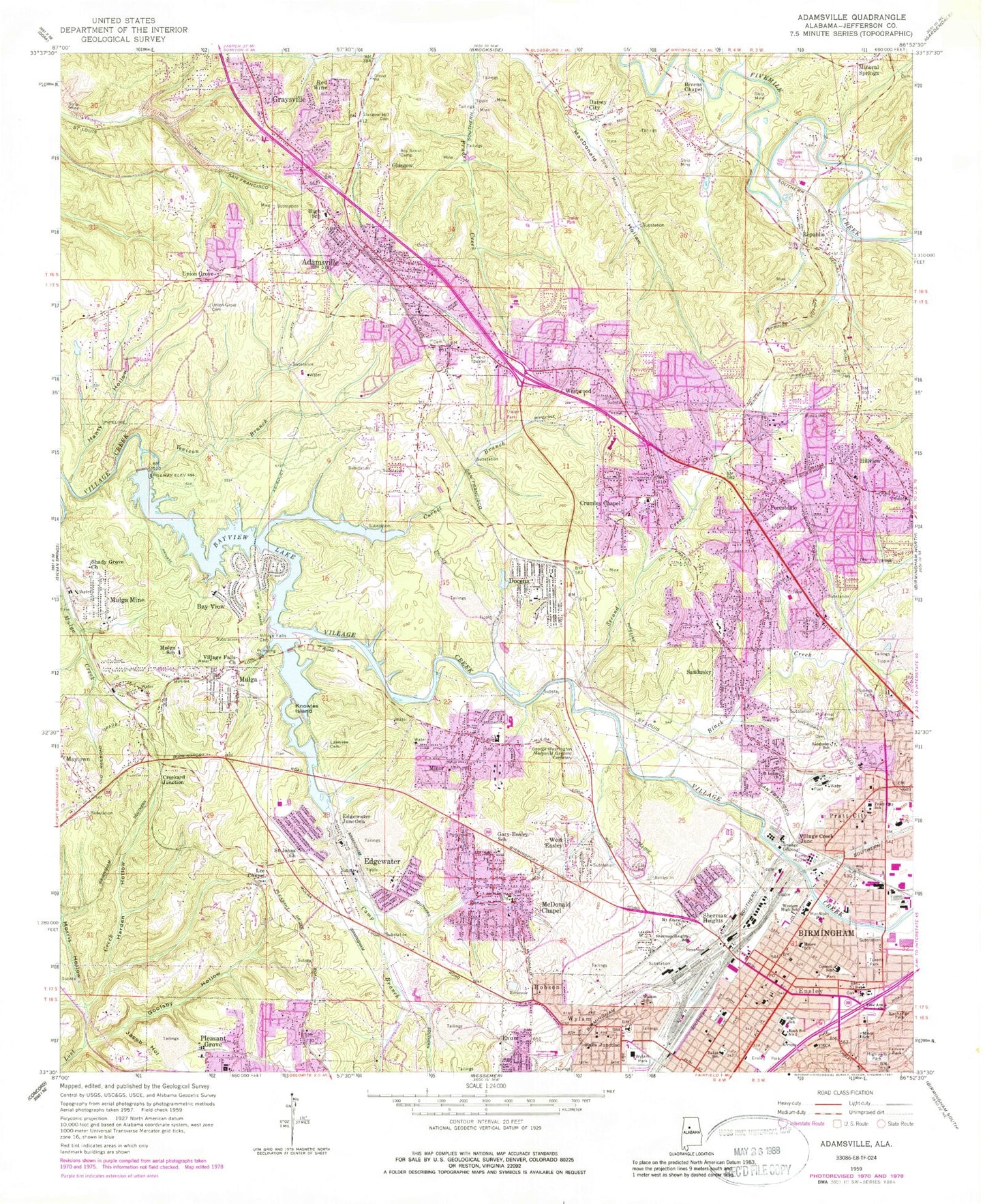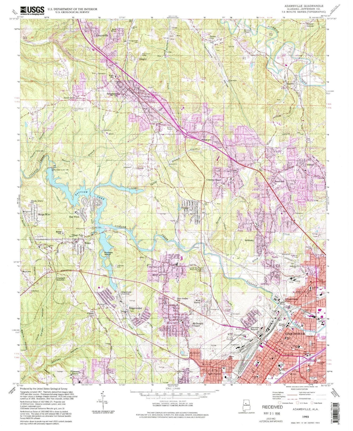
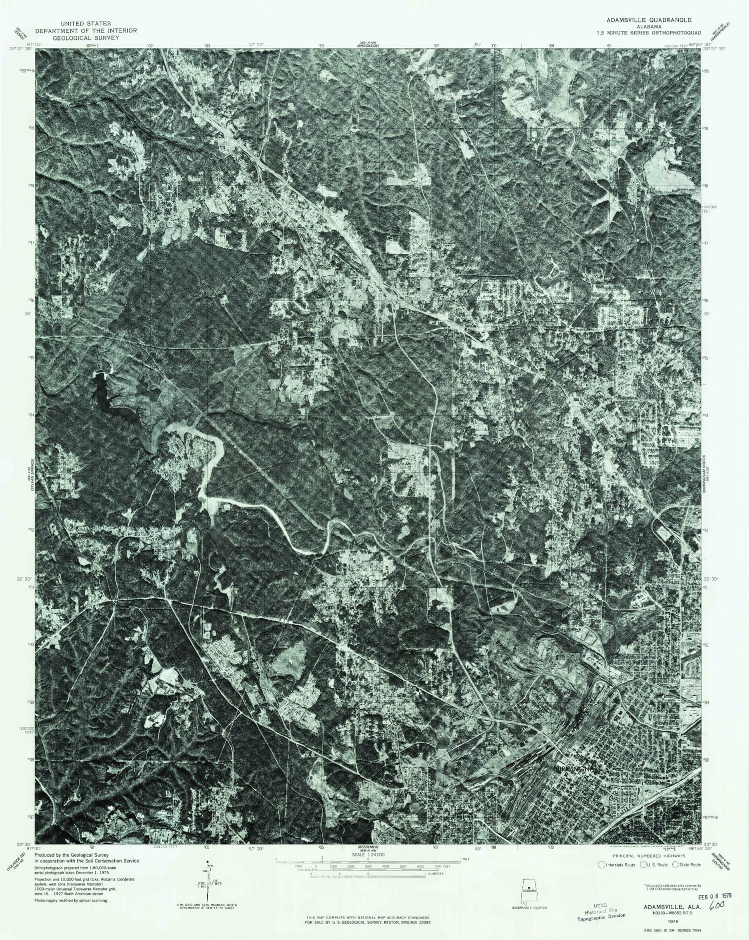

MyTopo
Classic USGS Adamsville Alabama 7.5'x7.5' Topo Map
Couldn't load pickup availability
Historical USGS topographic quad map of Adamsville in the state of Alabama. Map scale may vary for some years, but is generally around 1:24,000. Print size is approximately 24" x 27"
This quadrangle is in the following counties: Jefferson.
The map contains contour lines, roads, rivers, towns, and lakes. Printed on high-quality waterproof paper with UV fade-resistant inks, and shipped rolled.
Contains the following named places: Abyssinia Baptist Church, Adamsville, Adamsville Church of God, Adamsville City Hall, Adamsville Elementary School, Adamsville Fire Department, Adamsville High School, Adamsville Park, Adamsville Police Department, Adamsville Post Office, Baker School, Bay View, Bayview Elementary School, Bayview Lake, Bayview Lake Dam, Bayview Mine, Bellevue Baptist Church, Bethel African Methodist Episcopal Church, Birmingham Fire and Rescue Service Station 16, Birmingham Fire and Rescue Service Station 17, Birmingham Fire and Rescue Service Station 18, Birmingham Police Department West Precinct, Birmingham Post Office - Ensley Station, Bivens Chapel, Bivens Chapel Cemetery, Black Creek, Blossburg East Mine, Blossburg Mine, Bonham Airport, Brvens Chapel, Bush School Number 2, Butterfield Junior High School, Camp Branch, Cat Mountain, Community Hospital, Community Primitive Baptist Church, Cooks Mine, Corbet Branch, Corinthian Baptist Church, Councill Elementary School, Crockard Junction, Crumley Chapel, Crumley Chapel Cemetery, Crumley Chapel Community Center, Crumley Chapel Elementary School, Daisey City, Daisey City Trailer Park, Docena, Docena Elementary School, Docena Post Office, Docena Slope Mine, Dogtown, Dolomite Mine, Dolomite Number 1 Slope Mine, Dolomite Number 2 Mine, Edgewater, Edgewater Census Designated Place, Edgewater Church, Edgewater Elementary School, Edgewater Junction, Edgewater Junior High School, Edgewater School, Edgewater Shaft Mine, Ensley, Ensley Baptist Church, Ensley Bible Church, Ensley Christian Church, Ensley Church of Christ, Ensley Community Church, Ensley High School, Ensley Highland Presbyterian Church, Ensley Highlands, Ensley Park, Exchange Park, Exum, Fairview Park, Falls Junction, Fields Branch, First Baptist Church of Ensley, Forest Square Shopping Center, Forest View Estates, Forestdale, Forestdale by the Brook, Forestdale Census Designated Place, Forestdale Fire District Station 2, Forestdale Fire District Station 3, Forestdale Mobile Home Park, Forestdale Plaza Shopping Center, Forestdale Post Office, Forestdale Square Shopping Center, Fraternal Cemetery, Frenchtown, Friendship Primitive Baptist Church Number One, Gary-Ensley Elementary School, George Washington Memorial Gardens Cemetery, Glasgow, Glasgow Hill Cemetery, Glasgow Ridge, Goolsby Hollow, Grays Gardens, Graysville, Graysville Heights, Graysville-Adamsville Division, Hamilton Mine, Hanty Hollow, Harden Hollow, Highlands Park, Hillcrest Estates, Hillview, Hobson, Holy Family Catholic Church, Holy Family Elementary School, Holy Family High School, Irish Hill, Jackson Olin School, Jacob Hollow, Jefferson County, Knowles Island, Lakeview Cemetery, Latter Day Apostolic Church of God, Lee Chapel, Lily Grove Baptist Church, Lindbergh Number 6 Mine, Little Italy, Longview Estates, Longview General Hospital, Longview Mobile Home Park, MacAlpin Park, Macedonia Missionary Baptist Church, Maytown, Maytown Volunteer Fire Department, McArdle Mine, McDonald Chapel, McDonald Chapel Census Designated Place, McDonald Chapel Elementary School, McDonald Hollow Landfill, Merrywood, Metropolitan Christian Methodist Episcopal Church, Midway, Midway Cemetery, Mineral Springs Church, Mineral Springs Elementary School, Minor, Minor Census Designated Place, Minor First Baptist Church, Minor Heights Fire District, Minor High School, Minor School, Moore Elementary School, Morris Hollow, Mulga, Mulga Elementary School, Mulga Mine, Mulga Post Office, Mulga Volunteer Fire Department, Murray, New Pleasant Hill Baptist Church, New Town, Nolanville, Oakwood, Park West Shopping Center, Pleasant Hill Baptist Church, Pratt City Carline Historic District, Pratt City School, Pratt Mines, Red Wine, Reids Mine, Republic, Republic Baptist Church, Republic Mine, Roberts Cemetery, Rock Slope Number 4 Mine, Saint Anthony of Padua Catholic Church, Saint Anthony School, Saint Catherine of Siena Immaculate Heart Catholic Church, Saint James Baptist Church, Saint Johns Church, Saint Johns Episcopal Church, Saint Josephs Catholic Church, Saint Lukes Church, Saint Matthew Baptist Church, Saint Paul Christian Methodist Episcopal Church, Saint Stanislaus Catholic Church, Sandusky, Sandusky Elementary School, Sandusky School, Sandusky United Methodist Church, Scarlet Town, Second Creek, Shady Grove Church, Shadyside, Sherman Heights, Sherman Heights School, Sherwood Hills, Shugart Springs, Simmons Airport, Stagg, Sunset Mountain, The Drifttracks, The Elbow, Town of Mulga, Trinity African Methodist Episcopal Zion Church, Trinity Baptist Church, Truelove Church, Tuxedo Heights, Tuxedo Park, Union Grove, Union Grove Cemetery, Venison Branch, Village Creek Junction, Village Creek Sewage Treatment Plant, Village Falls, Village Falls Cemetery, Village Hills Shopping Center, Walton School, WAPI-AM (Birmingham), Warner Mine, West Ensley, Westchester Estates, Western High School, Westwood, Westwood Garden Estates, Westwood Trailer Court, Woodruff Mill Mine, Wylam, Wylam Baptist Church, Wylam Elementary School, Wylam Fire Station, Wylam Mine, Wylam Park, Wylam Presbyterian Church, ZIP Codes: 35060, 35214, 35218, 35224