MyTopo
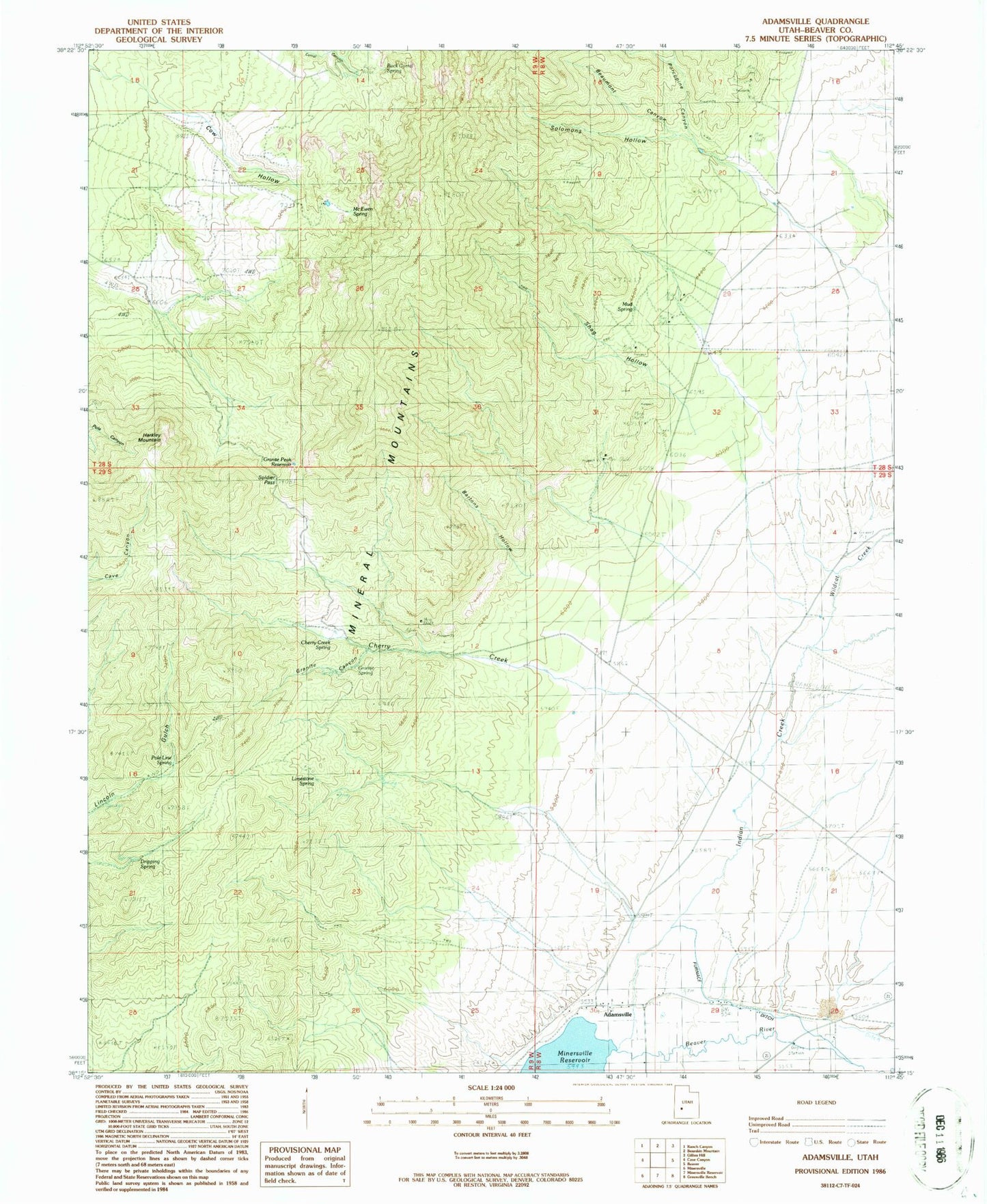
Classic USGS Adamsville Utah 7.5'x7.5' Topo Map
Couldn't load pickup availability
Historical USGS topographic quad map of Adamsville in the state of Utah. Map scale may vary for some years, but is generally around 1:24,000. Print size is approximately 24" x 27"
This quadrangle is in the following counties: Beaver.
The map contains contour lines, roads, rivers, towns, and lakes. Printed on high-quality waterproof paper with UV fade-resistant inks, and shipped rolled.
Contains the following named places: Adamsville, Adamsville Cemetery, Bartons Hollow, Beaumont Canyon, Beaver View Mine, Blue Star Mine, Cherry Creek, Cherry Creek Spring, Cow Hollow, Dripping Spring, Furnace Ditch, Granite Canyon, Granite Peak Reservoir, Granite Spring, Harkley Mountain, Indian Creek, Limestone Spring, McEwen Spring, Mineral Mountains, Mud Spring, Pole Line Spring, Porcupine Canyon, Rock Corral, Rock Corral Recreation Site, Rock Corral Spring, Shag Hollow, Soldier Pass, Solomons Hollow, Wildcat Creek, ZIP Code: 84731