
MyTopo
Classic USGS Adel Oregon 7.5'x7.5' Topo Map
Couldn't load pickup availability
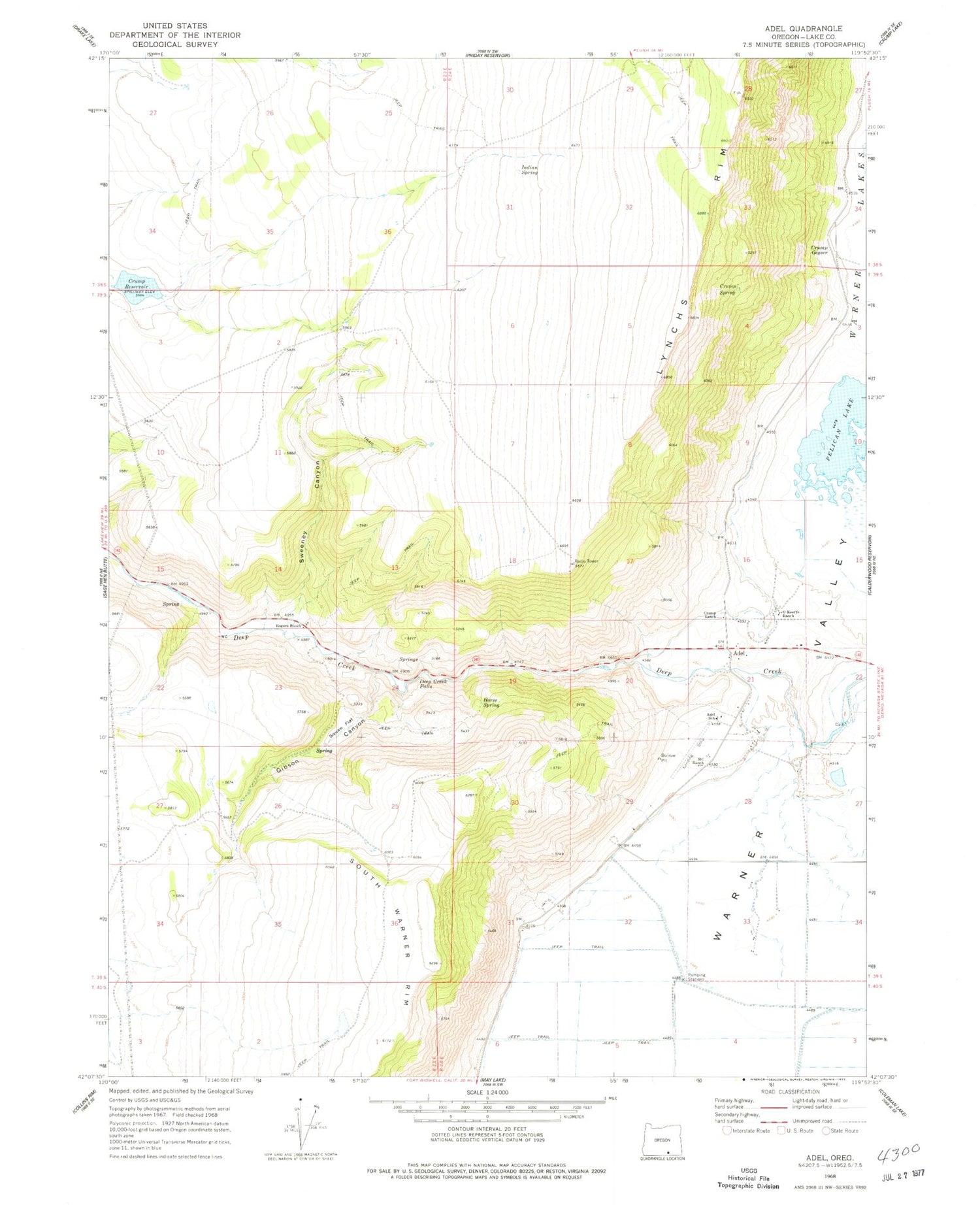
Historical USGS topographic quad map of Adel in the state of Oregon. Map scale may vary for some years, but is generally around 1:24,000. Print size is approximately 24" x 27"
This quadrangle is in the following counties: Lake.
The map contains contour lines, roads, rivers, towns, and lakes. Printed on high-quality waterproof paper with UV fade-resistant inks, and shipped rolled.
Contains the following named places: Adel, Adel Elementary School, Adel Post Office, Bitter Brush Basin, Bug Waterhole, Crump Dam, Crump Ditch, Crump Geyser, Crump Ranch, Crump Reservoir, Crump Spring, Deep Creek Falls, Gibson Canyon, Horse Spring, Indian Spring, Lonely Post Office, Lynchs Rim, M C Ranch, MC Ranch Airport, O'Keefe Ranch, Pelican Lake, Rodgers Reservoir, Rogers Ranch, Squaw Creek, Squaw Flat, Sweeney Canyon, Sweeney Waterhole, Wakefield Waterhole


