MyTopo
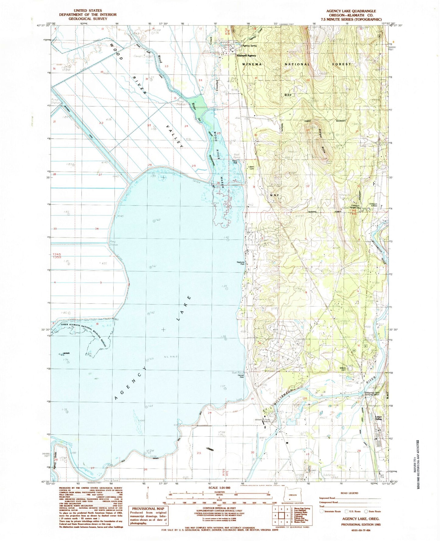
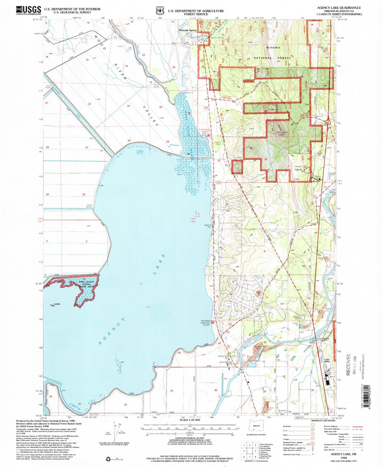
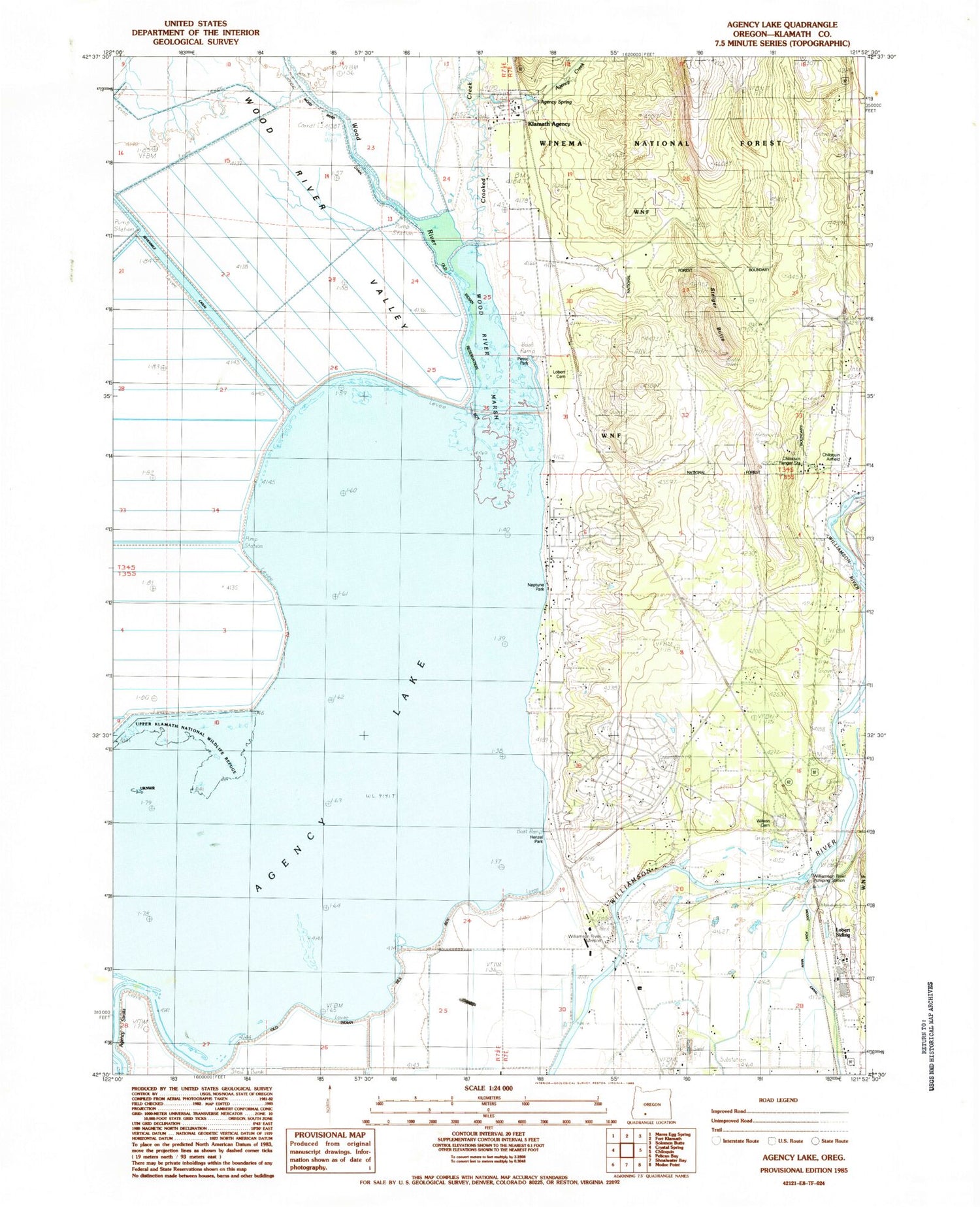
Classic USGS Agency Lake Oregon 7.5'x7.5' Topo Map
Couldn't load pickup availability
Historical USGS topographic quad map of Agency Lake in the state of Oregon. Map scale may vary for some years, but is generally around 1:24,000. Print size is approximately 24" x 27"
This quadrangle is in the following counties: Klamath.
The map contains contour lines, roads, rivers, towns, and lakes. Printed on high-quality waterproof paper with UV fade-resistant inks, and shipped rolled.
Contains the following named places: Agency Creek, Agency Lake, Agency Lake Resort, Agency Lake Resort Boat Ramp, Agency Landing, Agency Spring, B Canal, Beetles Rest Reservoir, Bootleg Pond, C Canal, Chiloquin Agency Lake Fire District Station 2, Chiloquin Boat Access, Chiloquin Ranger Station, Chiloquin State Airport, Crooked Creek, Henzel County Park, Henzel Park Boat Ramp, Klamath Agency, Klamath Agency Post Office, Lobert, Lobert Cemetery, Lobert Draw, Miller Pond, Modoc Point Main Canal, Oregon Shores Census Designated Place, Petric County Park, Petric Park Boat Ramp, Rayenoof Field, Sevenmile Canal, Squaw Creek, Steiger Butte, Waterwheel Campground Boat Launch, Williamson River Mission, Williamson River Pumping Plant, Wilson Cemetery, Wood River, Wood River Marsh, Wood River Valley