MyTopo
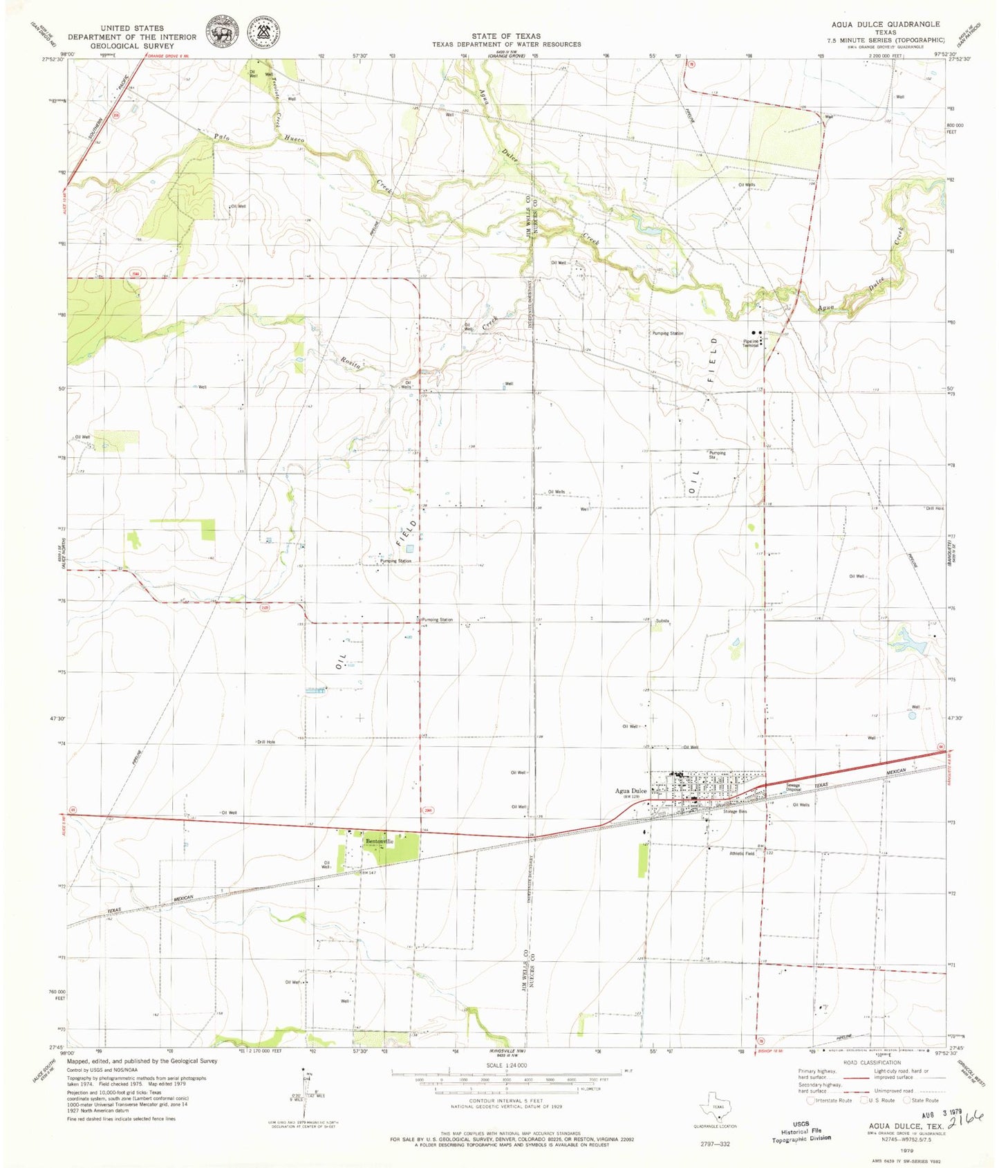
Classic USGS Agua Dulce Texas 7.5'x7.5' Topo Map
Couldn't load pickup availability
Historical USGS topographic quad map of Agua Dulce in the state of Texas. Map scale may vary for some years, but is generally around 1:24,000. Print size is approximately 24" x 27"
This quadrangle is in the following counties: Jim Wells, Nueces.
The map contains contour lines, roads, rivers, towns, and lakes. Printed on high-quality waterproof paper with UV fade-resistant inks, and shipped rolled.
Contains the following named places: Agua Dulce, Agua Dulce City Hall, Agua Dulce Elementary School, Agua Dulce High School, Agua Dulce Post Office, Agua Dulce Volunteer Fire Department, Alfred Census Designated Place, Bentonville, City of Agua Dulce, Harvest Acres Colonia, Palo Hueco Creek, Palo Hueco Estates Colonia, Rosita Creek, Tecolate Creek, Tecolote Creek, Water City Estates Colonia