
MyTopo
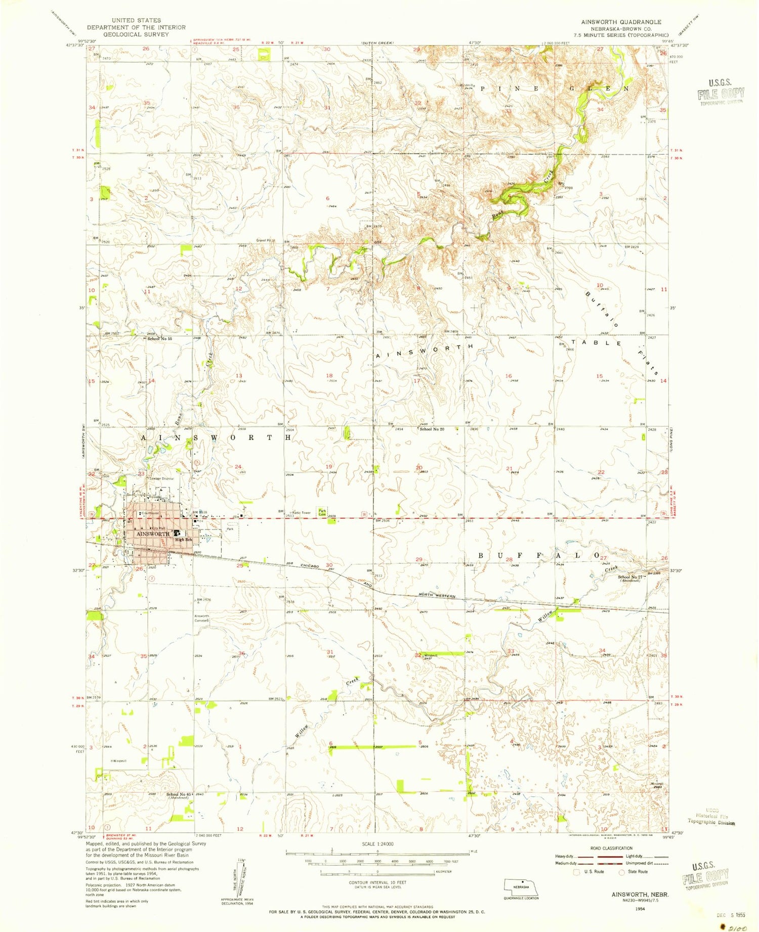
Classic USGS Ainsworth Nebraska 7.5'x7.5' Topo Map
Couldn't load pickup availability
Historical USGS topographic quad map of Ainsworth in the state of Nebraska. Map scale may vary for some years, but is generally around 1:24,000. Print size is approximately 24" x 27"
This quadrangle is in the following counties: Brown.
The map contains contour lines, roads, rivers, towns, and lakes. Printed on high-quality waterproof paper with UV fade-resistant inks, and shipped rolled.
Contains the following named places: Ainsworth, Ainsworth Cemetery, Ainsworth Community Schools, Ainsworth Family Clinic, Ainsworth Feed Yards, Ainsworth Police Department, Ainsworth Post Office, Ainsworth Public Library, Ainsworth Table, Ainsworth Volunteer Fire Department, Assembly of God Church, Berean Fundamental Church, Brown County Ambulance Association, Brown County Clinic, Brown County Courthouse, Brown County Hospital, Brown County Sheriff's Office, Buffalo Flats, Church of the Nazarene, City of Ainsworth, Coleman House, Community Care of Ainsworth, Congregational United Church of Christ, East City Park, East City Park Campground, East Park Cemetery, Eddys School, Evangelical Free Church, Faith Baptist Church, Jehovahs Witnesses Kingdom Hall, KBRB-AM (Ainsworth), KBRB-FM (Ainsworth), Lazy A Motel and Campground, Moody Group Dam, Moody Group Reservoir, New Apostolic Church, Parkside Berean Church, Saint Pius X Catholic Church, School Number 20, School Number 27, School Number 55, Sellors-Barton Museum, Skinners Motor Court, United Methodist Church, Zion Lutheran Church


