
MyTopo
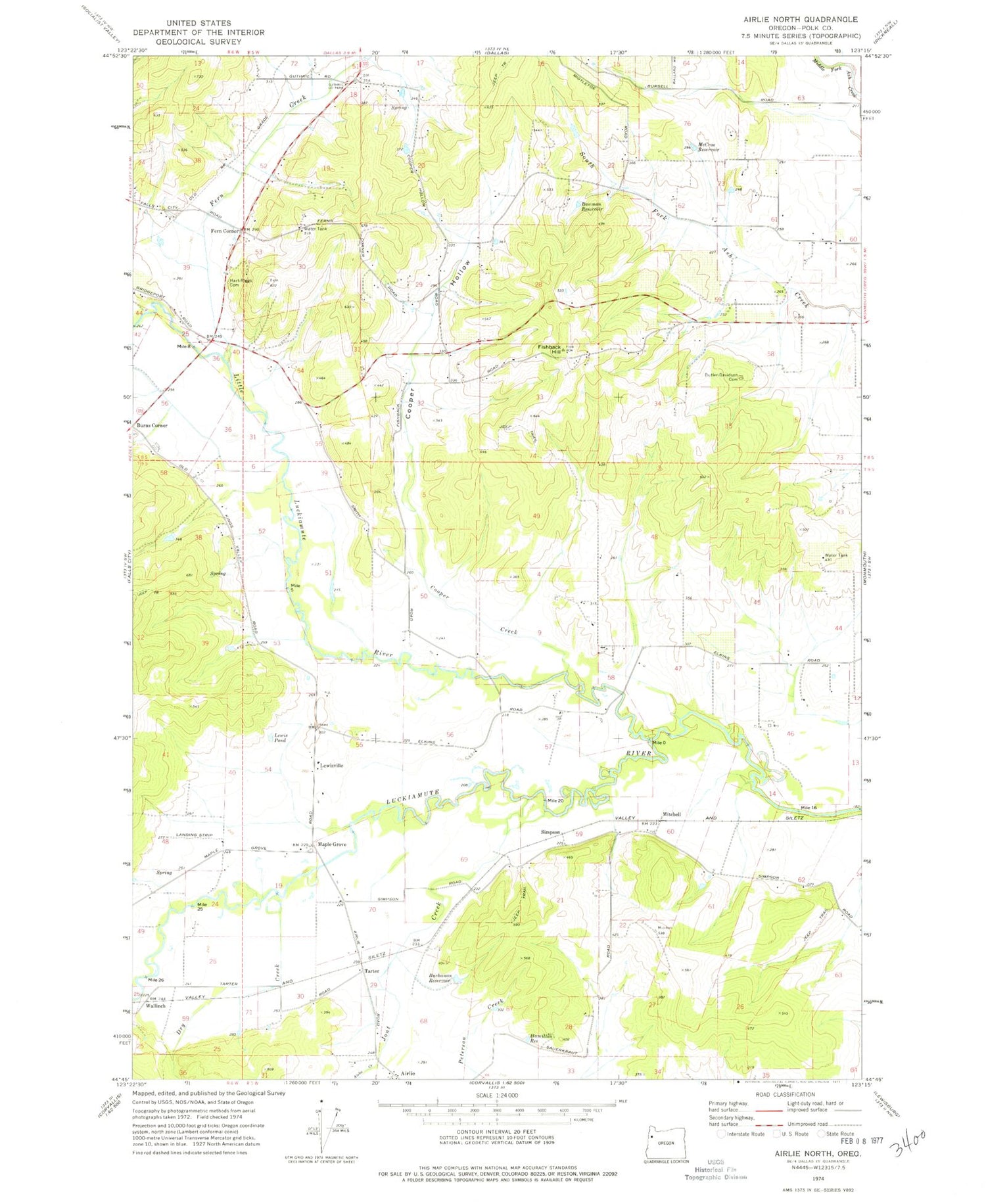
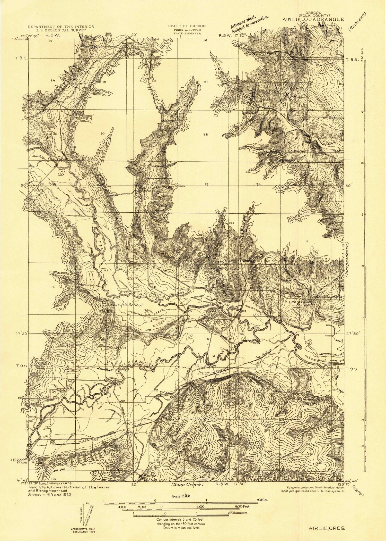
Classic USGS Airlie North Oregon 7.5'x7.5' Topo Map
Couldn't load pickup availability
Historical USGS topographic quad map of Airlie North in the state of Oregon. Map scale may vary for some years, but is generally around 1:24,000. Print size is approximately 24" x 27"
This quadrangle is in the following counties: Polk.
The map contains contour lines, roads, rivers, towns, and lakes. Printed on high-quality waterproof paper with UV fade-resistant inks, and shipped rolled.
Contains the following named places: Airlie, Airlie Creek, Airlie Post Office, Alsip Reservoir, Bass Reservoir, Bauman Reservoir, Bowen Reservoir, Bridgeport Post Office, Buchanan Reservoir, Butler Davidson Cemetery, Cooper Creek, Cooper Hollow, Crisp, Dry Creek, Fern Corner, Fern Creek, Ferns, Fishback Hill, Fisher Reservoir, Garber Reservoir, Gilliam Swale, Gilliams, Guthrie Community Park, Hamilton Reservoir, Hart Riggs Cemetery, Jont Creek, JPM Airport, Lackemute Post Office, Lamer Pond, Lenhard Reservoir, Lewis Pond, Lewisville, Lewisville Post Office, Little Luckiamute River, Luckiamute, Maple Grove, Maple Grove Post Office, Marr Field, McCrae Reservoir, McGuire Reservoir, Mitchell, Oberg Reservoir, Polk County Fire District 1 Station 80, Polk Post Office, Pond A, Putnam, Ratzlaff Reservoir, Simpson, Tarter, V and S Crossing, Wallinch, Winegar Reservoir, ZIP Code: 97361


