MyTopo
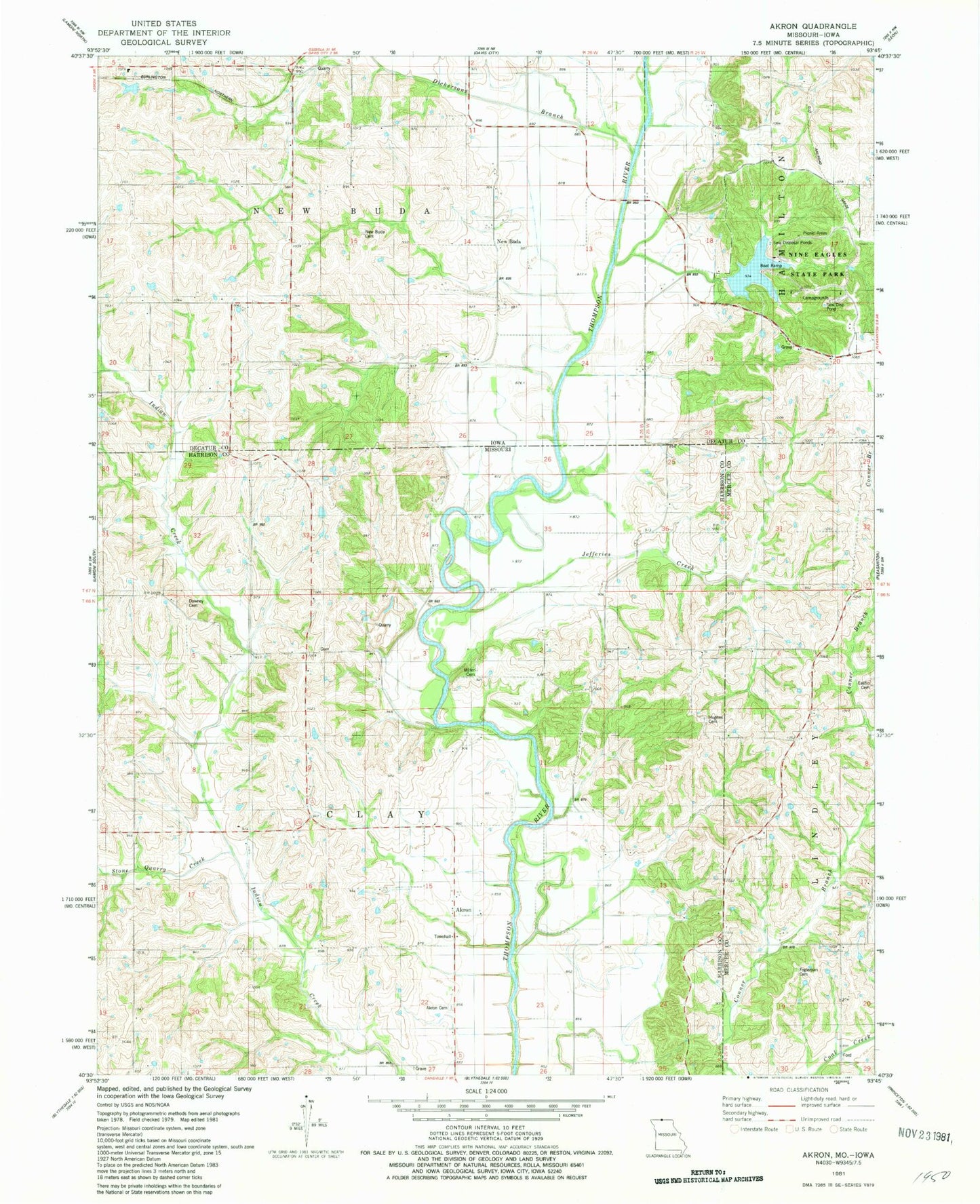
Classic USGS Akron Missouri 7.5'x7.5' Topo Map
Couldn't load pickup availability
Historical USGS topographic quad map of Akron in the states of Missouri, Iowa. Map scale may vary for some years, but is generally around 1:24,000. Print size is approximately 24" x 27"
This quadrangle is in the following counties: Decatur, Harrison, Mercer.
The map contains contour lines, roads, rivers, towns, and lakes. Printed on high-quality waterproof paper with UV fade-resistant inks, and shipped rolled.
Contains the following named places: Akron, Akron Cemetery, Akron Townhall, Burrows, Campbell Cemetery, Dickersons Branch, Downey Cemetery, Downey School, Eastin Cemetery, Fogleman Cemetery, Hagan School, Hughes Cemetery, Hutchinson School, Jefferies Creek, Miller Cemetery, Mount Pleasant School, New Buda, New Buda Cemetery, New Buda Post Office, Nine Eagles Lake, Nine Eagles State Park, Saint Marys Cemetery, Stone Quarry Creek, Surprise School, Toad Valley School, Township of Clay, Township of New Buda, ZIP Codes: 50065, 64426