
MyTopo
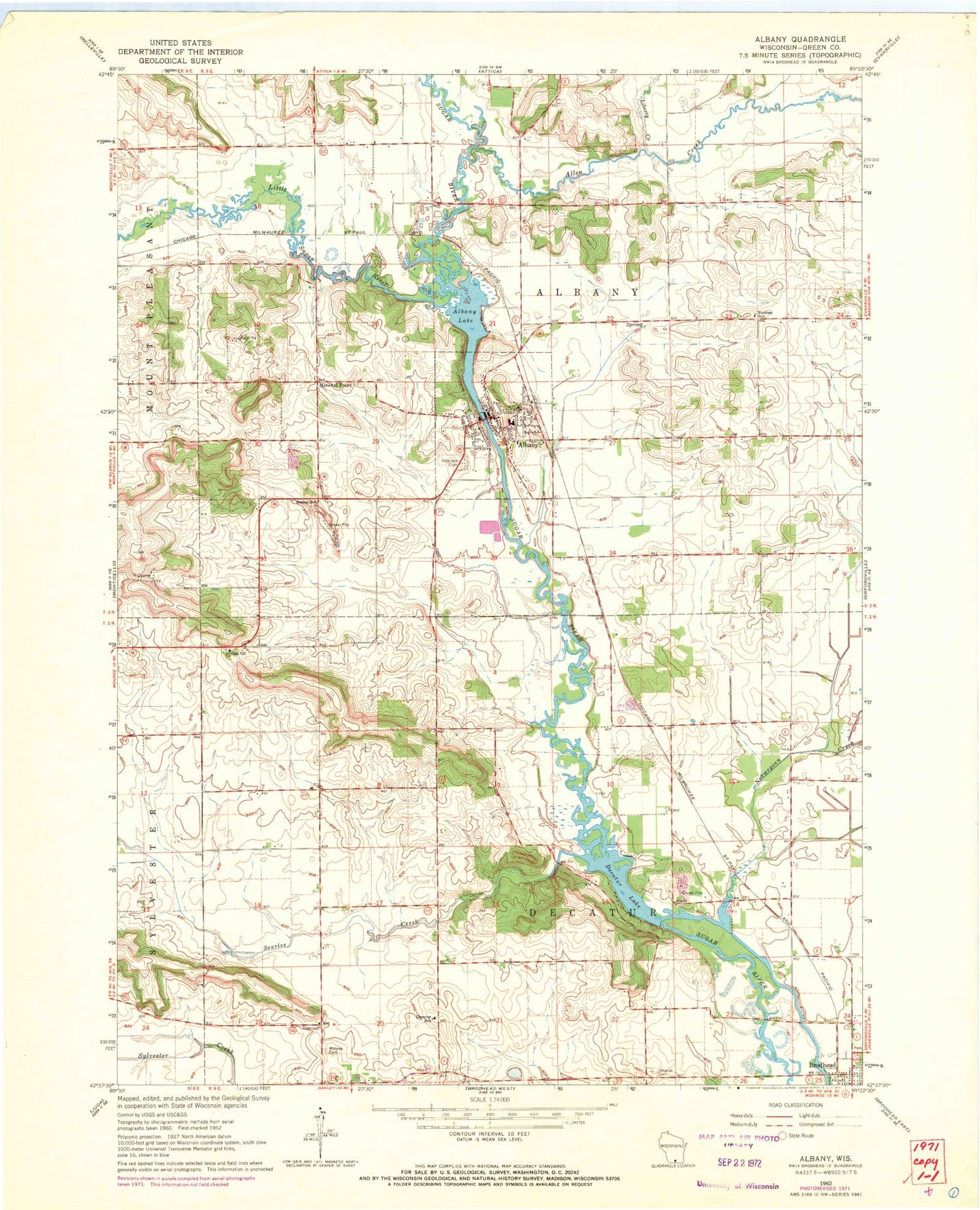
Classic USGS Albany Wisconsin 7.5'x7.5' Topo Map
Couldn't load pickup availability
Historical USGS topographic quad map of Albany in the state of Wisconsin. Map scale may vary for some years, but is generally around 1:24,000. Print size is approximately 24" x 27"
This quadrangle is in the following counties: Green.
The map contains contour lines, roads, rivers, towns, and lakes. Printed on high-quality waterproof paper with UV fade-resistant inks, and shipped rolled.
Contains the following named places: Abrahams Woods State Natural Area, Albany, Albany Airport, Albany Community Middle School, Albany Dam, Albany Elementary School, Albany Emergency Medical Services, Albany Fire Department, Albany High School, Albany Lake, Albany Police Department, Albany Post Office, Allen Creek, Brodhead Dam, County of Green Landfill, Decatur, Decatur Cemetery, Decatur Lake, Decatur School, Dunphy Branch, Gap Church, Hillcrest Cemetery, Liberty Creek, Little Sugar River, Marsh Creek, Mineral Point, Moores Cemetery, Muralt Bluff Prairie State Natural Area, Norwegian Creek, Oliver Prairie State Natural Area, Oliver Quarry, Peebles School, Searles Creek, Smiley School, Town of Albany, Town of Decatur, Village of Albany, Ward Swartz Decatur Woods State Natural Area, ZIP Code: 53502


