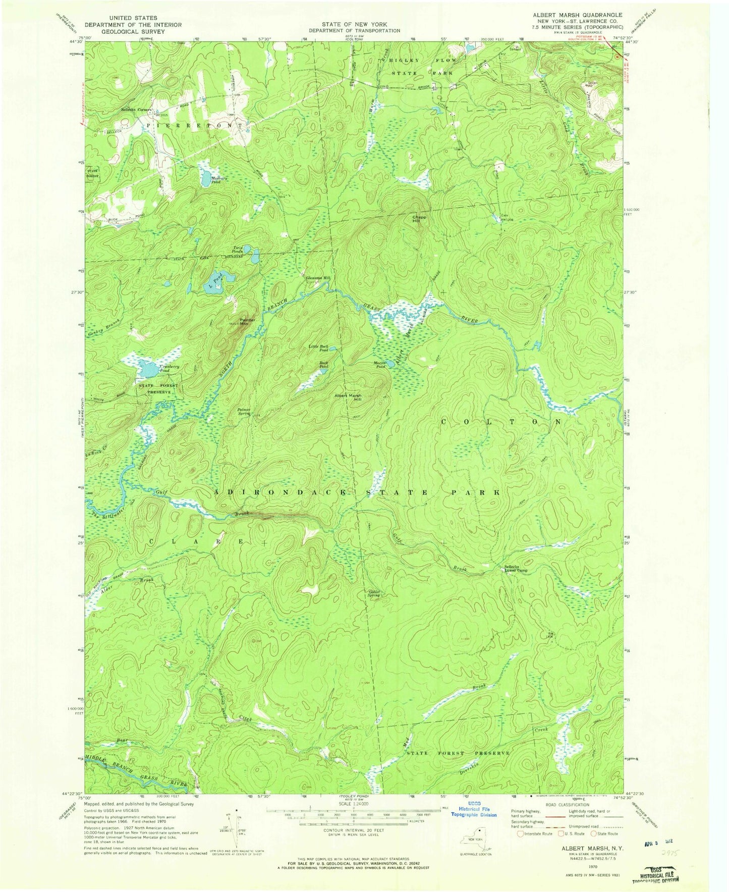
MyTopo
Classic USGS Albert Marsh New York 7.5'x7.5' Topo Map
Regular price
$16.95
Regular price
Sale price
$16.95
Unit price
per
Couldn't load pickup availability
Historical USGS topographic quad map of Albert Marsh in the state of New York. Map scale may vary for some years, but is generally around 1:24,000. Print size is approximately 24" x 27"
This quadrangle is in the following counties: St. Lawrence.
The map contains contour lines, roads, rivers, towns, and lakes. Printed on high-quality waterproof paper with UV fade-resistant inks, and shipped rolled.
Contains the following named places: Albert Marsh, Albert Marsh Hill, Chapp Hill, Cranberry Pond, Gleasons Mill, Goblet Spring, Gulf Brook, Higley Flow State Park, L Pond, Little Rock Pond, Marsh Pond, Painter Mountain, Palmer Spring, Rock Pond, Sellecks Corners, Sellecks Lower Camp, Twin Ponds