MyTopo
Classic USGS Albertville Alabama 7.5'x7.5' Topo Map
Couldn't load pickup availability
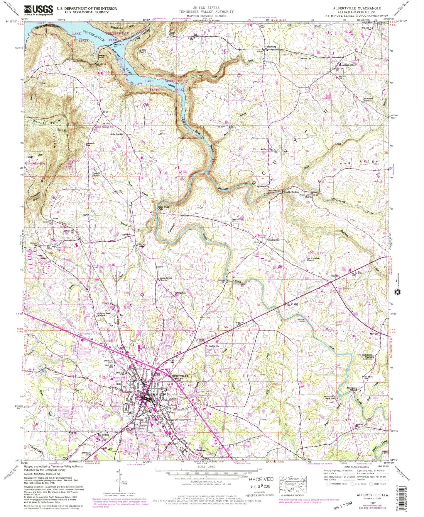
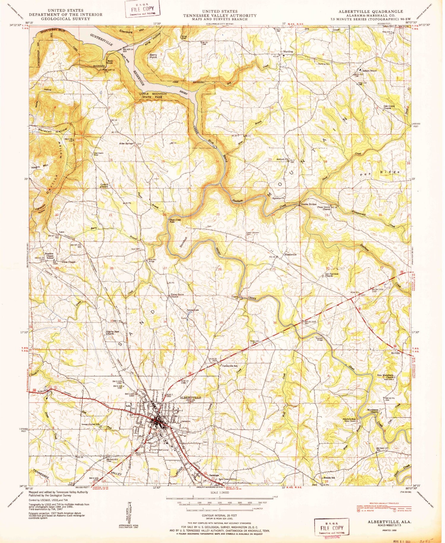
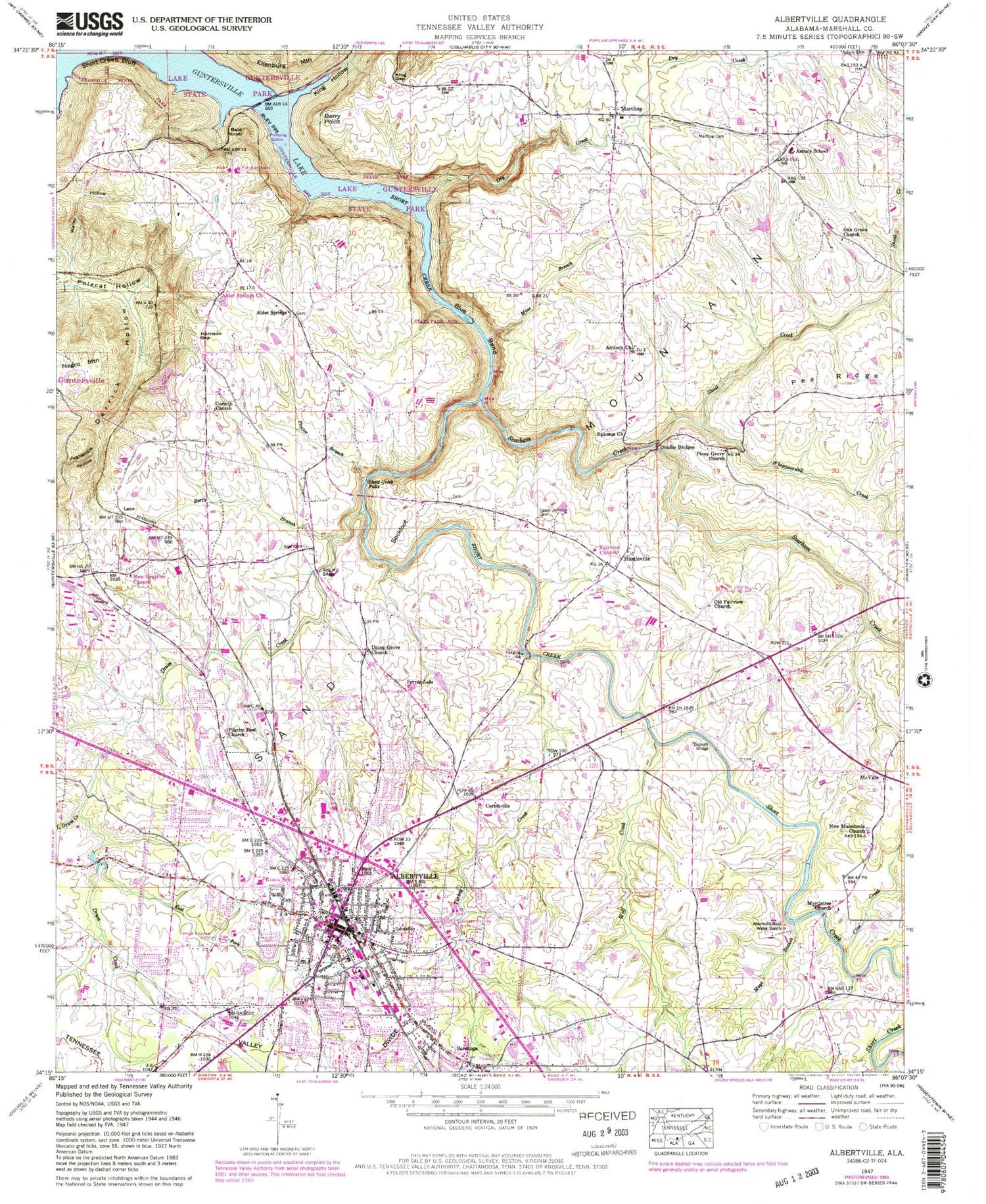
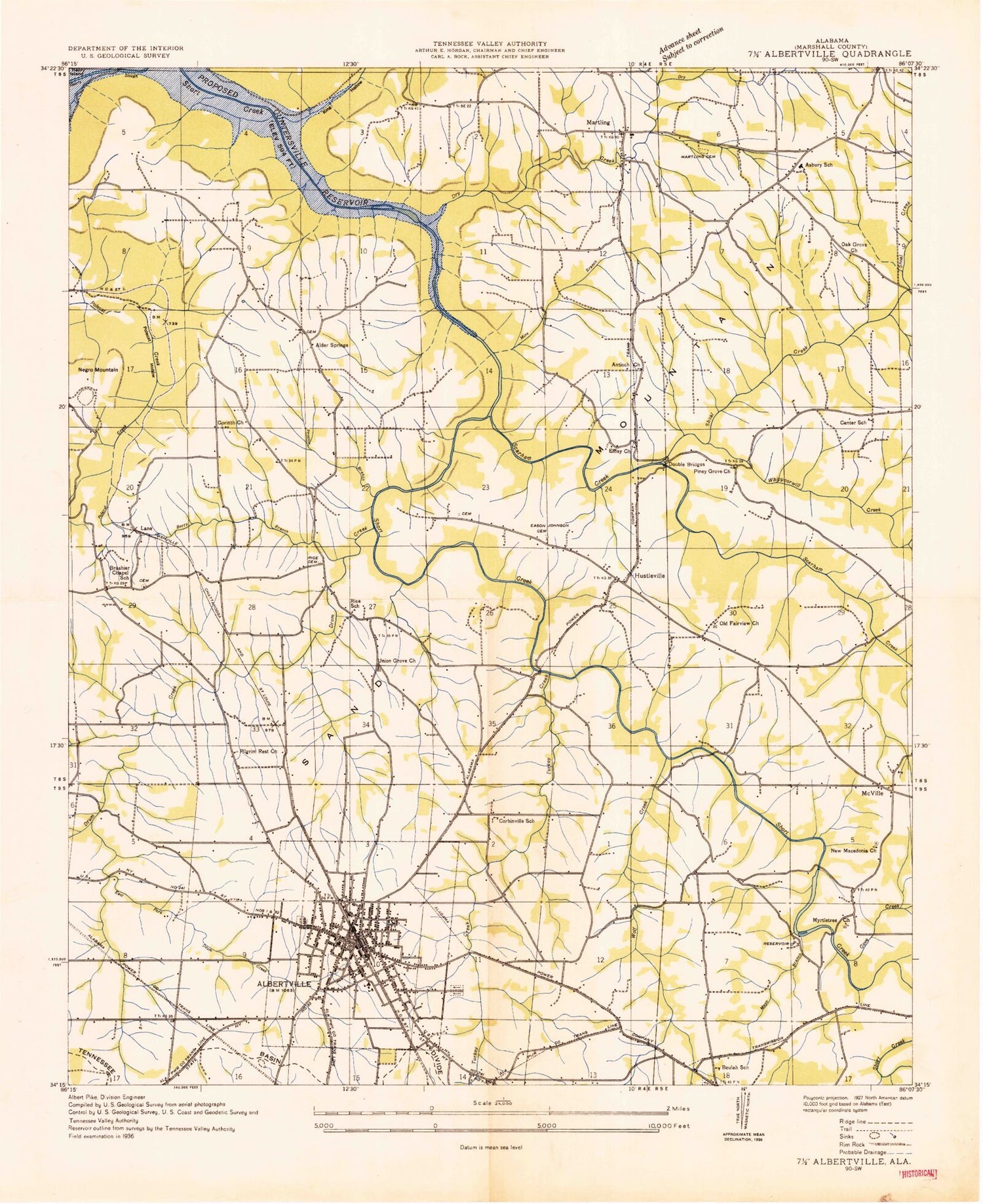
Historical USGS topographic quad map of Albertville in the state of Alabama. Map scale may vary for some years, but is generally around 1:24,000. Print size is approximately 24" x 27"
This quadrangle is in the following counties: Marshall.
The map contains contour lines, roads, rivers, towns, and lakes. Printed on high-quality waterproof paper with UV fade-resistant inks, and shipped rolled.
Contains the following named places: Albertville, Albertville City Hall, Albertville Country Club, Albertville Fire Department Station 1, Albertville Fire Department Station 3, Albertville High School, Albertville Junior High School, Albertville Police Department, Albertville Post Office, Albertville Public School, Albertville-Boaz Water Supply, Alder Springs, Alder Springs Cemetery, Alder Springs Church, Alder Springs Cumberland Presbyterian Church, Alder Springs School, Alder Springs Volunteer Fire Department, Antioch Church, Arbor Acres Farm, Asbury Church Cemetery, Asbury School, Asbury Volunteer Fire Department, Ashbury Church, Bald Knob, Berry Branch, Berry Point, Beulah Baptist Church, Beulah School, Blue Bend, Brashier Chapel School, Carbinville Church, Church of Christ, City of Albertville, Corbinville, Corbinville School, Corinth Church, Cove Creek, Derrick Hollow, Double Bridges, Drum Creek, Dry Creek, Duckett Bridge, Eason Johnson Cemetery, East Fork Drum Creek, Ephesus Church, Evans School, Fairview Cemetery, Fairview Church, First Baptist Church, First Methodist Church, Harrison Gap, Hustleville, Hustleville Church, Jones Chapel School, Jughandle Hollow, King Gap, King Hollow, Lane, Little Branch Cemetery, Little Branch Primitive Baptist Church, Little Drum Creek, Lot, Marshall County Courthouse, Martling, Martling Branch, Martling Cemetery, Martling Church, Martling School, Maxwell Church, Mayo Branch, McVille, Memorial Hill Cemetery, Mine Branch, Minorville, Mount Calvary Baptist Church, Myrtletree Baptist Church, Myrtletree Cemetery, New Brashier Chapel, New Brashiers Chapel Cemetery, New Macedonia Church Cemetery, New Macedonia Missionary Baptist Church, Northeast Alabama Agricultural School, Oak Grove Church, Old Albertville Cemetery, Old Fairview Church, Pea Ridge, Pilgrim Rest Baptist Church, Pilgrims Rest Primitive Baptist Church, Piney Grove Church, Proctor Branch, Rice School, Sand Mountain Infirmary, Saratoga, Scarham Creek, Shoal Creek, Short Creek, Short Creek Bluff, Short Creek Falls, Sockfoot, Spring Lake, Turkey Creek, Union Grove Baptist Church, Union Grove Cemetery, Walley Hollow, Whippoorwill Creek, Wolf Creek, WXBK-AM (Albertville), ZIP Code: 35951