MyTopo
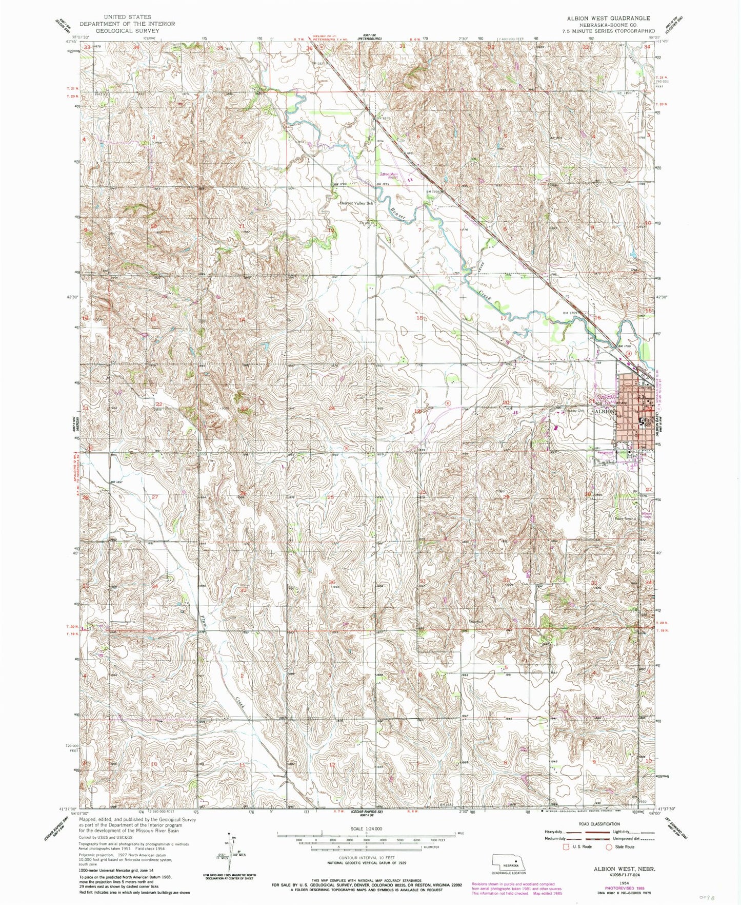
Classic USGS Albion West Nebraska 7.5'x7.5' Topo Map
Couldn't load pickup availability
Historical USGS topographic quad map of Albion West in the state of Nebraska. Map scale may vary for some years, but is generally around 1:24,000. Print size is approximately 24" x 27"
This quadrangle is in the following counties: Boone.
The map contains contour lines, roads, rivers, towns, and lakes. Printed on high-quality waterproof paper with UV fade-resistant inks, and shipped rolled.
Contains the following named places: Albion, Albion Bible Church, Albion City Park, Albion Country Club, Albion Dental Clinic, Albion Municipal Airport, Albion Police Department, Albion Post Office, Albion Public Schools, Beaver Valley School, Boone County, Boone County Ambulance Service, Boone County Courthouse, Boone County Fairground, Boone County Health Center, Boone County Health Center - Hospital, Boone County Historical Museum, Boone County Sheriff's Office, Callahan Chiropractic Center, City of Albion - RV Campground, First Baptist Church, Fuller Park, KLBN-FM (Albion), Kohtz-City of Albion Dam, Kohtz-City of Albion Reservoir, Koinzan Dam, Koinzan Reservoir, Maple Hill School, Palmer Eye Associates Center, Rose Hill Cemetery, Saint Michaels Catholic Church, Saint Michaels Elementary School, School Number 2, School Number 21, School Number 25, School Number 44, School Number 81, Seventh Day Adventist Church, Southwest Manchester Election Precinct, United Church of Christ, United Methodist Church, Wolf Memorial Good Samaritan, Zion Lutheran Church, ZIP Code: 68620