MyTopo
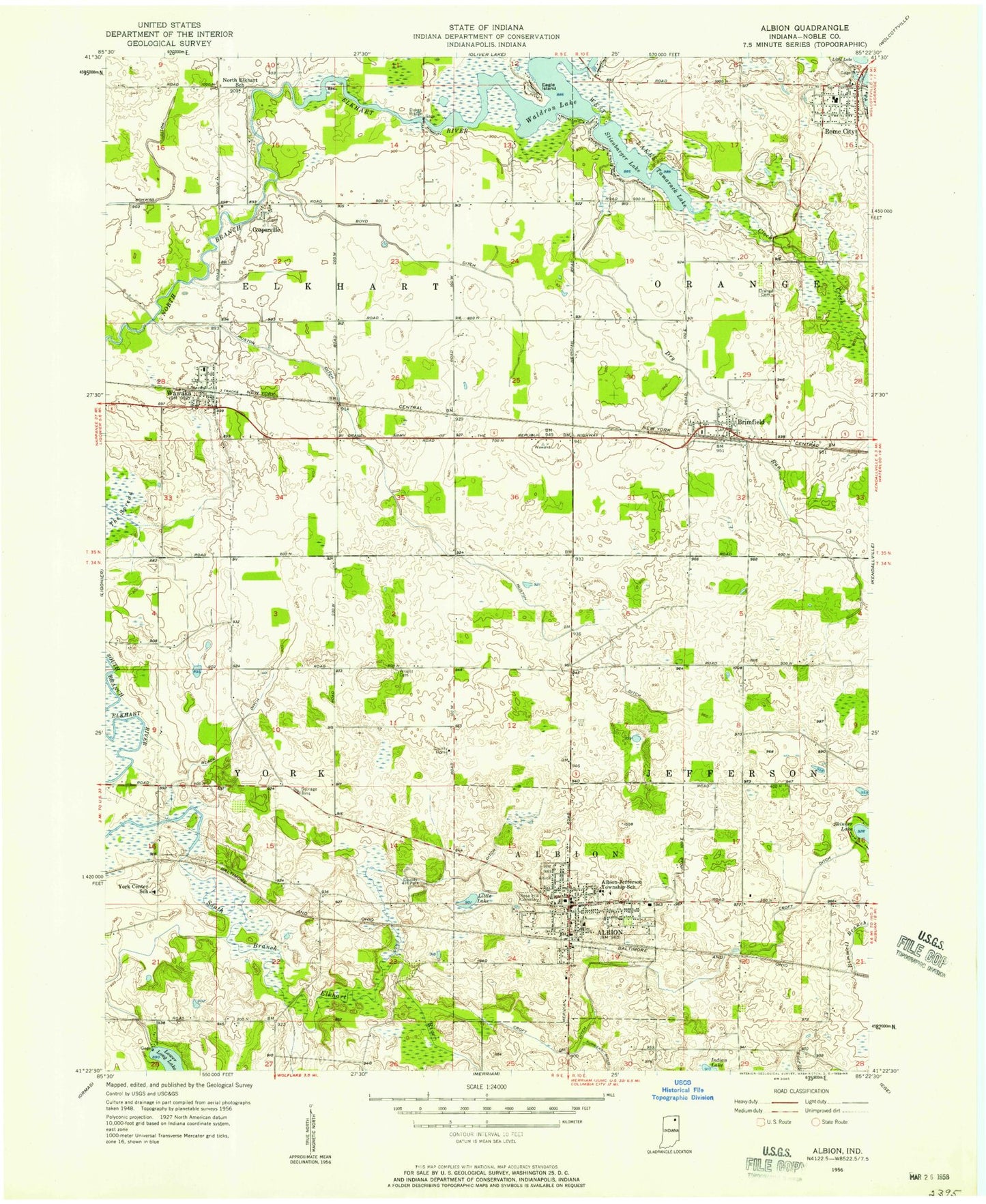
Classic USGS Albion Indiana 7.5'x7.5' Topo Map
Couldn't load pickup availability
Historical USGS topographic quad map of Albion in the state of Indiana. Map scale may vary for some years, but is generally around 1:24,000. Print size is approximately 24" x 27"
This quadrangle is in the following counties: Noble.
The map contains contour lines, roads, rivers, towns, and lakes. Printed on high-quality waterproof paper with UV fade-resistant inks, and shipped rolled.
Contains the following named places: Albion, Albion Elementary School, Albion Police Department, Albion Post Office, Albion Volunteer Fire Department, Black Ditch, Boyd Ditch, Brimfield, Central Noble High School, Central Noble Middle School, Clock Creek, Cosperville, Croft Ditch, Dry Run, Dukes Bridge, Eagle Island, Huston Ditch, Indian Lake, Little Lake, Long Ditch, Noble County, Noble County Emergency Medical Services - Albion Quarters, Noble County Sheriff's Office, Orange Cemetery, Orange Township Fire Department, Perlich Stock Farms, Rich Haven Farms, Rome City, Rome City Elementary and Middle School, Rome City Police Department, Rome City Post Office, Rose Hill Cemetery, Schwab Ditch, Steinbarger Lake, Tamarack Lake, Town of Albion, Township of Albion, Township of Elkhart, Township of York, Trinity Church, Waldron Lake, Wawaka, Wawaka Elementary School, Wawaka Post Office, West Lakes, Wright Cemetery, York Center School, ZIP Code: 46794