MyTopo
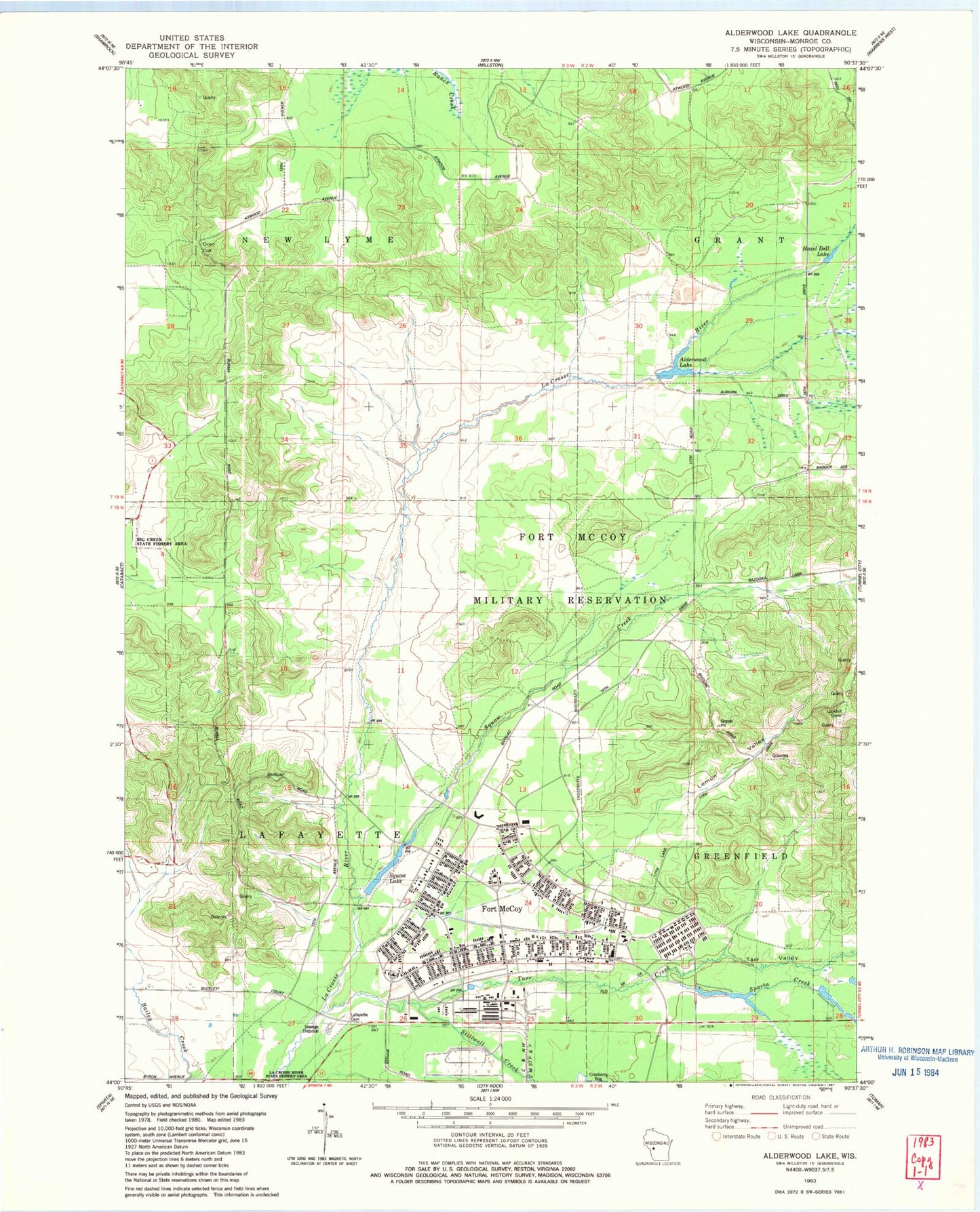
Classic USGS Alderwood Lake Wisconsin 7.5'x7.5' Topo Map
Couldn't load pickup availability
Historical USGS topographic quad map of Alderwood Lake in the state of Wisconsin. Typical map scale is 1:24,000, but may vary for certain years, if available. Print size: 24" x 27"
This quadrangle is in the following counties: Monroe.
The map contains contour lines, roads, rivers, towns, and lakes. Printed on high-quality waterproof paper with UV fade-resistant inks, and shipped rolled.
Contains the following named places: Alderwood Lake, Camp McCoy, Sparta Creek, Suukjak Sep Creek, Stillwell Creek, Tarr Creek, Greenfield Fire Tower, Town of Lafayette, Town of New Lyme, Alder Lake WP358 Dam, Alder Lake 19, Dorn Cut, Hazel Dell Lake, Lafayette Cemetery, Lemon Valley, Suukjak Sep Lake, Tarr Valley, Fort McCoy, Fort McCoy Fire Department Main Station, Fort Mccoy Police Department, Upper Sparta Pond