
MyTopo
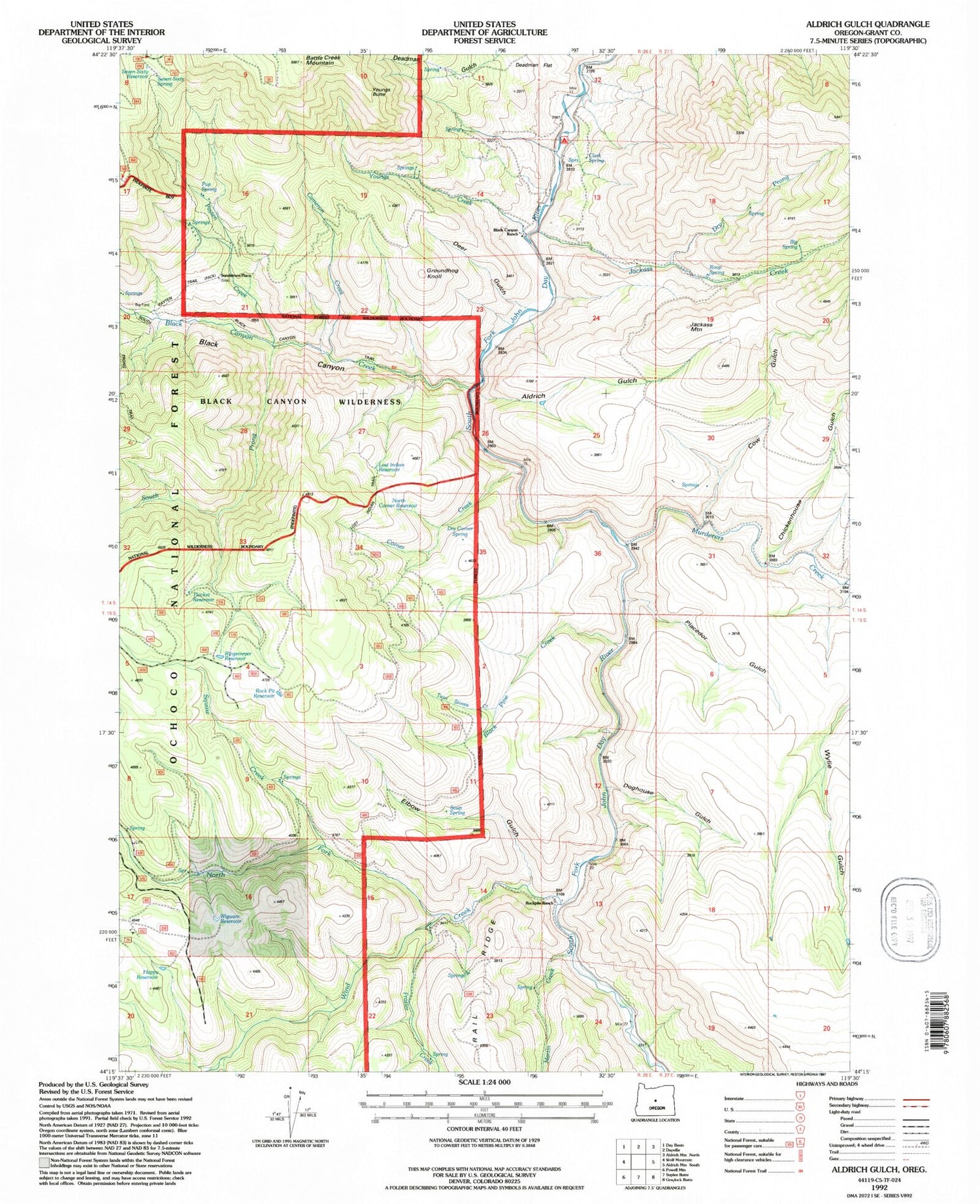
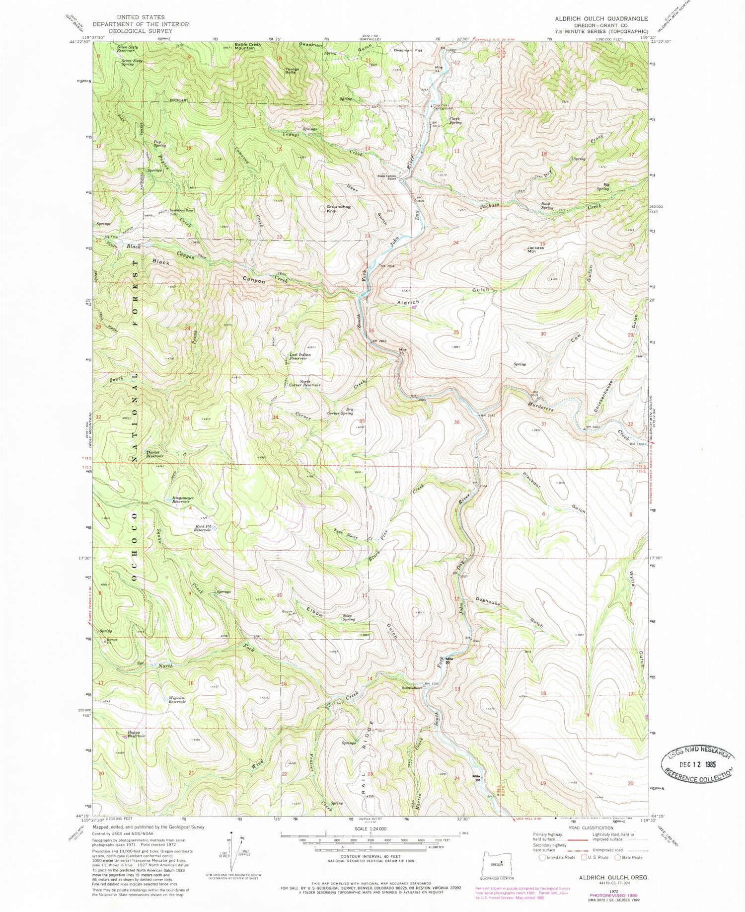
Classic USGS Aldrich Gulch Oregon 7.5'x7.5' Topo Map
Couldn't load pickup availability
Historical USGS topographic quad map of Aldrich Gulch in the state of Oregon. Map scale may vary for some years, but is generally around 1:24,000. Print size is approximately 24" x 27"
This quadrangle is in the following counties: Grant.
The map contains contour lines, roads, rivers, towns, and lakes. Printed on high-quality waterproof paper with UV fade-resistant inks, and shipped rolled.
Contains the following named places: Aldrich Gulch, Big Spring, Black Canyon, Black Canyon Creek, Black Canyon Ranch, Black Pine Creek, Cameron Creek, Chickenhouse Gulch, Clark Spring, Congleton Creek, Corner Creek, Cow Gulch, Deadman Flat, Deer Gulch, Doghouse Gulch, Dry Corner Spring, Dry Prong, Elbow Gulch, Frazier Creek, Groundhog Knoll, Happy Reservoir, Jackass Creek, Jackass Mountain, Lost Indian Reservoir, Lost Indian Trail, Martin Creek, Murderers Creek, North Corner Reservoir, North Fork Wind Creek, Payten Creek, Payten Trail, Pine Tree Campground, Placedor Gulch, Ringsmeyer Reservoir, Rock Pit Reservoir, Rockpile Ranch, Roop Spring, Seven Sixty Reservoir, Seven Sixty Spring, Soup Spring, South Prong Black Canyon Creek, Sundstrom Place, Thicket Reservoir, Twin Stoves Creek, Wigwam Reservoir, Wind Creek, Youngs Butte, Youngs Creek


