
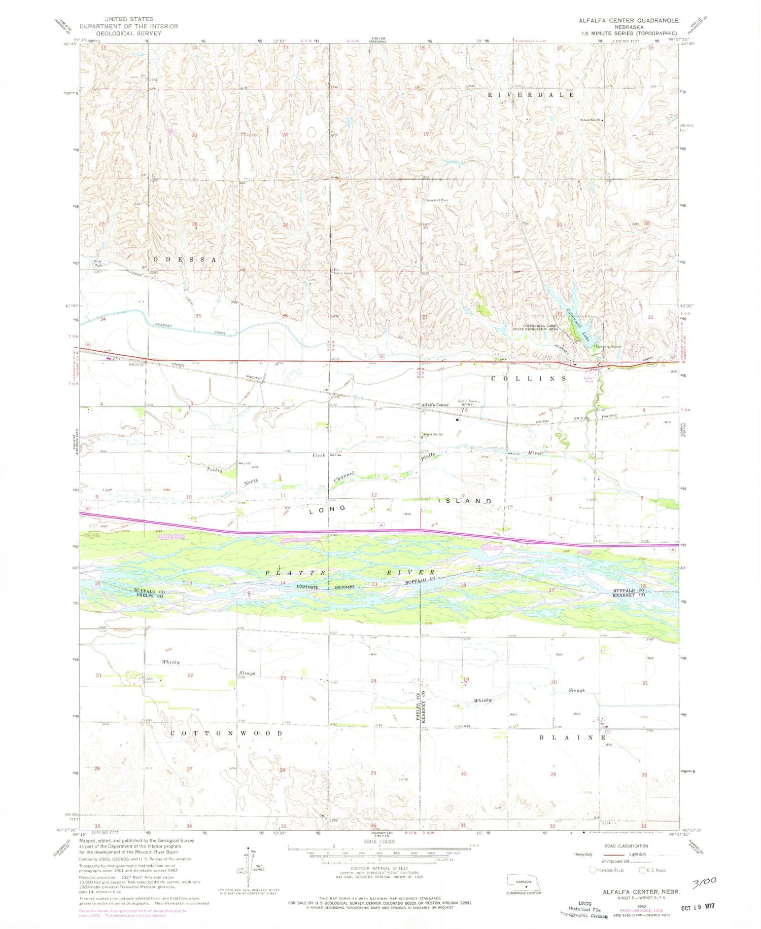
MyTopo
Classic USGS Alfalfa Center Nebraska 7.5'x7.5' Topo Map
Couldn't load pickup availability
Historical USGS topographic quad map of Alfalfa Center in the state of Nebraska. Map scale may vary for some years, but is generally around 1:24,000. Print size is approximately 24" x 27"
This quadrangle is in the following counties: Buffalo, Kearney, Phelps.
The map contains contour lines, roads, rivers, towns, and lakes. Printed on high-quality waterproof paper with UV fade-resistant inks, and shipped rolled.
Contains the following named places: Alfalfa Center, Cottonmill Dam, Cottonmill Lake, Cottonmill Lake State Recreation Area, Cottonmill Mobile Home Court, Cottonmill Reservoir, Cottonmill Trail, Dove Hill Cemetery, East Odessa State Wildlife Management Area, Election Precinct 26, Fort Kearney Historical Marker, Kearney Canal, Kearney Cotton Mill Historical Marker, Kearney Rest Area - Eastbound, KKPR-AM (Kearney), Long Island, Meadowlark Hills Golf Course, Patterson Dam, Patterson Reservoir, School Number 114, School Number 120, Sheens Trailer Court, Township of Collins, Turkey Creek, Walter Dam, Walter Reservoir, Watson Ranch Historical Marker, Whisky Slough, ZIP Code: 68845


