MyTopo
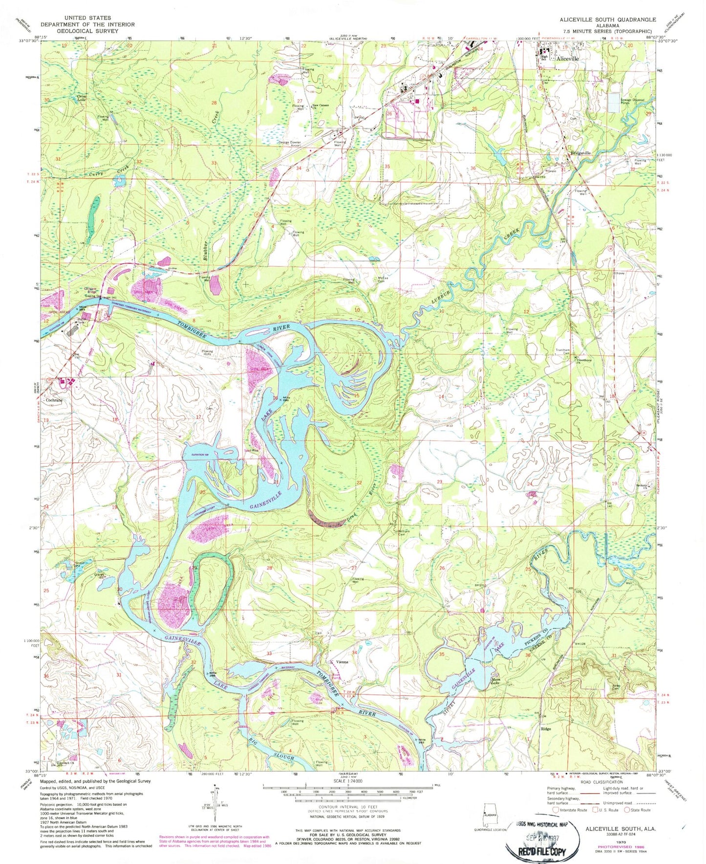
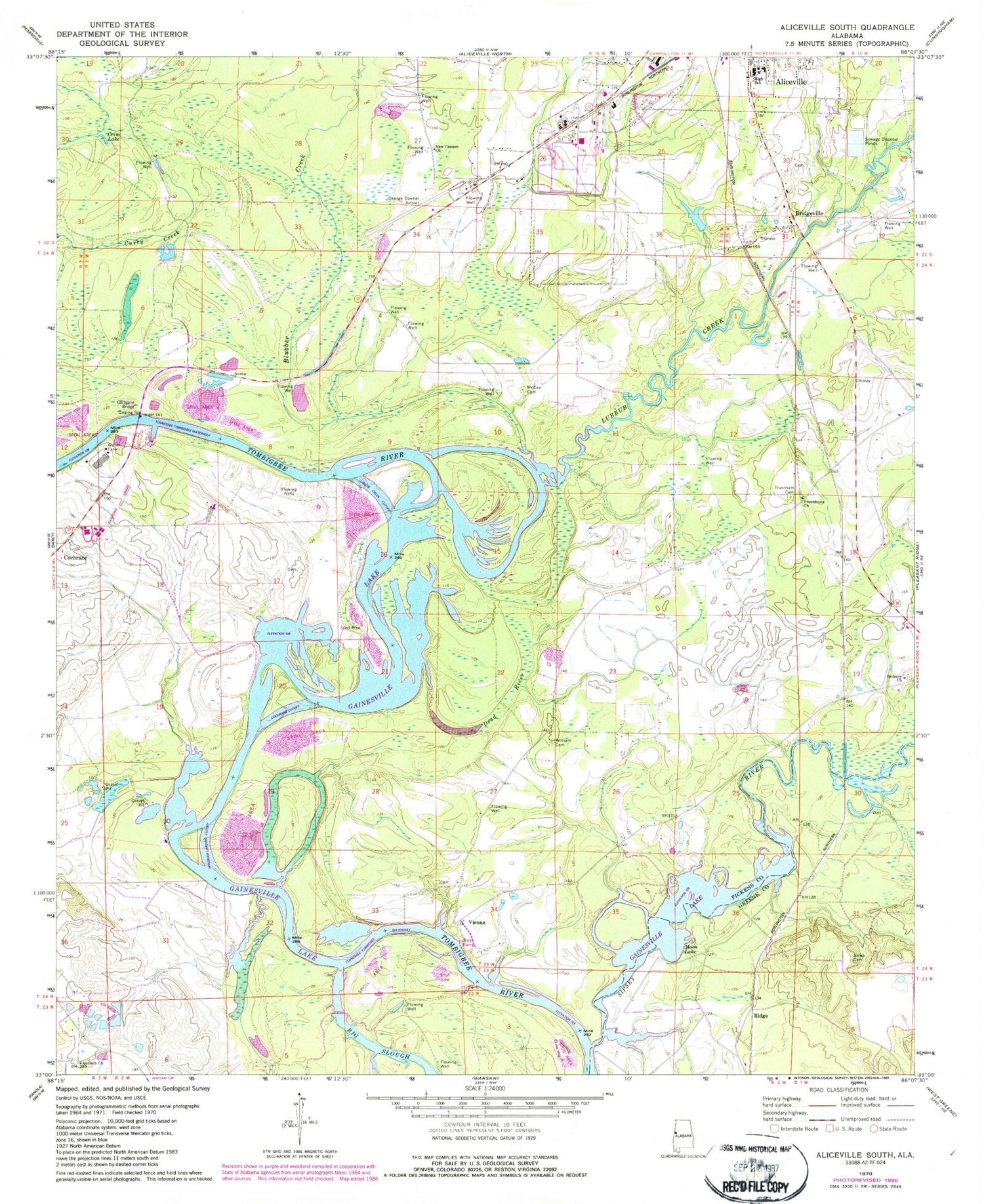
Classic USGS Aliceville South Alabama 7.5'x7.5' Topo Map
Couldn't load pickup availability
Historical USGS topographic quad map of Aliceville South in the state of Alabama. Typical map scale is 1:24,000, but may vary for certain years, if available. Print size: 24" x 27"
This quadrangle is in the following counties: Greene, Pickens.
The map contains contour lines, roads, rivers, towns, and lakes. Printed on high-quality waterproof paper with UV fade-resistant inks, and shipped rolled.
Contains the following named places: Antioch Church, Bethany Church, Blubber Creek, Crim Lake, Dead River, Jones Cemetery, McCaa Cemetery, Moon Lake, New Canaan Church, Providence Church, George Downer Airport, J S Sommerville Lake, J S Sommerville Dam, Mouth of Sipsey Landing (historical), Sipsey Bar, Aliceville High School, Catfish Bar, Catfish Bend, Catfish Shoals, Cedar Creek Shoals, Cochrane Ferry (historical), Cuba Landing, Cuba Shoals, Gardner Cemetery, Goose Pond, Hancock Shoals, Huyck Bridge, Kearnens Bend, Lubbub Bar, Newport (historical), Newport Shoals, Sipsey Island (historical), Stones Ferry (historical), Streets Island, Summerville Bar, Summerville Cutoff Bar, Thomas Landing (historical), Vienna Access Area, Vienna Bar, Vienna Island (historical), Windhams Bar, Windhams Landing, Old Bethany Cemetery, Lubbub Creek, Bridgeville, Ridge, Vienna, Antioch Cemetery, Fowler Cemetery, Sipsey River, Trantham Cemetery, William Cemetery, Antioch Cemetery, Aliceville Division (historical), Camp Aliceville (historical), City of Aliceville, Cow Creek Ranch