MyTopo
Classic USGS Alkali Flat Oregon 7.5'x7.5' Topo Map
Regular price
$16.95
Regular price
Sale price
$16.95
Unit price
per
Couldn't load pickup availability
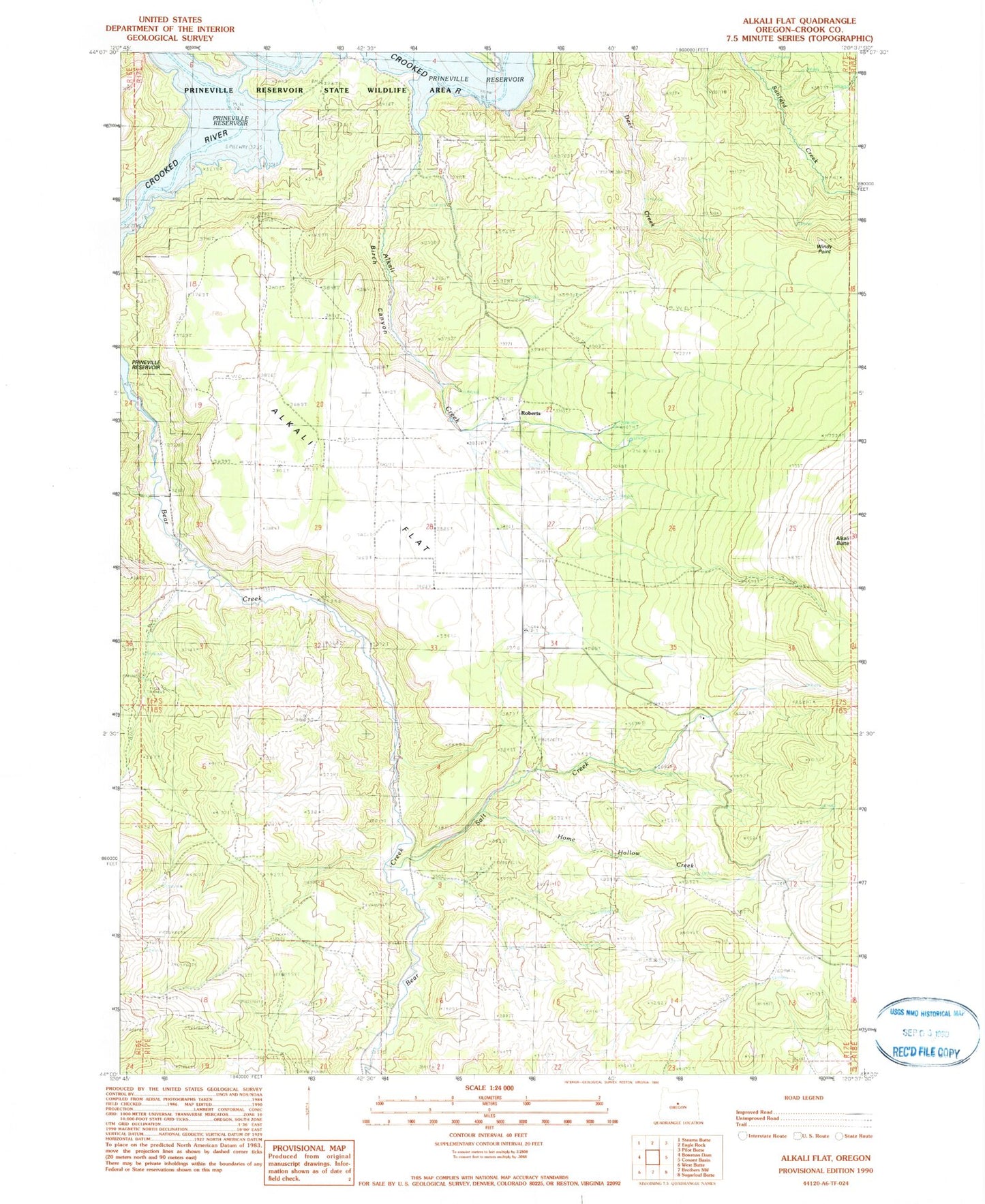
Historical USGS topographic quad map of Alkali Flat in the state of Oregon. Map scale may vary for some years, but is generally around 1:24,000. Print size is approximately 24" x 27"
This quadrangle is in the following counties: Crook.
The map contains contour lines, roads, rivers, towns, and lakes. Printed on high-quality waterproof paper with UV fade-resistant inks, and shipped rolled.
Contains the following named places: Alkali Creek, Alkali Flat, Birch Canyon, Bottero Park, Home Hollow Creek, Prineville Reservoir Resort, Prineville Reservoir Resort Boat Ramp, Prineville Reservoir Resort Marina, Roberts, Roberts Bay, Roberts Cemetery, Roberts Post Office, Salt Creek, Windy Point