MyTopo
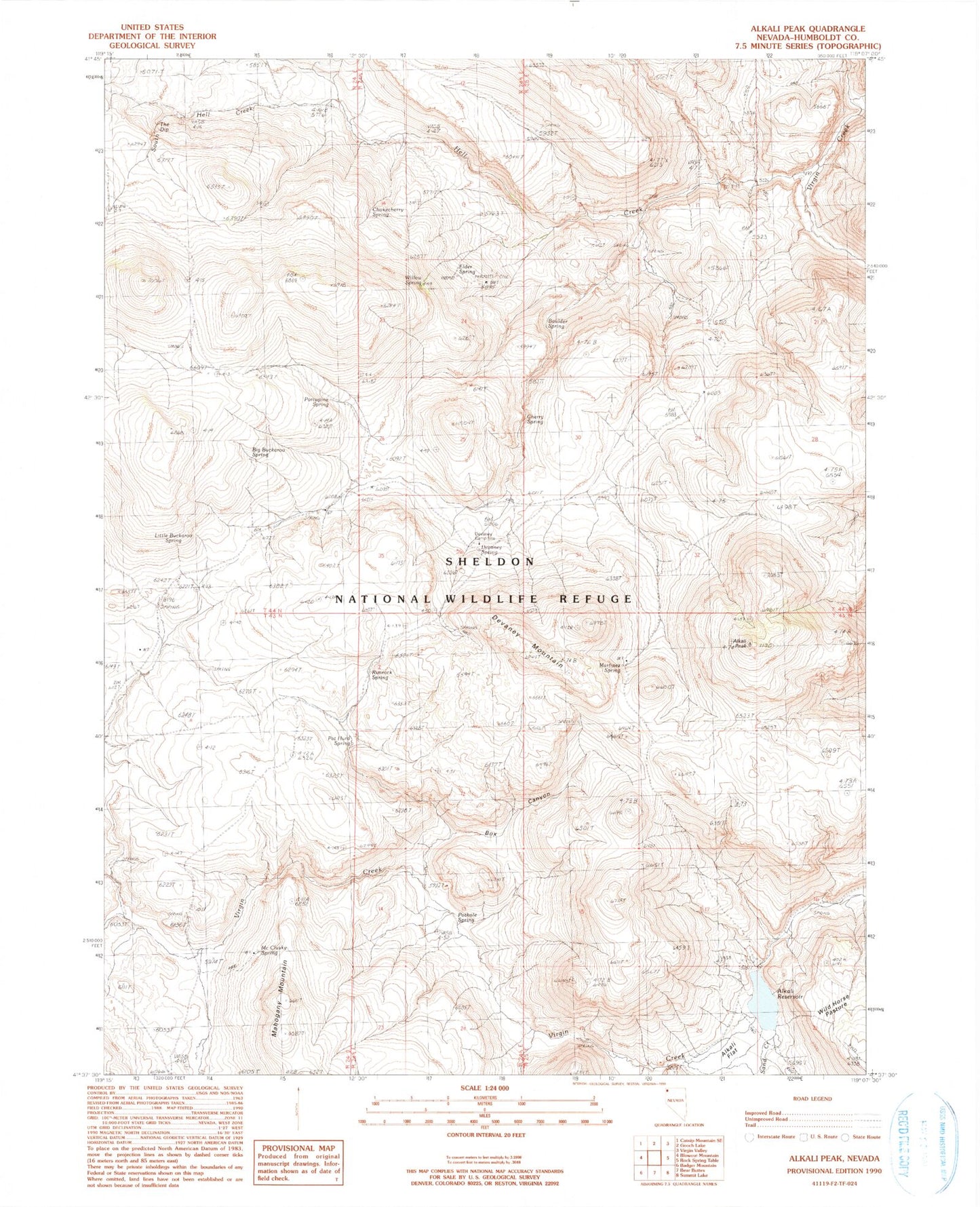
Classic USGS Alkali Peak Nevada 7.5'x7.5' Topo Map
Couldn't load pickup availability
Historical USGS topographic quad map of Alkali Peak in the state of Nevada. Map scale may vary for some years, but is generally around 1:24,000. Print size is approximately 24" x 27"
This quadrangle is in the following counties: Humboldt.
The map contains contour lines, roads, rivers, towns, and lakes. Printed on high-quality waterproof paper with UV fade-resistant inks, and shipped rolled.
Contains the following named places: Alkali Flat, Alkali Peak, Alkali Reservoir, Alkali Reservoir Dam, Big Buckaroo Spring, Boulder Spring, Box Canyon, Cherry Spring, Chokecherry Spring, Devaney Camp, Devaney Mountain, Devaney Spring, Elder Spring, Hell Creek, Little Buckaroo Spring, Martinez Spring, McClusky Spring, Pat Hurd Spring, Porcupine Spring, Pothole Spring, Rimrock Spring, Roadside Spring, Sand Creek, South Hell Creek, The Dip, Willow Spring