MyTopo
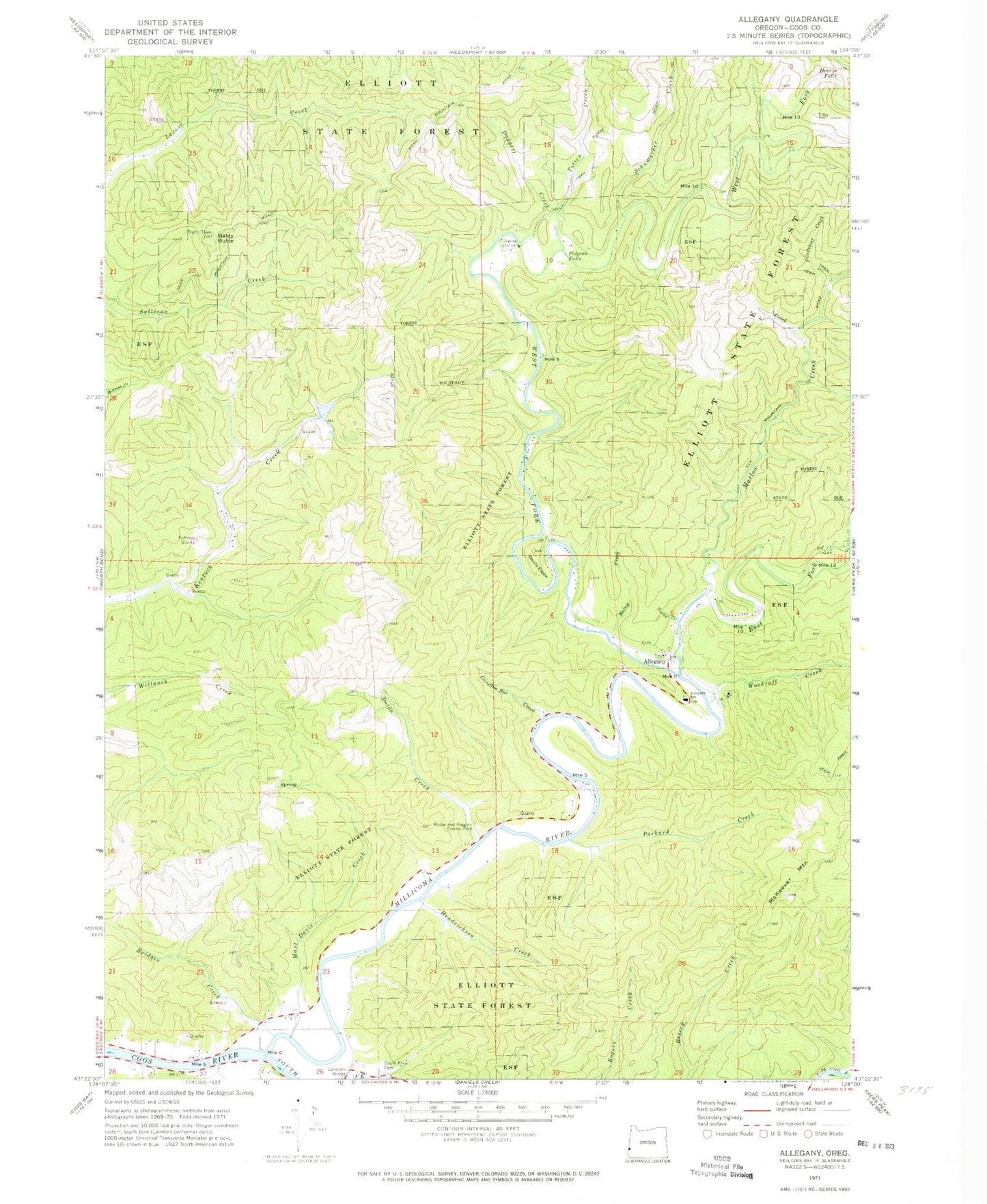
Classic USGS Allegany Oregon 7.5'x7.5' Topo Map
Couldn't load pickup availability
Historical USGS topographic quad map of Allegany in the state of Oregon. Map scale may vary for some years, but is generally around 1:24,000. Print size is approximately 24" x 27"
This quadrangle is in the following counties: Coos.
The map contains contour lines, roads, rivers, towns, and lakes. Printed on high-quality waterproof paper with UV fade-resistant inks, and shipped rolled.
Contains the following named places: Allegany, Allegany Cemetery, Allegany Post Office, Allegany School, Baldwin Post Office, Baldy Butte, Bridges Creek, Caroline Bar Creek, Chute Creek, Coos River, Coos River Post Office, Daggett Creek, Deton Creek, Devils Elbow, Doris Place Boat Ramp, East Fork Millicoma River, Estelle Falls, Franson Creek, Hendrickson Creek, Henrys Falls, Hodson Creek, Kuhnert Quarry, Marlow Creek, Mart Davis Creek, McKeever Mountain, Millicoma River, Nowlin Creek, Packard Creek, Pidgeon Falls, Piledriver Creek, Rainy Creek, Rooke and Higgins County Park Boat Ramp, Schumacher Creek, Smith Creek, South Fork Cemetery, South Fork Coos River, Stonehouse Bridge Boat Launch, Totten Creek, Wee House Hole, West Fork Millicoma River, Woodruff Creek