
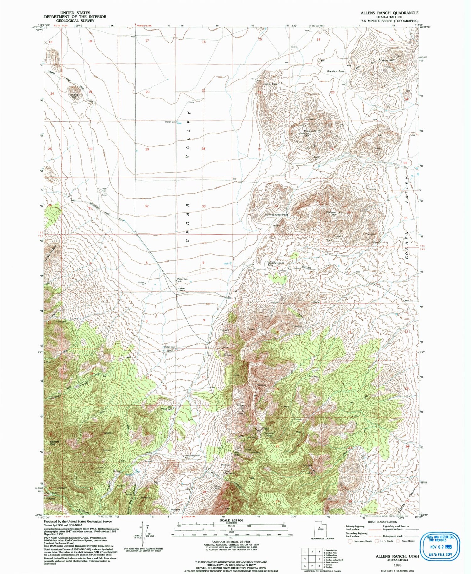
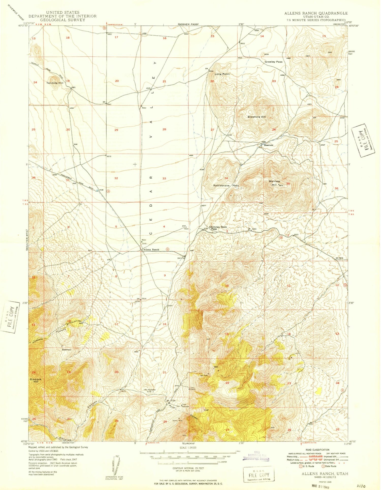
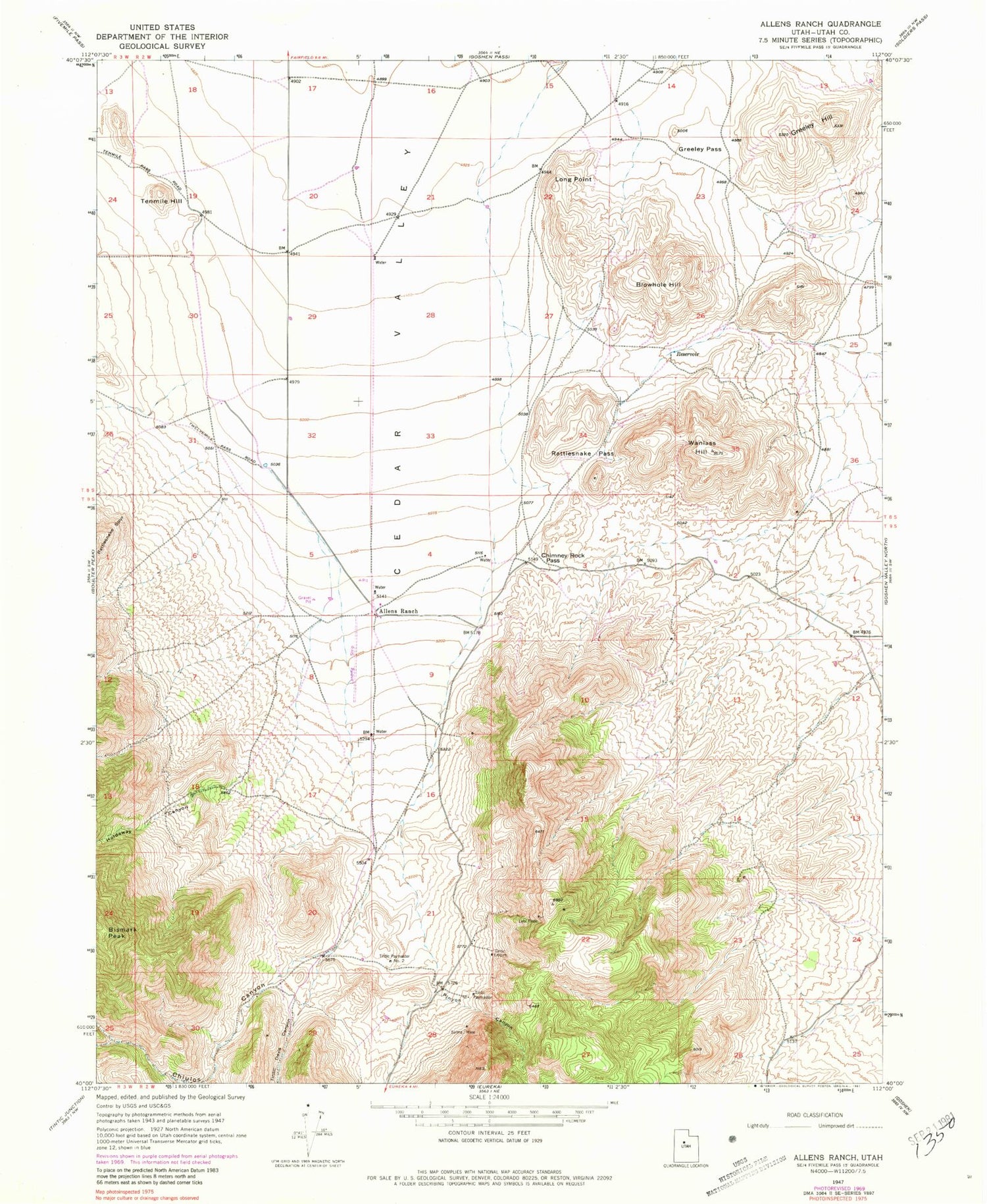
MyTopo
Classic USGS Allens Ranch Utah 7.5'x7.5' Topo Map
Couldn't load pickup availability
Historical USGS topographic quad map of Allens Ranch in the state of Utah. Map scale may vary for some years, but is generally around 1:24,000. Print size is approximately 24" x 27"
This quadrangle is in the following counties: Utah.
The map contains contour lines, roads, rivers, towns, and lakes. Printed on high-quality waterproof paper with UV fade-resistant inks, and shipped rolled.
Contains the following named places: Allens Ranch, Chimney Rock Pass, Chiulos Canyon, Greeley Hill, Greeley Pass, Holdaway Canyon, John Jones Hill, Lehi Tintic, Long Point, Pinyon Canyon, Rattlesnake Pass, Selma Mine, Tenmile Hill, Tintic Davis Canyon, Tintic Empire, Tintic Paymaster, Tintic Paymaster Number 2, Wanlass Hill


