MyTopo
Classic USGS Allenton Wisconsin 7.5'x7.5' Topo Map
Couldn't load pickup availability
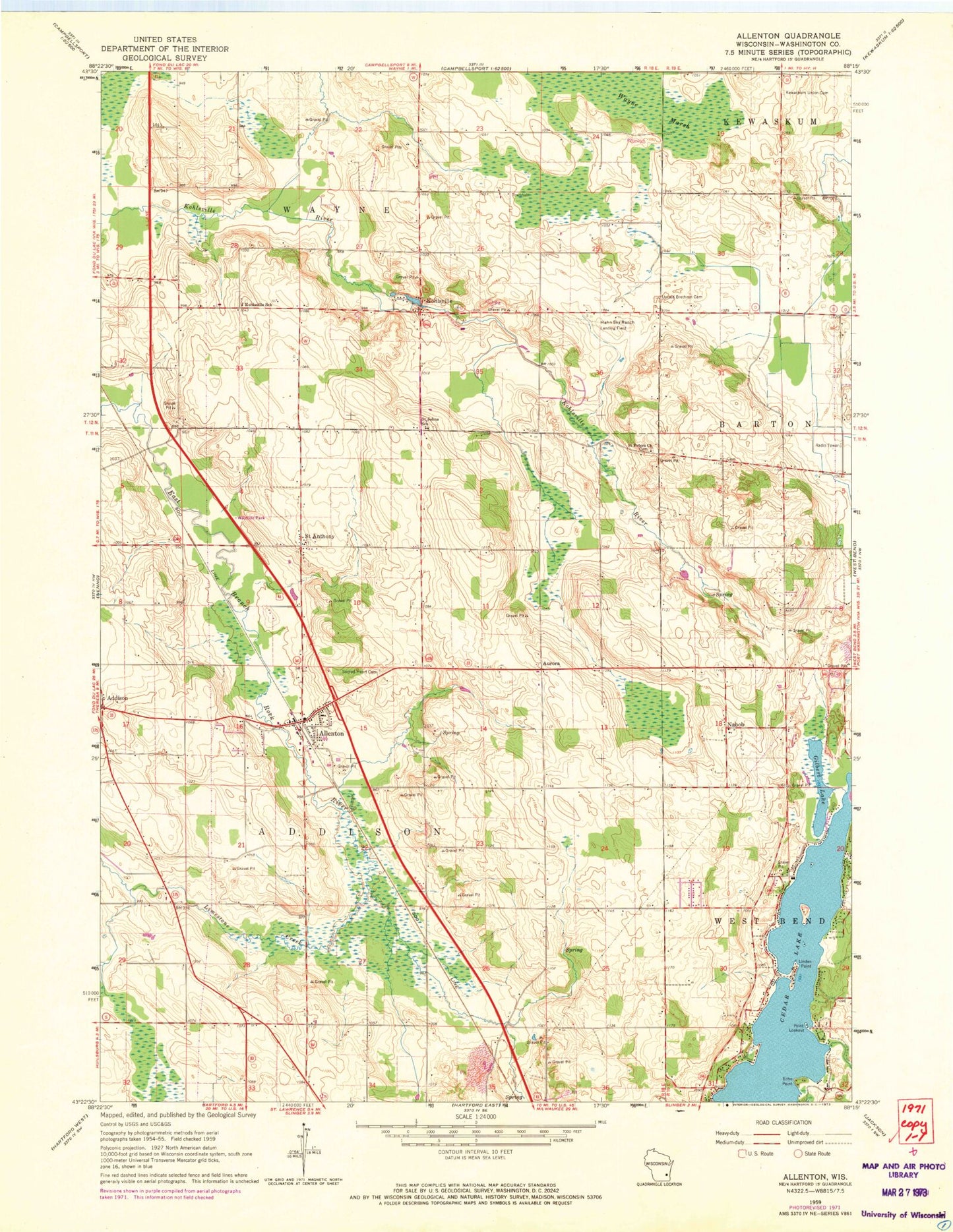
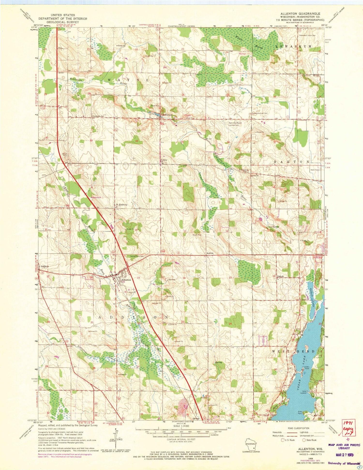
Historical USGS topographic quad map of Allenton in the state of Wisconsin. Map scale may vary for some years, but is generally around 1:24,000. Print size is approximately 24" x 27"
This quadrangle is in the following counties: Washington.
The map contains contour lines, roads, rivers, towns, and lakes. Printed on high-quality waterproof paper with UV fade-resistant inks, and shipped rolled.
Contains the following named places: Addison, Addison Elementary School, Albright United Brethren Cemetery, Allenton, Allenton Census Designated Place, Allenton Creek, Allenton Elementary School, Allenton Post Office, Allenton Volunteer Fire Department, Aurora, Brittany Farms, Cedar Lake, Dominion Valley Farm, Dornacker Prairie Acres, Echo Point, Four Way Farms, Garden View Dairy, Gilbert Lake, Goeller Family Farms, Hahn Sky Ranch Airport, Highview Farm, Ihlenfeld Farms, Kedinger Farms, Kewaskum Union Cemetery, Kohlsville, Kohlsville Millpond, Kohlsville School, Kohlsville Volunteer Fire Department, L - J Farms, Limestone Creek, Linden Point, Lone Island, Nabob, Point Lookout, Proeber Dairy, Sacred Heart Cemetery, Saint Anthony, Saint Johns School, Saint Peters Church, Schelle Pit, Sunset Farms, Town of Addison, Town of Wayne, Twisted Pine Farm, Wayne Creek, Wayne Marsh, WBWI-FM (West Bend), Whispering View Farm, ZIP Code: 53002