MyTopo
Classic USGS Allentown New Jersey 7.5'x7.5' Topo Map
Couldn't load pickup availability
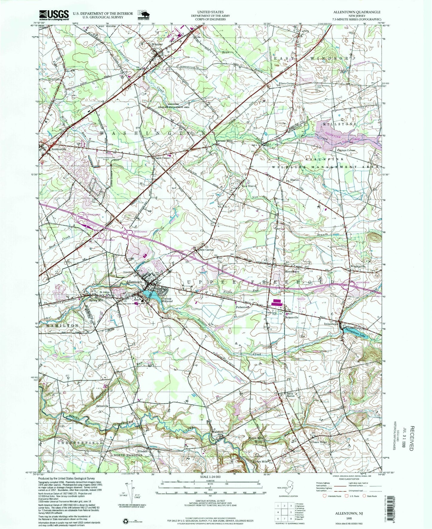
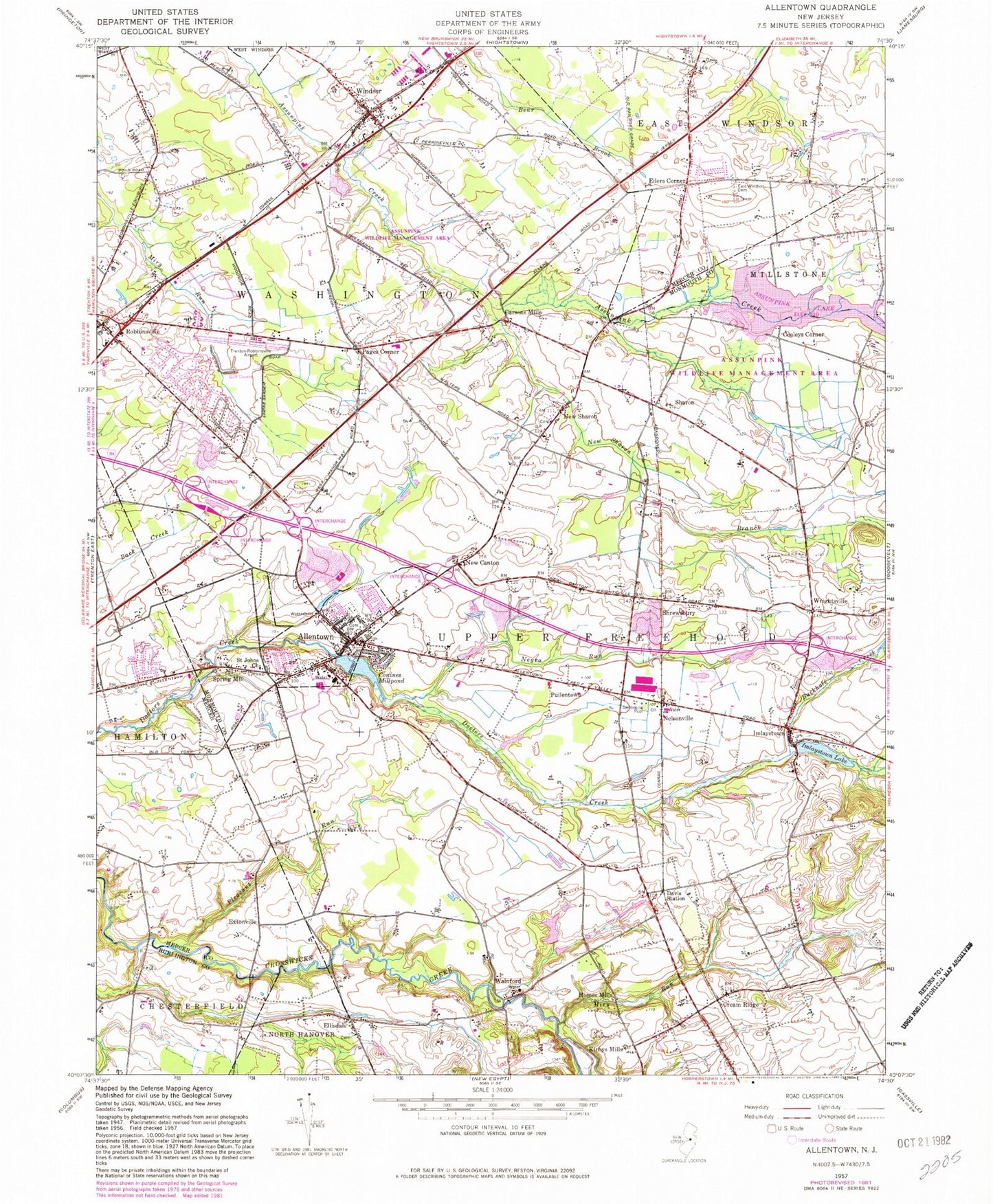
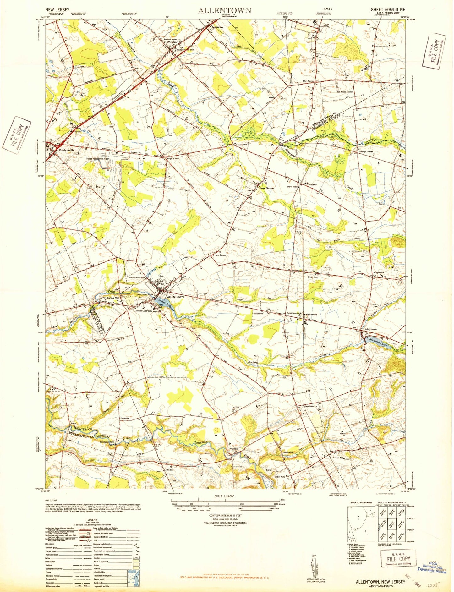
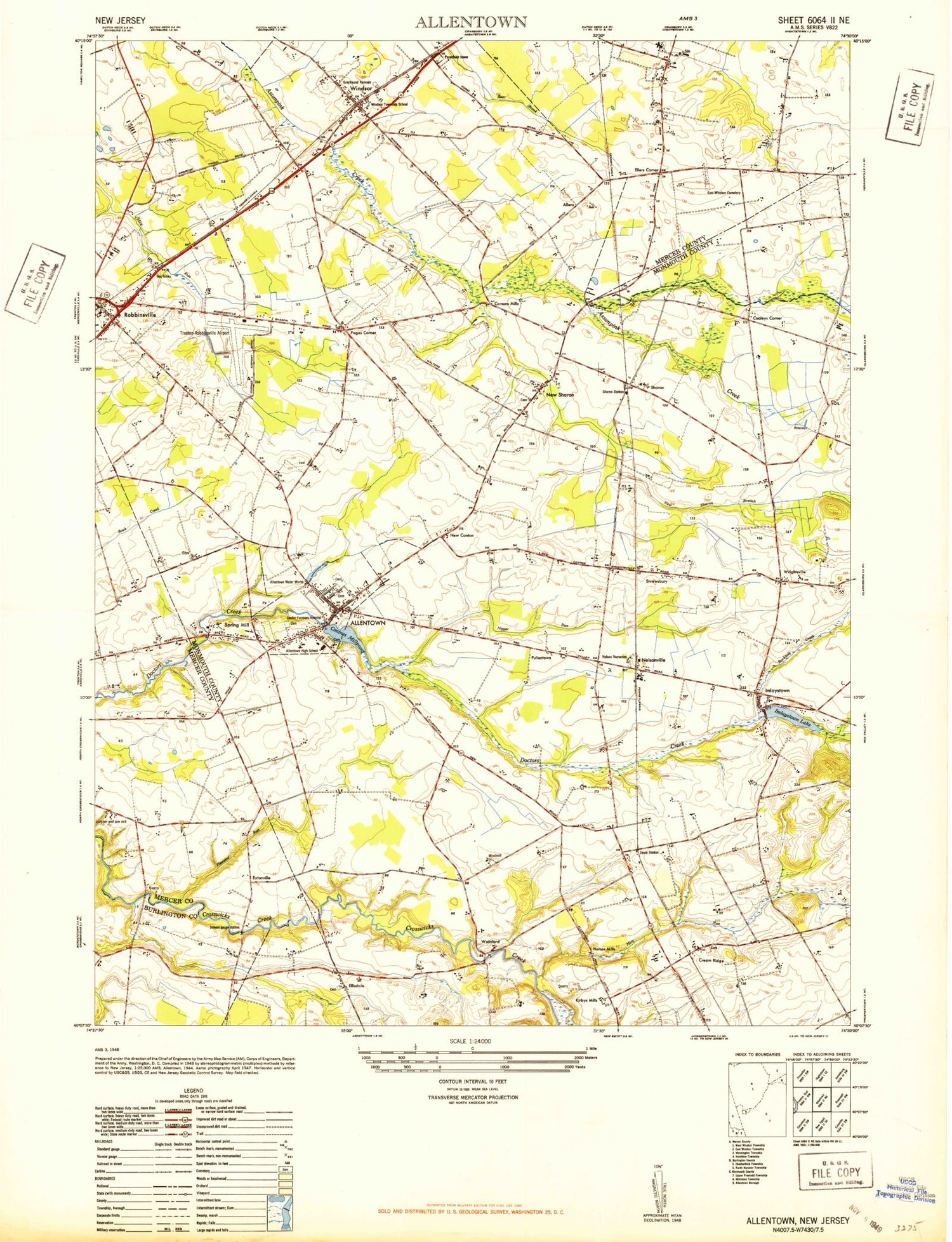
Historical USGS topographic quad map of Allentown in the state of New Jersey. Typical map scale is 1:24,000, but may vary for certain years, if available. Print size: 24" x 27"
This quadrangle is in the following counties: Burlington, Mercer, Monmouth.
The map contains contour lines, roads, rivers, towns, and lakes. Printed on high-quality waterproof paper with UV fade-resistant inks, and shipped rolled.
Contains the following named places: Allentown, Buckhole Creek, Carsons Mills, Conines Millpond, Cooleys Corner, Cream Ridge, Davis Station, East Windsor Cemetery, Eilers Corner, Ellisdale, Extonville, Homes Mills, Imlaystown, Imlaystown Lake, Kirbys Mills, Miry Run, Ashby Creek, Nelsonville, New Canton, New Sharon, New Sharon Branch, Pages Corner, Pleasant Run, Pullentown, Robbinsville, Saint Johns Church, Sharon, Shrewsbury, Spring Mill, Walnford, Windsor, Wrightsville, Township of Upper Freehold, Township of Robbinsville, Meadows Terrace, Polhemustown, Allens Station, Hillside Terrace, Indian Lake Dam, Indian Lake, Allentown Dam, Indian Run, Imlaystown Lake Dam, Trenton-Robbinsville Airport, Borough of Allentown, Allentown High School, Robbinsville High School, Sharon Elementary School, Upper Freehold Regional Elementary School, Hope Fire Company 1, Robbinsville Township Fire Department, Allentown First Aid Squad, Allentown Police Department, Robbinsville Township Police Department, Allentown Methodist Cemetery, Allentown Presbyterian Cemetery, Cream Ridge Cemetery, Saint John's Cemetery, Princeton Memorial Park, Allentown Post Office, Cream Ridge Post Office, Windsor Post Office, Cream Ridge Census Designated Place, Windsor Census Designated Place, Allentown, Buckhole Creek, Carsons Mills, Conines Millpond, Cooleys Corner, Cream Ridge, Davis Station, East Windsor Cemetery, Eilers Corner, Ellisdale, Extonville, Homes Mills, Imlaystown, Imlaystown Lake, Kirbys Mills, Miry Run, Ashby Creek, Nelsonville, New Canton, New Sharon, New Sharon Branch, Pages Corner, Pleasant Run, Pullentown, Robbinsville, Saint Johns Church, Sharon, Shrewsbury, Spring Mill, Walnford, Windsor, Wrightsville, Township of Upper Freehold, Township of Robbinsville, Meadows Terrace, Polhemustown, Allens Station, Hillside Terrace, Indian Lake Dam, Indian Lake, Allentown Dam, Indian Run, Imlaystown Lake Dam, Trenton-Robbinsville Airport, Borough of Allentown, Allentown High School, Robbinsville High School, Sharon Elementary School, Upper Freehold Regional Elementary School, Hope Fire Company 1, Robbinsville Township Fire Department, Allentown First Aid Squad, Allentown Police Department, Robbinsville Township Police Department, Allentown Methodist Cemetery, Allentown Presbyterian Cemetery, Cream Ridge Cemetery, Saint John's Cemetery, Princeton Memorial Park, Allentown Post Office, Cream Ridge Post Office, Windsor Post Office, Cream Ridge Census Designated Place, Windsor Census Designated Place